World Heritage Identification Number: 487
World Heritage since: 1988
Category: Natural Heritage
WHE Type: Natural Landscapes & Geographic Features
Transboundary Heritage: No
Endangered Heritage: No
Country: 🇬🇧 United Kingdom of Great Britain and Northern Ireland
Continent: Europe
UNESCO World Region: Europe and North America
Map
Henderson Island: A Remote Haven of Biodiversity
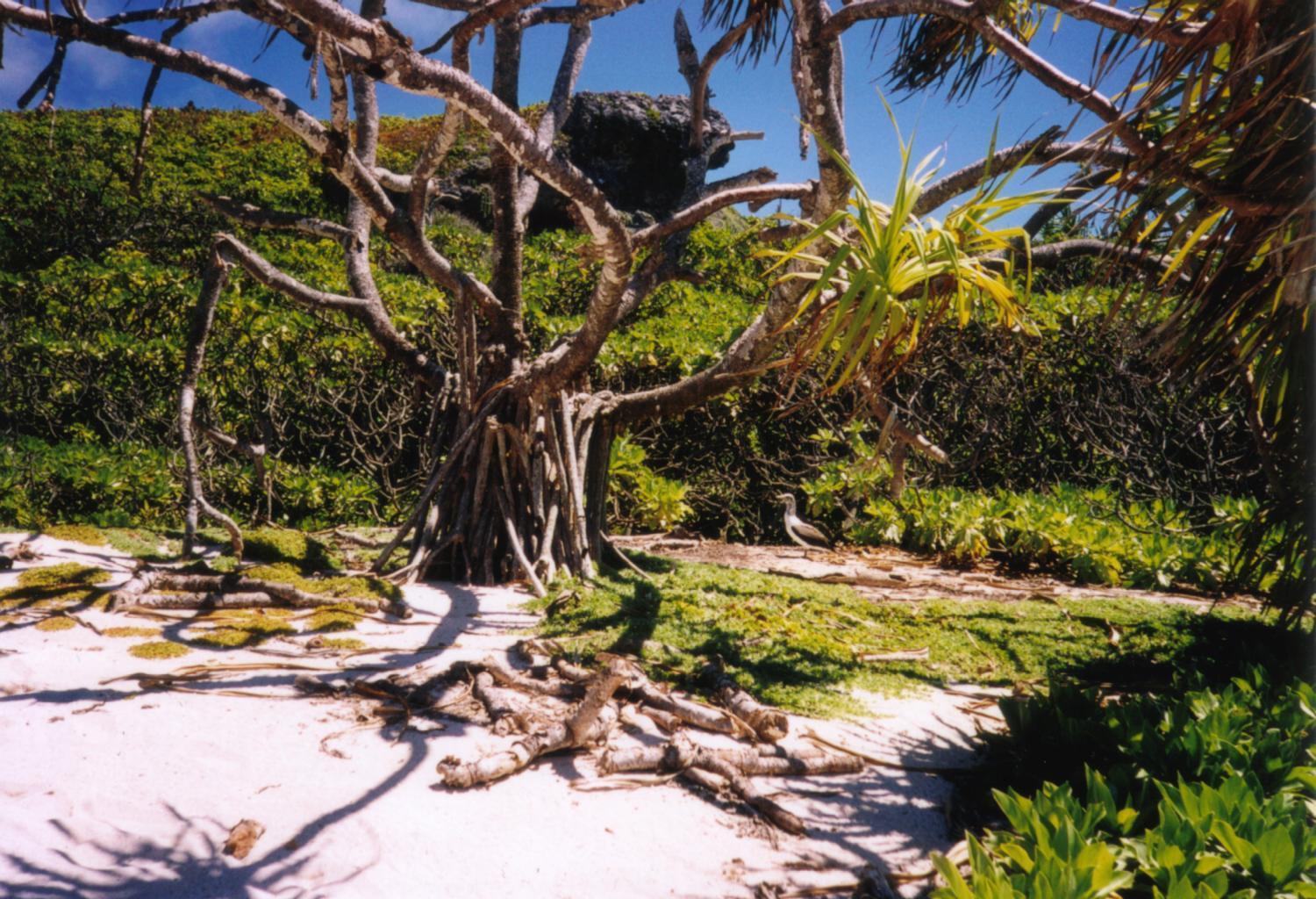
Henderson Island, a remote atoll in the eastern South Pacific, is one of the most pristine and unique ecosystems on Earth. This uninhabited island, measuring approximately 9.6 by 5.1 kilometers, forms part of the Pitcairn Island Group, along with Pitcairn, Oeno, and Ducie Islands. With an area of 37.3 square kilometers, Henderson Island lies 193 kilometers northeast of Pitcairn Island, the only inhabited island in the group.
More to come…UNESCO Description of the World Heritage Site
Henderson Island, which lies in the eastern South Pacific, is one of the few atolls in the world whose ecology has been practically untouched by a human presence. Its isolated location provides the ideal context for studying the dynamics of insular evolution and natural selection. It is particularly notable for the 10 plants and four land birds that are endemic to the island.
UNESCO Justification of the World Heritage Site
Criterion (vii): As one of the last near-pristine limestone islands of significant size in the world, Henderson Island retains its exceptional natural beauty with its white, sandy beaches, limestone cliffs, and rich and almost undisturbed vegetation. With its vast numbers of breeding seabirds, the island is an outstanding example of a raised and forested oceanic coral atoll with its fundamental features intact.
Criterion (x): While isolated coral atolls are typically species-poor, all four of Henderson’s land birds are endemic including the very distinct flightless Henderson Crake. At least four other endemic and one native species of bird are believed to have become extinct following human colonization. The island today is the only known breeding site of the endangered Henderson Petrel and is an important breeding area for at least ten other seabird species. While the flora is also typically poor with some 57 native vascular species recorded, these include six endemic species, three endemic varieties and another species endemic to Henderson and Pitcairn. As the island has never been intensively studied it seems likely that other as yet unidentified endemics occur. For example, the island's invertebrate fauna is little known but about one-third of the insects and gastropods so far collected are endemic.
Encyclopedia Record: Henderson Island (Pitcairn Islands)
Henderson Island is an uninhabited island in the south Pacific Ocean. It is part of the Pitcairn Island Group, together with Pitcairn, Oeno, and Ducie Islands. Measuring 9.6 by 5.1 kilometres, it has an area of 37.3 km2 (14.4 sq mi) and is located 193 km northeast of Pitcairn Island, which is the only inhabited island of the group. It has poor soil and little fresh water, and is unsuitable for agriculture. There are three beaches on the northern end and the remaining coast comprises steep cliffs up to 15 m (50 ft) in height. In 1902, it was annexed to the Pitcairn Islands colony, which is now a British Overseas Territory.Additional Site Details
Area: 3,700 hectares
Number of Components: 1
(x) — Contains most important habitats for biodiversity
Coordinates: -24.3666666667 , -128.333333333
IUCN World Heritage Outlook
The 2025 Conservation Outlook on Henderson Island reports the following assessment:
Source: International Union for Conservation of Nature (IUCN) · View assessment
Image
© Makemake at German Wikipedia, CC BY-SA 3.0 Resized from original. (This derivative is under the same CC BY-SA license.)
