World Heritage Identification Number: 474
World Heritage since: 1999
Category: Cultural Heritage
WHE Type: Protected Areas & National Parks
Transboundary Heritage: No
Endangered Heritage: No
Country: 🇭🇺 Hungary
Continent: Europe
UNESCO World Region: Europe and North America
Map
Hortobágy National Park: A Glimpse into the Heart of Hungarian Culture
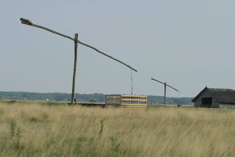
The Hortobágy National Park, often referred to as the "Puszta," is a captivating expanse of plains and wetlands nestled in the eastern region of Hungary. This vast, unspoiled territory spans over 800 square kilometers and has been recognized as a UNESCO World Heritage Site since 1999.
More to come…UNESCO Description of the World Heritage Site
The cultural landscape of the Hortobágy Puszta consists of a vast area of plains and wetlands in eastern Hungary. Traditional forms of land use, such as the grazing of domestic animals, have been present in this pastoral society for more than two millennia.
UNESCO Justification of the World Heritage Site
Criterion (iv): The Hungarian Puszta is an exceptional surviving example of a cultural landscape constituted by a pastoral society.
Criterion (v): The landscape of the Hortobágy National Park maintains intact and visible traces of its traditional land-use forms over several thousand years, and illustrates the harmonious interaction between people and nature.
Encyclopedia Record: Hortobágy National Park
Hortobágy is an 800 km2 national park in eastern Hungary, rich with folklore and cultural history. The park, a part of the Alföld, was designated as a national park in 1973, and elected among the World Heritage Sites in 1999. The Hortobágy is Hungary's largest protected area, and the largest semi-natural grassland in Europe.Additional Site Details
Area: 74,820 hectares
Number of Components: 1
(v) — Outstanding example of traditional human settlement
Coordinates: 47.59458 , 21.15678