World Heritage Identification Number: 1415
World Heritage since: 2018
Category: Mixed Cultural Heritage and Natural Heritage
WHE Type: Natural Landscapes & Geographic Features
Transboundary Heritage: No
Endangered Heritage: No
Country: 🇨🇦 Canada
Continent: Americas
UNESCO World Region: Europe and North America
Map
Pimachiowin Aki: A Cultural Landscape of Indigenous Significance
Pimachiowin Aki, meaning 'The Land That Gives Life', is a vast and pristine wilderness straddling the provinces of Manitoba and Ontario in Canada. This UNESCO World Heritage Site spans over 29,000 square kilometers, encompassing the traditional territories of four Anishinaabe First Nations communities – Poplar River First Nation, Little Grand Rapids First Nation, Pauingassi First Nation, and Bloodvein First Nation.
More to come…UNESCO Description of the World Heritage Site
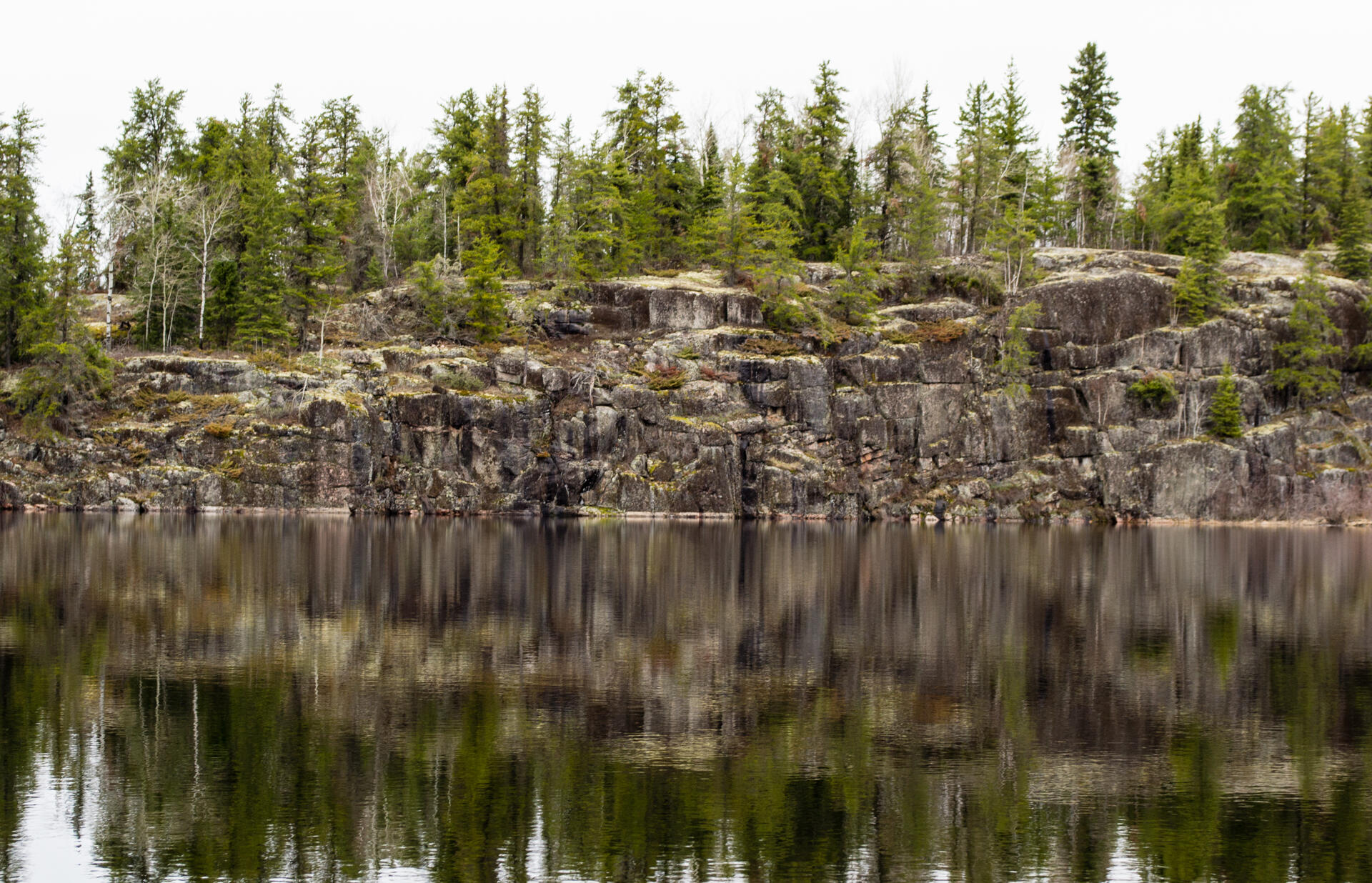
Pimachiowin Aki ('The Land That Gives Life') is a landscape of rivers, lakes, wetlands, and boreal forest. It forms part of the ancestral home of the Anishinaabeg, an indigenous people living from fishing, hunting and gathering. The site encompasses the traditional lands of four Anishinaabeg communities (Bloodvein River, Little Grand Rapids, Pauingassi and Poplar River). It is an exceptional example of the cultural tradition of Ji-ganawendamang Gidakiiminaan ('keeping the land'), which consists of honouring the gifts of the Creator, respecting all forms of life, and maintaining harmonious relations with others. A complex network of livelihood sites, habitation sites, travel routes and ceremonial sites, often linked by waterways, provides testimony to this ancient and continuing tradition.
UNESCO Justification of the World Heritage Site
Criterion (iii): Pimachiowin Aki provides an exceptional testimony to the continuing Anishinaabe cultural tradition of Ji-ganawendamang Gidakiiminaan (Keeping the Land). Ji-ganawendamang Gidakiiminaan guides relations between Anishinaabeg and the land; it is the framework through which the cultural landscape of Pimachiowin Aki is perceived, given meaning, used and sustained across the generations. Widely dispersed across the landscape are ancient and contemporary livelihood sites, sacred sites and named places, most linked by waterways that are tangible reflections of Ji-ganawendamang Gidakiiminaan.
Criterion (vi): Pimachiowin Aki is directly and tangibly associated with the living tradition and beliefs of the Anishinaabeg, who understand they were placed on the land by the Creator and given all they need to survive. They are bound to the land and to caring for it through a sacred responsibility to maintain their cultural tradition of Ji-ganawendamang Gidakiiminaan (Keeping the Land). This involves ceremonies at specific sites to communicate with other beings, and respect for sacred places such as pictograph sites, Thunderbird nests, and places where memegwesiwag (little rock people) dwell, in order to ensure harmonious relations with the other spirit beings with whom Anishinaabeg share the land, and to maintain a productive life on the land. The beliefs and values that make up Ji-ganawendamang Gidakiiminaan are sustained by systems of customary governance based on family structures and respect for elders, and through vibrant oral traditions that are tangibly associated with intimate knowledge of the land through named places that serve as mnemonic prompts, including locations of resources, travel routes, and the history of Anishinaabe occupation and use. The size of Pimachiowin Aki and the strength of these traditions make it an exceptional example of a belief that can be seen to be of universal significance.
Criterion (ix): Pimachiowin Aki is the most complete and largest example of the North American boreal shield, including its characteristic biodiversity and ecological processes. Pimachiowin Aki contains an exceptional diversity of terrestrial and freshwater ecosystems and fully supports wildfire, nutrient flow, species movements, and predator-prey relationships, which are essential ecological processes in the boreal forest. Pimachiowin Aki’s remarkable size, intactness, and ecosystem diversity support characteristic boreal species such as Woodland Caribou, Moose, Wolf, Wolverine, Lake Sturgeon, Leopard Frog, Loon and Canada Warbler. Notable predator-prey relationships are sustained among species such as Wolf and Moose and Woodland Caribou, and Lynx and Snowshoe Hare. Traditional use by Anishinaabeg, including sustainable fishing, hunting and trapping, is also an integral part of the boreal ecosystems in Pimachiowin Aki.
Encyclopedia Record: Pimachiowin Aki
Pimachiowin Aki is a UNESCO World Heritage Site located in the boreal forest that covers parts of Manitoba and Ontario. The site is more than 29,000 square kilometres (11,000 sq mi) in area, and includes ancestral lands of four First Nations including Poplar River First Nation, Little Grand Rapids First Nation, Pauingassi First Nation, and Bloodvein First Nation. The area also includes the Manitoba Provincial Wilderness Park of Atikaki Provincial Park and the Ontario Woodland Caribou Provincial Park. The World Heritage Site's original proposal started with the signing of the Protected Areas and First Nation Resource Stewardship Accord in 2002. The name means land that gives life in Ojibwe.Additional Site Details
Area: 2,904,000 hectares
Number of Components: 1
(vi) — Directly associated with events or living traditions
(ix) — Outstanding example representing ecological and biological processes
Coordinates: 51.8264166667 , -95.4112777778
IUCN World Heritage Outlook
The 2025 Conservation Outlook on Pimachiowin Aki reports the following assessment:
Source: International Union for Conservation of Nature (IUCN) · View assessment