World Heritage Identification Number: 1013
World Heritage since: 2000
Category: Natural Heritage
WHE Type: Protected Areas & National Parks
Transboundary Heritage: No
Endangered Heritage: No
Country: 🇲🇾 Malaysia
Continent: Asia
UNESCO World Region: Asia and the Pacific
Map
Gunung Mulu National Park: A Tropical Karst Haven
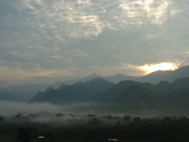
Nestled within the heart of Borneo, the Gunung Mulu National Park (often abbreviated as Mulu National Park) stands as a testament to the wonders of nature and the intricate beauty of tropical karst landscapes. Established in 1974 and designated as a UNESCO World Heritage Site in 2000, this pristine protected area spans an expansive 52,864 hectares, making it one of the largest national parks in Malaysia.
More to come…UNESCO Description of the World Heritage Site
Important both for its high biodiversity and for its karst features, Gunung Mulu National Park, on the island of Borneo in the State of Sarawak, is the most studied tropical karst area in the world. The 52,864-ha park contains seventeen vegetation zones, exhibiting some 3,500 species of vascular plants. Its palm species are exceptionally rich, with 109 species in twenty genera noted. The park is dominated by Gunung Mulu, a 2,377 m-high sandstone pinnacle. At least 295 km of explored caves provide a spectacular sight and are home to millions of cave swiftlets and bats. The Sarawak Chamber, 600 m by 415 m and 80 m high, is the largest known cave chamber in the world.
UNESCO Justification of the World Heritage Site
Criterion (vii): Gunung Mulu National Park is an area of exceptional natural beauty, with striking primary forest, karst terrain, mountains, waterfalls and the largest caves on earth. Sarawak Chamber, the largest cave chamber in the world, stretches 600 m in length by 415 m wide and 80 m high. With a volume of 12 million cubic meters and an unsupported roof span of 300 m, this chamber dwarfs any other large chamber so far discovered. Deer Cave at 120 to 150 m in diameter is the largest cave passage in the world known at the present time and the Clearwater Cave System holds the world record as the longest cave in Asia at 110 km of mapped and explored passages. As some of the largest caves in the world they contain fine examples of tropical river caves, flood incuts, vadose, and phreatic caves, exhibiting fine examples of all types of speleothems (structures formed in a cave by the deposition of minerals from water).
Criterion (viii): The park is an outstanding example of major changes in the earth’s history. Three major rock formations are evident; the Mulu Formation of Paleocene and Eocene shale’s, and sandstone, rising to 2,376 m at the summit of Gunung Mulu: the 1.5 km thick Melinau Limestone formation of Upper Eocene, Oligocene and Lower Miocene, rising to 1,682 m at Gunung Api; and the Miocene Setap Shale formation outcropping as a gentle line of hills to the west. Major uplift that occurred during the late Pliocene to Pleistocene is well represented in the 295 km of explored caves as a series of major cave levels. The surface and underground geomorphology and hydrology reveal significant information on the tectonic and climatic evolution of Borneo. The sequence of terrestrial alluvial deposits provides an important record of glacial – interglacial cycles with the series of uplifted caves ranging from 28 m to over 300 m above sea level are at least 2 to 3 million years old, indicating uplift rates of about 19 cm per 1,000 years.
Criterion (ix): The property provides significant scientific opportunities to study theories on the origins of cave fauna with over 200 species recorded, including many troglobitic species and it displays outstanding examples of ongoing ecological and biological processes. Seventeen vegetation zones have been identified along with their diverse associated fauna. Some 3,500 species of plants, 1,700 mosses and liverworts and over 4,000 species of fungi have been recorded within the property. There are 20,000 species of invertebrates, 81 species of mammals, 270 species of birds, 55 species of reptiles, 76 species of amphibians and 48 species of fish.
Criterion (x): The property supports one of the richest assemblages of flora to be found in any area of comparable size in the world. It is botanically-rich in species and high in endemism, including one of the richest sites in the world for palm species and contains outstanding natural habitats for in-situ conservation for a large number of species; Deer Cave alone has one of the largest colonies in the world of free tailed bats, Chaerephon plicata at over 3 million. This one cave also has the largest number of different species of bats to be found in a single cave. Several million cave swiftlets (Aerodramus sp.) have been recorded from one cave system, constituting the largest colony in the world. Many species of fauna are endemic and 41 species are included on the endangered species list.
Encyclopedia Record: Gunung Mulu National Park
The Gunung Mulu National Park, also known simply as the Mulu National Park is a national park in Miri Division, Sarawak, Malaysia. It is a UNESCO World Heritage Site that encompasses caves and karst formations in a mountainous equatorial rainforest setting. The park is famous for its caves and the expeditions that have been mounted to explore them and their surrounding rainforest, most notably the Royal Geographical Society Expedition of 1977–1978, which saw over 100 scientists in the field for 15 months. This initiated a series of over 20 expeditions now named the Mulu Caves Project.Additional Site Details
Area: 52,864 hectares
Number of Components: 1
(viii) — Outstanding example representing major earth stages
(ix) — Outstanding example representing ecological and biological processes
(x) — Contains most important habitats for biodiversity
Coordinates: 4.13333 , 114.91667
IUCN World Heritage Outlook
The 2025 Conservation Outlook on Gunung Mulu National Park reports the following assessment:
Source: International Union for Conservation of Nature (IUCN) · View assessment
Image
© Juanita at the Japanese wikpedia, CC BY-SA 3.0 Resized from original. (This derivative is under the same CC BY-SA license.)
