World Heritage Identification Number: 890
World Heritage since: 1999
Category: Cultural Heritage
WHE Type: Historic Cities & Urban Areas
Transboundary Heritage: No
Endangered Heritage: No
Country: 🇧🇷 Brazil
Continent: Americas
UNESCO World Region: Latin America and the Caribbean
Map
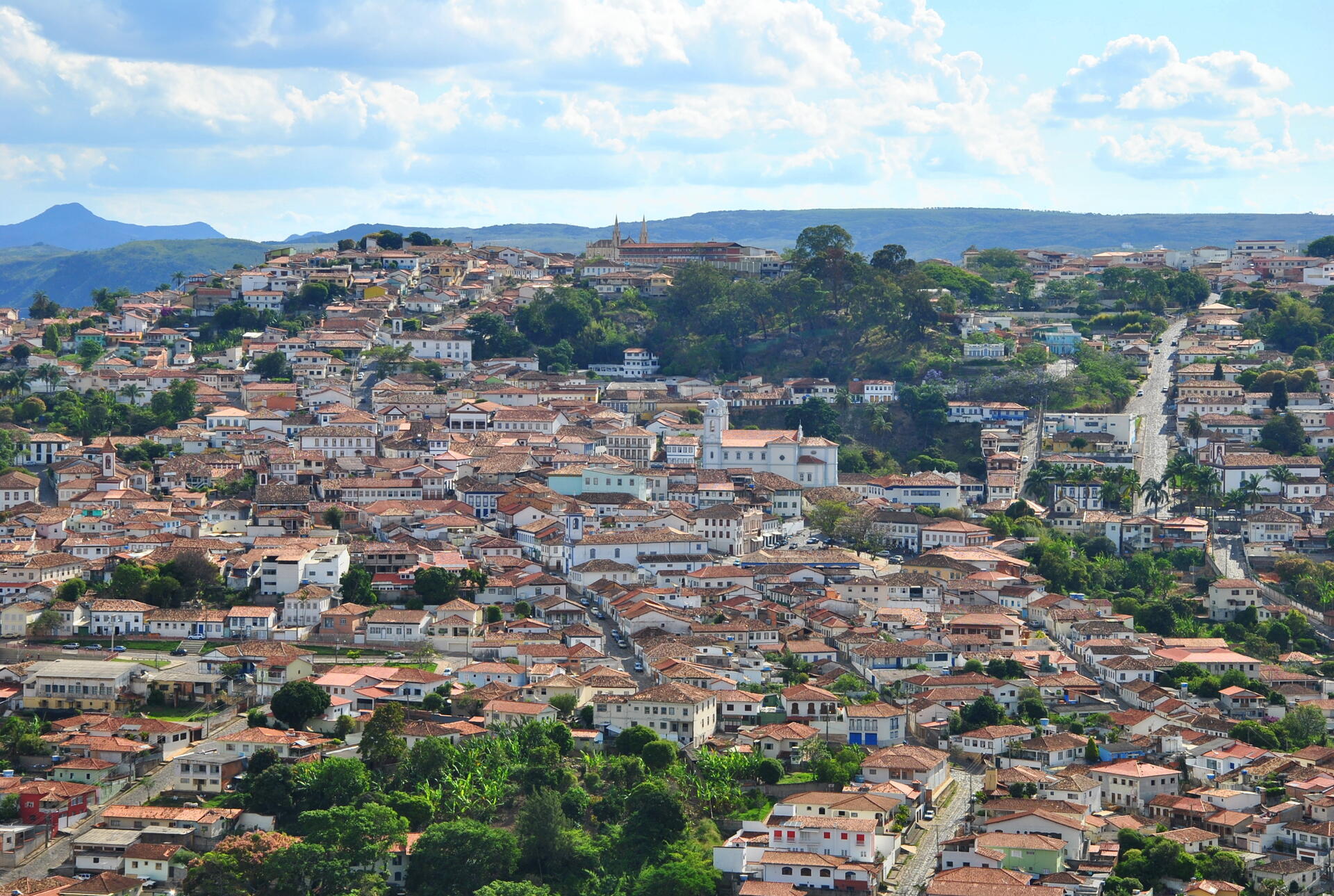
The Historic Centre of the Town of Diamantina: A Gem in the Heart of Minas Gerais, Brazil
The Historic Centre of the Town of Diamantina, inscribed as a UNESCO World Heritage Site in 1999, is a captivating colonial village nestled amidst the rugged, unforgiving landscapes of the Minas Gerais highlands in Brazil. This enchanting town, reminiscent of a precious gemstone set against a backdrop of barren, rocky mountains, bears witness to the indomitable spirit of diamond prospectors who once sought their fortune here during the 18th century.
More to come…UNESCO Description of the World Heritage Site
Diamantina, a colonial village set like a jewel in a necklace of inhospitable rocky mountains, recalls the exploits of diamond prospectors in the 18th century and testifies to the triumph of human cultural and artistic endeavour over the environment.
UNESCO Justification of the World Heritage Site
Criterion (ii): Diamantina shows how explorers of the Brazilian territory, diamond prospectors, and representatives of the Crown were able to adapt European models to an American context in the 18th century, thus creating a culture that was faithful to its roots yet completely original.
Criterion (iv): The urban and architectural group of Diamantina, perfectly integrated into a wild landscape, is a fine example of an adventurous spirit combined with a quest for refinement so typical of human nature.
Encyclopedia Record: Diamantina, Minas Gerais
Diamantina is a Brazilian municipality in the state of Minas Gerais. Its estimated population in 2020 was 47,825 in a total area of 3,870 km2.Additional Site Details
Area: 28.5 hectares
Number of Components: 1
(iv) — Outstanding example of a type of building or landscape
Coordinates: -18.244776 , -43.59768