World Heritage Identification Number: 861
World Heritage since: 1998
Category: Cultural Heritage
WHE Type: Buildings & Architectural Ensembles
Transboundary Heritage: No
Endangered Heritage: No
Country: 🇨🇿 Czechia
Continent: Europe
UNESCO World Region: Europe and North America
Map
Holašovice Historic Village: An Exceptional Example of Central European Vernacular Architecture
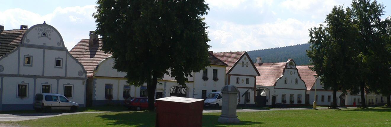
The Holašovice Historic Village, situated 16 kilometers west of České Budějovice in the southern part of the Czech Republic, stands as an extraordinary testament to the enduring legacy of traditional central European architecture. Inscribed as a UNESCO World Heritage Site in 1998, this picturesque hamlet offers a unique glimpse into the past, showcasing an unparalleled preservation of a Baroque-era village that remains largely untouched since the Middle Ages.
More to come…UNESCO Description of the World Heritage Site
Holašovice is an exceptionally complete and well-preserved example of a traditional central European village. It has a large number of outstanding 18th- and 19th-century vernacular buildings in a style known as 'South Bohemian folk Baroque', and preserves a ground plan dating from the Middle Ages.
UNESCO Justification of the World Heritage Site
Criterion (ii): Holašovice is of special significance in that it represents the fusion of two vernacular building traditions to create an exceptional and enduring style, known as South Bohemian “Folk Baroque”.
Criterion (iv): The exceptional completeness and excellent preservation of Holašovice and its buildings make it an outstanding example of traditional rural settlement in central Europe.
Encyclopedia Record: Holašovice
Holašovice is a small historic village located in the south of the Czech Republic, 16 kilometres west of České Budějovice. Village belongs to the municipality Jankov. To the south lies the protected landscape area of Blanský Forest. The village was deserted after the Second World War, allowing its medieval plan and vernacular buildings in the South Bohemian Folk or Rural Baroque style to remain intact. It was restored and repopulated from 1990, and it was designated as a UNESCO World Heritage Site in 1998 because of its exceptional preservation of a traditional Baroque-era village.Additional Site Details
Area: 11.4 hectares
Number of Components: 1
(iv) — Outstanding example of a type of building or landscape
Coordinates: 48.9696388889 , 14.2726111111
Image
© The original uploader was Sgbeer at German Wikipedia., CC BY-SA 3.0 Resized from original. (This derivative is under the same CC BY-SA license.)
