World Heritage Identification Number: 887
World Heritage since: 2008
Category: Cultural Heritage
WHE Type: Agriculture Landscapes, Parks & Gardens
Transboundary Heritage: No
Endangered Heritage: No
Country: 🇵🇬 Papua New Guinea
Continent: Oceania
UNESCO World Region: Asia and the Pacific
Map
Unraveling the Mysteries of Kuk Early Agricultural Site: A Testament to Ancient Agriculture in Papua New Guinea
The Kuk Early Agricultural Site, located in the Wahgi Valley of the highlands in Papua New Guinea, stands as a remarkable testament to human ingenuity and adaptation. Inscribed as a UNESCO World Heritage Site in 2008, this unique location offers a fascinating glimpse into the early stages of agriculture and the transformative impact it had on human societies.
More to come…UNESCO Description of the World Heritage Site
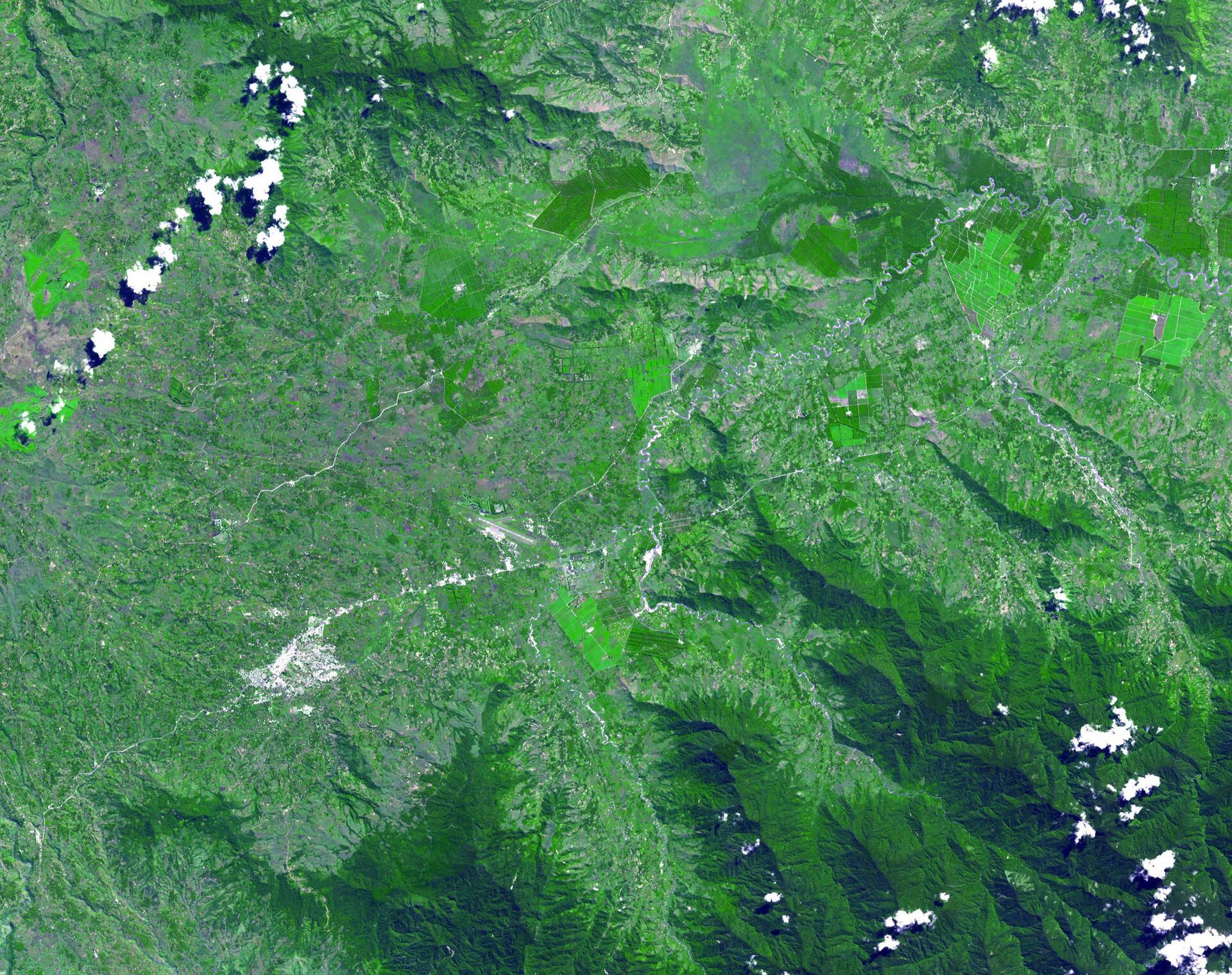
Kuk Early Agricultural Site consists of 116 ha of swamps in the western highlands of New Guinea 1,500 metres above sea-level. Archaeological excavation has revealed the landscape to be one of wetland reclamation worked almost continuously for 7,000, and possibly for 10,000 years. It contains well-preserved archaeological remains demonstrating the technological leap which transformed plant exploitation to agriculture around 6,500 years ago. It is an excellent example of transformation of agricultural practices over time, from cultivation mounds to draining the wetlands through the digging of ditches with wooden tools. Kuk is one of the few places in the world where archaeological evidence suggests independent agricultural development and changes in agricultural practice over such a long period of time.
UNESCO Justification of the World Heritage Site
Criterion (iii): The extent of the evidence of early agriculture on the Kuk site can be seen as an exceptional testimony to a type of exploitation of the land which reflects the culture of early man in the region.
Criterion (iv): Kuk is one of the few places in the world where archaeological evidence suggests independent agricultural development and changes in agricultural practice over a 7,000 and possibly a 10,000 year time span.
Encyclopedia Record: Kuk Swamp
Kuk Swamp is an archaeological site in Papua New Guinea, that lies in the Wahgi Valley of the highlands at an altitude of about 1550 m some 12–13 km northeast of Mount Hagen, the capital of Western Highlands Province. The swamp developed in a former lake basin, as it was filled by an alluvial fan or deposits of water-transported material. Archaeological evidence for early agricultural drainage systems was found here, beginning about 9,000 years ago. It includes draining ditches of three major classes, which were used to convert the area to an anthropogenic grassland. The native crop taro was grown here.Additional Site Details
Area: 116 hectares
Number of Components: 1
(iv) — Outstanding example of a type of building or landscape
Coordinates: -5.7837111111 , 144.3317222222
Image
NASA: JPL, Public domain
