World Heritage Identification Number: 1181
World Heritage since: 2005
Category: Cultural Heritage
WHE Type: Historic Cities & Urban Areas
Transboundary Heritage: No
Endangered Heritage: No
Country: 🇫🇷 France
Continent: Europe
UNESCO World Region: Europe and North America
Map
Le Havre, the City Rebuilt by Auguste Perret: A Post-War Architectural Marvel
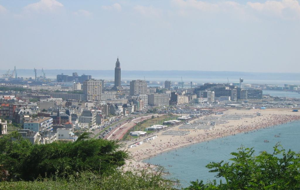
Le Havre, a significant port city in the Seine-Maritime department of Normandy, France, stands as a testament to architectural innovation and urban planning prowess. Inscribed as a UNESCO World Heritage Site in 2005, this city, rebuilt after extensive damage during World War II, represents a unique blend of historical preservation and modernist design.
More to come…UNESCO Description of the World Heritage Site
The city of Le Havre, on the English Channel in Normandy, was severely bombed during the Second World War. The destroyed area was rebuilt according to the plan of a team headed by Auguste Perret, from 1945 to 1964. The site forms the administrative, commercial and cultural centre of Le Havre. Le Havre is exceptional among many reconstructed cities for its unity and integrity. It combines a reflection of the earlier pattern of the town and its extant historic structures with the new ideas of town planning and construction technology. It is an outstanding post-war example of urban planning and architecture based on the unity of methodology and the use of prefabrication, the systematic utilization of a modular grid, and the innovative exploitation of the potential of concrete.
UNESCO Justification of the World Heritage Site
Criterion (ii): The post-war reconstruction plan of Le Havre is an outstanding example and a landmark of the integration of urban planning traditions and a pioneer implementation of modern development in architecture, technology and town planning.
Criterion (iv): Le Havre is an outstanding post-war example of urban planning and architecture, based on the unity of methodology and system of prefabrication, the systematic use of a modular grid and the innovative exploitation of the potential of concrete.
Encyclopedia Record: Le Havre
Le Havre is a major port city in the Seine-Maritime department in the Normandy region of northern France. It is situated on the right bank of the estuary of the river Seine on the Channel southwest of the Pays de Caux, very close to the Prime Meridian. Le Havre is the most populous commune of Upper Normandy, although the total population of the greater Le Havre conurbation is smaller than that of Rouen. It is also the second largest subprefecture in France, after only Reims. The name Le Havre means "the harbour" or "the port". Its inhabitants are known as Havrais or Havraises.Additional Site Details
Area: 133 hectares
Number of Components: 1
(iv) — Outstanding example of a type of building or landscape
Coordinates: 49.49278 , 0.1075
Image
©
- derivative work:Ignis
- Le_Havre_Vue_Plage_14_07_2005.jpg: Urban
