World Heritage Identification Number: 1259
World Heritage since: 2008
Category: Cultural Heritage
WHE Type: Cultural Landscapes
Transboundary Heritage: No
Endangered Heritage: No
Country: 🇲🇺 Mauritius
Continent: Africa
UNESCO World Region: Africa
Map
Le Morne Cultural Landscape: A Symbol of Resilience and Freedom
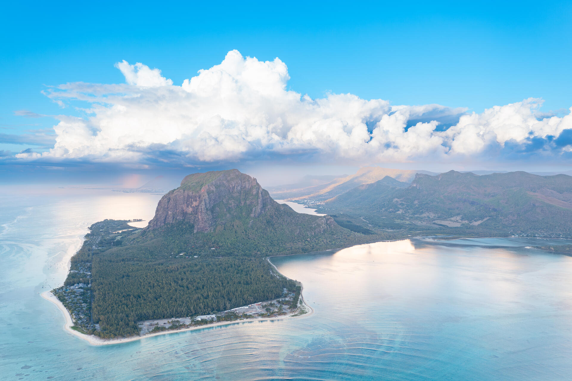
The Le Morne Cultural Landscape, inscribed as a UNESCO World Heritage Site in 2008, stands as a testament to the indomitable spirit of humanity and the enduring legacy of the struggle for freedom. Situated in the southwest of Mauritius, this rugged mountain jutting into the Indian Ocean serves as a poignant reminder of the resilience and courage exhibited by runaway slaves, or maroons, during the 18th and early 19th centuries.
More to come…UNESCO Description of the World Heritage Site
Le Morne Cultural Landscape, a rugged mountain that juts into the Indian Ocean in the southwest of Mauritius was used as a shelter by runaway slaves, maroons, through the 18th and early years of the 19th centuries. Protected by the mountain’s isolated, wooded and almost inaccessible cliffs, the escaped slaves formed small settlements in the caves and on the summit of Le Morne. The oral traditions associated with the maroons, have made Le Morne a symbol of the slaves’ fight for freedom, their suffering, and their sacrifice, all of which have relevance to the countries from which the slaves came - the African mainland, Madagascar, India, and South-east Asia. Indeed, Mauritius, an important stopover in the eastern slave trade, also came to be known as the “Maroon republic” because of the large number of escaped slaves who lived on Le Morne Mountain.
UNESCO Justification of the World Heritage Site
Criterion (iii): The mountain is an exceptional testimony to maroonage or resistance to slavery in terms of it being used as a fortress for the shelter of escaped slaves, with evidence to support that use.
Criterion (vi): The dramatic form of the mountain, the heroic nature of the resistance it sheltered, and the longevity of the oral traditions associated with the maroons, has made Le Morne a symbol of slaves’ fight for freedom, their suffering, and their sacrifice, all of which have relevance beyond its geographical location, to the countries from which the slaves came – in particular the African mainland, Madagascar and India and South-east Asia.
Encyclopedia Record: Le Morne Brabant
Le Morne Brabant is a peninsula at the extreme southwestern tip of the Indian Ocean island of Mauritius. On it is a basaltic monolith of the same name 556 metres high. Its summit covers an area of over 12 hectares. There are many caves and overhangs on the steep slopes. It is largely surrounded by a lagoon and is a well known tourist attraction. It is also a refuge for two rare plants, the Mandrinette and the Boucle d'Oreille. The peninsula of Le Morne benefits from a micro-climate. The mountain is named after the Dutch East India Company ship Brabant that ran aground here on 29 December 1783.Additional Site Details
Area: 349.6 hectares
Number of Components: 1
(vi) — Directly associated with events or living traditions
Coordinates: -20.4519444444 , 57.3283333333