World Heritage Identification Number: 1227
World Heritage since: 2006
Category: Cultural Heritage
WHE Type: Buildings & Architectural Ensembles
Transboundary Heritage: No
Endangered Heritage: No
Country: 🇲🇺 Mauritius
Continent: Africa
UNESCO World Region: Africa
Map
Aapravasi Ghat: The Gateway to a New Life
The small but historically significant site of Aapravasi Ghat, located in the heart of Port Louis, the capital city of Mauritius, stands as a testament to one of the most significant migrations in human history. Inscribed as a UNESCO World Heritage Site in 2006, this 1,640 m² area holds immense importance not only for Mauritius but also for numerous other countries that were part of the British Empire during the period when the site was operational.
More to come…UNESCO Description of the World Heritage Site
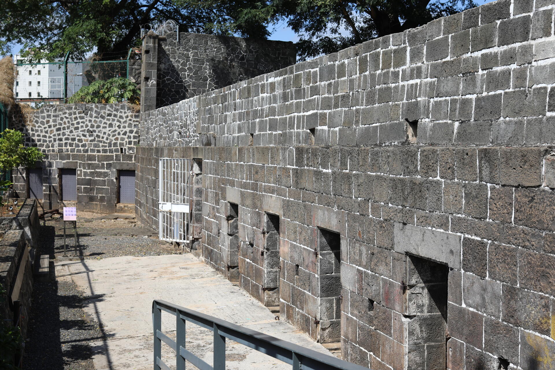
In the district of Port Louis, lies the 1,640 m2 site where the modern indentured labour diaspora began. In 1834, the British Government selected the island of Mauritius to be the first site for what it called ‘the great experiment’ in the use of ‘free’ labour to replace slaves. Between 1834 and 1920, almost half a million indentured labourers arrived from India at Aapravasi Ghat to work in the sugar plantations of Mauritius, or to be transferred to Reunion Island, Australia, southern and eastern Africa or the Caribbean. The buildings of Aapravasi Ghat are among the earliest explicit manifestations of what was to become a global economic system and one of the greatest migrations in history.
UNESCO Justification of the World Heritage Site
Criterion (vi): Aapravasi Ghat, as the first site chosen by the British Government in 1834 for the ‘great experiment’ in the use of indentured, rather than slave labour, is strongly associated with memories of almost half a million indentured labourers moving from India to Mauritius to work on sugar cane plantations or to be transshipped to other parts of the world.
Encyclopedia Record: Aapravasi Ghat
Aapravasi Ghat is a building complex located in Port Louis, Mauritius, the first British colony to receive indentured, or contracted, labour workforce from many countries. From 1849 to 1923, half a million Indian indentured labourers passed through the Immigration Depot, to be transported to plantations throughout the British Empire. The large-scale migration of the labourers left an indelible mark on the societies of many former British colonies, with Indians constituting a substantial proportion of their national populations. In Mauritius alone, 68 percent of the current total population is of Indian ancestry. The Immigration Depot has thus become an important reference point in the history and cultural identity of Mauritius.Additional Site Details
Area: 0.164 hectares
Number of Components: 1
Coordinates: -20.1586388889 , 57.5031666666
Image
© Suyash Dwivedi, CC BY-SA 4.0 Resized from original. (This derivative is under the same CC BY-SA license.)
