World Heritage Identification Number: 24
World Heritage since: 1978
Category: Natural Heritage
WHE Type: Protected Areas & National Parks
Transboundary Heritage: No
Endangered Heritage: No
Country: 🇨🇦 Canada
Continent: Americas
UNESCO World Region: Europe and North America
Map
Exploring the Majestic Landscape of Nahanni National Park
Nahanni National Park, located in the Dehcho Region of the Northwest Territories, Canada, offers visitors a glimpse into one of the most pristine and breathtaking landscapes in North America. This UNESCO World Heritage Site, officially named Nahatta Dehe, meaning "river of the land of the Nahatta people," was designated as such in 1978 due to its stunning wilderness, diverse waterways, towering limestone canyons, and rich biodiversity.
More to come…UNESCO Description of the World Heritage Site
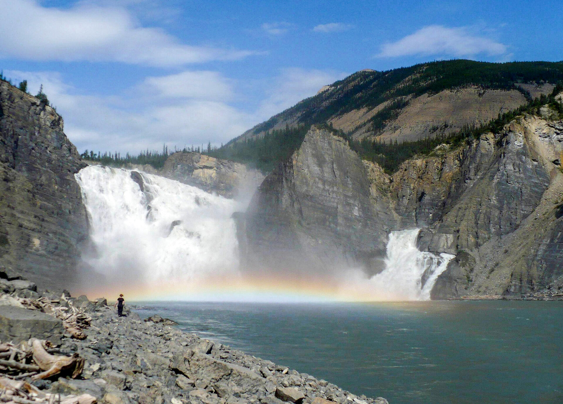
Located along the South Nahanni River, one of the most spectacular wild rivers in North America, this park contains deep canyons and huge waterfalls, as well as a unique limestone cave system. The park is also home to animals of the boreal forest, such as wolves, grizzly bears and caribou. Dall's sheep and mountain goats are found in the park's alpine environment.
UNESCO Justification of the World Heritage Site
Criterion (vii): The South Nahanni River is one of the most spectacular wild rivers in North America, with deep canyons, huge waterfalls, and spectacular karst terrain, cave systems and hot springs. Exposure of geologic and geomorphologic features includes the meanders of ancient rivers, now raised high above present river levels.
Criterion (viii): In Nahanni National Park, there is exceptional representation of on-going geological processes, notably fluvial erosion, tectonic uplift, folding and canyon development, wind erosion, karst and pseudo-karst landforms, and a variety of hot springs. The major geologic and geomorphologic features provide a combination of geological processes that are globally unique.
Encyclopedia Record: Nahanni National Park Reserve
The Nahanni National Park Reserve, sometimes known as "Headless Valley" or "Valley of The Headless Men", in the Dehcho Region of the Northwest Territories, Canada, protects a portion of the Mackenzie Mountains Natural Region. The centrepiece of the park is the South Nahanni River. Four noteworthy canyons, called First, Second, Third and Fourth Canyon, line the whitewater river. Each canyon has walls reaching some 1,000 m (3,300 ft) in height. The word nahanni comes from the local Dene name for the area, Nahʔa Dehé, which means "river of the land of the Nahʔa people". The park was one of the earliest locations to be inscribed as World Heritage Sites by UNESCO; this designation was given in 1978 due to the area's picturesque wilderness, its various waterways and giant falls, and its 1,000 meter-deep limestone canyons, among other features.Additional Site Details
Area: 476,560 hectares
Number of Components: 1
(viii) — Outstanding example representing major earth stages
Coordinates: 61.54722222 , -125.5894444
IUCN World Heritage Outlook
The 2025 Conservation Outlook on Nahanni National Park reports the following assessment:
Source: International Union for Conservation of Nature (IUCN) · View assessment