World Heritage Identification Number: 134
World Heritage since: 1980
Category: Natural Heritage
WHE Type: Protected Areas & National Parks
Transboundary Heritage: No
Endangered Heritage: No
Country: 🇺🇸 United States of America
Continent: Americas
UNESCO World Region: Europe and North America
Map
Redwood National and State Parks: A Haven for the Tallest Trees on Earth
The Redwood National and State Parks (RNSP), situated along the rugged coast of northern California, offer a unique blend of natural beauty and historical significance. This expansive network of protected areas encompasses four distinct entities: Redwood National Park, Del Norte Coast Redwoods State Park, Jedediah Smith Redwoods State Park, and Prairie Creek Redwoods State Park. Together, these parks protect approximately 139,000 acres of land, home to over 45% of the world's remaining old-growth coast redwood forests.
More to come…UNESCO Description of the World Heritage Site
Redwood National Park comprises a region of coastal mountains bordering the Pacific Ocean north of San Francisco. It is covered with a magnificent forest of coastal redwood trees, the tallest and most impressive trees in the world. The marine and land life are equally remarkable, in particular the sea lions, the bald eagle and the endangered California brown pelican.
UNESCO Justification of the World Heritage Site
Criterion (vii): Redwood National and State Parks comprise a region of coastal mountains bordering the Pacific Ocean. It is covered with a magnificent forest of Coast Redwoods (Sequoia sempervirens), the tallest living things and among the most impressive trees in the world. Several of the world's tallest known trees grow within the property.
Criterion (ix): Redwood National and State Parks preserve the largest remaining contiguous ancient coast redwood forest in the world in their original forest and streamside settings.
Encyclopedia Record: Redwood National and State Parks
The Redwood National and State Parks (RNSP) are a complex of one United States national park and three California state parks located along the coast of northern California. The combined RNSP contain Redwood National Park, Del Norte Coast Redwoods State Park, Jedediah Smith Redwoods State Park, and Prairie Creek Redwoods State Park. The parks' 139,000 acres preserve 45 percent of all remaining old-growth coast redwood forests.Additional Site Details
Area: 41,571 hectares
Number of Components: 1
(ix) — Outstanding example representing ecological and biological processes
Coordinates: 41.37388889 , -123.9980556
IUCN World Heritage Outlook
The 2025 Conservation Outlook on Redwood National and State Parks reports the following assessment:
Source: International Union for Conservation of Nature (IUCN) · View assessment
Image
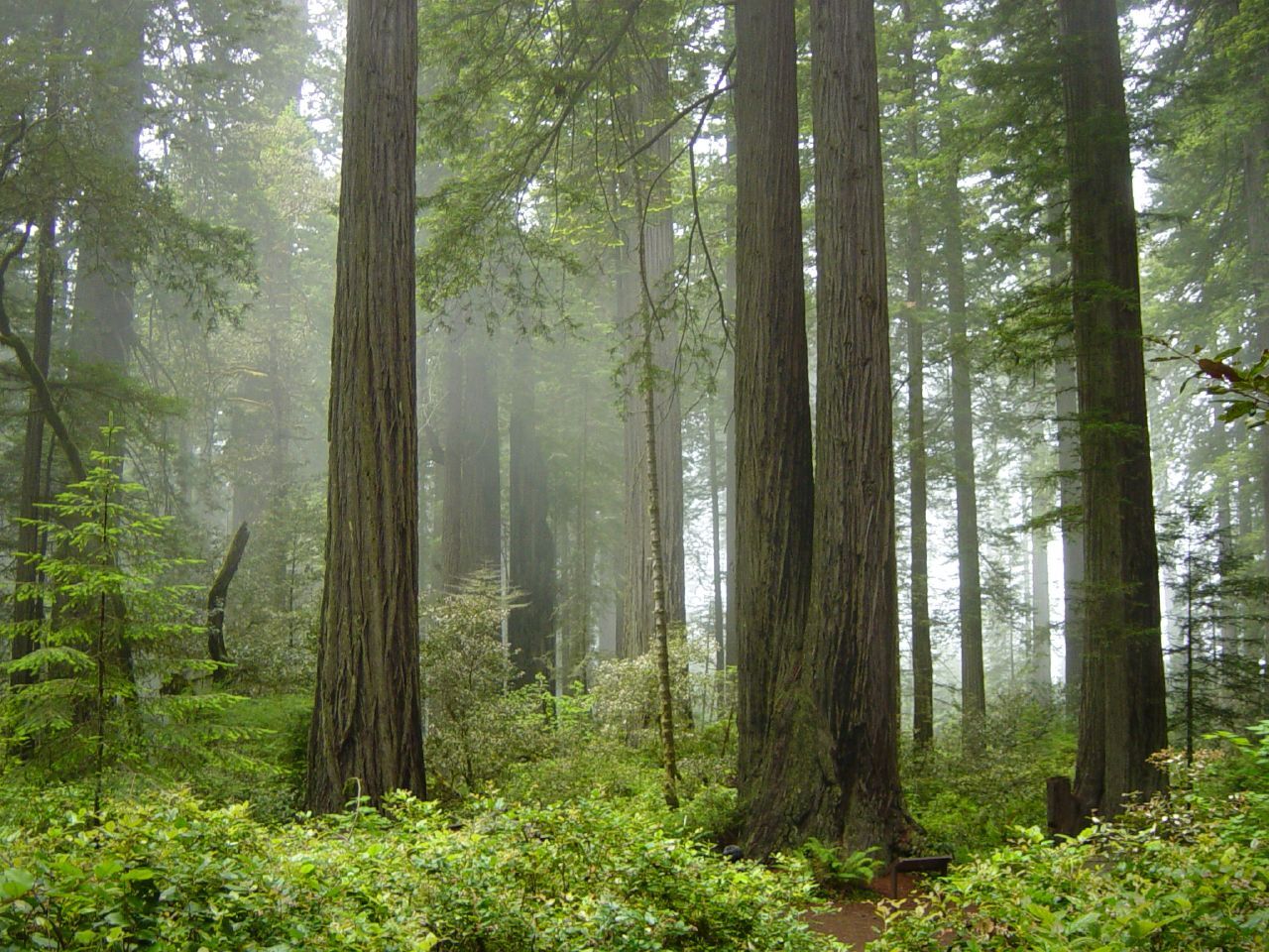
© Michael Schweppe, CC BY-SA 2.0 Resized from original. (This derivative is under the same CC BY-SA license.)
World Heritage Research
Discover scientific research and academic studies that deepen our understanding of Redwood National and State Parks from its history and significance to its conservation, management, and contemporary challenges.
-
Crescent City in Living Waves: Space, Time, People, and Minds on the Southern Cascadian Coast
Crescent City, California, stands at the intersection of geological hazard and human resilience, offering a critical case study on the southern Cascadia margin. The region faces a 37% chance of an M >= 8.0 earthquake and tsunami within 50 years, yet its history reveals cycles of extraction, disaster, and adaptation—from Indigenous Tolowa Dee-ni’ stewardship to modern conservation efforts like the 2023 Yurok–Tolowa Dee-ni’ Indigenous Marine Stewardship Area. The study synthesizes space, time, people, and ideas, integrating paleoseismic data, historical records, and governance frameworks to explore nested risks in this coastal community. A reproducible, open-source approach ensures transparency, while the narrative spans ecological, economic, and political dimensions, from 19th-century genocide to contemporary resilience strategies.
Friedman, D. (2026). Crescent City in Living Waves: Space, Time, People, and Minds on the Southern Cascadian Coast. Zenodo. https://doi.org/10.5281/ZENODO.20286170
View Publication Record | Read Publication -
Old growth forests: A blueprint for restoring mycorrhizal fungi in second-growth and thinned coast redwood (Sequoia sempervirens) stands
Second-growth coast redwood (Sequoia sempervirens) stands, particularly those with encroaching Pinaceae species like Sitka spruce and Douglas-fir, exhibit significantly reduced richness and abundance of arbuscular mycorrhizal fungi (AMF) compared to old-growth forests. This study, conducted in Redwood National and State Parks, found that while ectomycorrhizal fungi (EMF) prevalence did not differ between old- and second-growth stands, AMF were nearly absent in the latter due to the dominance of EMF-dependent Pinaceae species. Thinning efforts failed to restore AMF communities, which remained closer to unthinned second-growth levels rather than old-growth benchmarks. The broader fungal community showed only marginal differences across stand types, underscoring the need for targeted restoration strategies—such as inoculum introduction—to recover mycorrhizal diversity to pre-logged conditions.
Bañuelas, D. C., Bellier-Igasaki, S. A., Guzman, D. J., Esquivel, A., Le, N. H. D., Nguyen, D. M., Franco, C. A., Giampietro, J. R., & Treseder, K. K. (2025). Old growth forests: A blueprint for restoring mycorrhizal fungi in second-growth and thinned coast redwood (Sequoia sempervirens) stands. Biological Conservation, 305, 111036. https://doi.org/10.1016/j.biocon.2025.111036
View Publication Record | Read Publication -
Rocky intertidal monitoring: 2021–2022 results from Redwood National and State Parks
Monitoring of rocky intertidal ecosystems in Redwood National and State Parks from 2021 to 2022 revealed dynamic changes in populations of key species, including sessile invertebrates, algae, ochre sea stars (Pisaster ochraceus), surfgrass (Phyllospadix spp.), and sea palm (Postelsia palmaeformis). The study, part of the Multi-Agency Rocky Intertidal Network (MARINe) and funded by the National Park Service, employed permanent plots and transects to track annual trends. While populations fluctuated, the data contribute to long-term biodiversity assessments, with broader analyses available in 5-year trend reports. The study also incorporated optional MARINe protocols, though some measurements may be discontinued in future years.
Cox-Ammann, K., Cortez, M., Dinger, E., & Necarsulmer, A. (2025). Rocky intertidal monitoring: 2021–2022 results from Redwood National and State Parks (, Ed.). National Park Service. https://doi.org/10.36967/2309092
View Publication Record | Read Publication -
A Walk to the Park: Trail Connectivity in Orick, California
A proposed connector trail aims to link the unincorporated community of Orick, California, with Redwood National and State Parks, offering residents and tourists a pedestrian and cycling route. This study identifies key constraints hindering the trail's implementation: insufficient funding, absence of a project proponent, and challenging terrain. Collaboration among organizations, community engagement, and strategic prioritization are critical for success. The research, based on planning documents, field observations, participant observation, and stakeholder interviews, highlights competing priorities in rural development as a recurring obstacle. Future revisits to this project could yield better outcomes with increased resources, capacity, and focus.
Smith, A. F. A Walk to the Park: Trail Connectivity in Orick, California. https://doi.org/10.46569/qr46r950b
View Publication Record | Read Publication -
Land Cover Summary Statistics for Klamath Network Park Units
A comprehensive dataset of land cover summary statistics for six National Park Service Klamath Network park units, including Redwood National and State Parks, has been developed. This dataset integrates multiple high-resolution sources such as the Multi-Resolution Land Characteristics Consortium products in the National Land Cover Database (NLCD) and the USGS's LCMAP raster dataset, providing land cover classifications at three scales: Level 1, modified Anderson Level 2, and Natural versus Converted land cover. The most recent versions of these datasets were utilized to generate accurate statistics for park units and custom analysis areas, supporting the NPS Inventory and Monitoring Program and environmental assessments.
Cleary, S. (2024). Land Cover Summary Statistics for Klamath Network Park Units (, Ed.). National Park Service. https://doi.org/10.36967/2303211
View Publication Record | Read Publication -
Analysis of stream types in Klamath Network parks based on physical habitat and chemical characters
A comprehensive analysis of stream types across five Klamath Network parks, including Redwood National and State Parks, reveals distinct groupings based on physical habitat and chemical characteristics. Using multivariate exploratory analyses and Similarity Profile methods, streams were categorized into eight metric categories such as channel morphology, habitat complexity, large woody debris, riparian characters, slope and sinuosity, stream substrate, water chemistry, and water quality. The study identified statistically significant similarities among streams within and across parks, suggesting shared stressors and management practices. This foundational work paves the way for future analyses incorporating biological data to support trend reports.
Dinger, E. (2024). Analysis of stream types in Klamath Network parks based on physical habitat and chemical characters (, Ed.). National Park Service. https://doi.org/10.36967/2306085
View Publication Record | Read Publication -
Landbird monitoring: 2023 results from Oregon Caves National Monument and Preserve, Lava Beds National Monument, and Redwood National and State Parks
Landbird monitoring in 2023, conducted by the Klamath Inventory and Monitoring Network (KLMN) in partnership with the Klamath Bird Observatory, revealed significant insights into bird populations across three UNESCO World Heritage Sites: Oregon Caves National Monument and Preserve, Lava Beds National Monument, and Redwood National and State Parks. The study, now in its 15th year, used standardized avian sampling methods, including point counts, mist netting, species checklists, and habitat surveys. Notably, the analysis of relative abundance models and constant effort mist netting data highlighted that species of conservation importance were among the most abundant at each park. While survey locations at Redwood National and State Parks were reduced to 15 out of 30 for safety reasons, the ongoing monitoring continues to provide critical data on landbird status and long-term trends. These findings contribute valuable information for regional bird conservation efforts, particularly when integrated with broader Klamath Bird Monitoring Network data.
Webb, S., McLaren, T., Gillespie, C., Zawadzki, L., & Terril, R. (2024). Landbird monitoring: 2023 results from Oregon Caves National Monument and Preserve, Lava Beds National Monument, and Redwood National and State Parks (, Ed.). National Park Service. https://doi.org/10.36967/2306091
View Publication Record | Read Publication