Category:
Mixed Cultural Heritage and Natural Heritage
WHE Type:
Protected Areas & National Parks
Transboundary Heritage:
No
Endangered Heritage:
No
Country:
🇳🇿 New Zealand
Continent:
Oceania
UNESCO World Region:
Asia and the Pacific
Map
Sorry, we detected automated browsing. If you are a human, please interact with the page to view the map of Tongariro National Park
Tongariro National Park: A Unique Blend of Cultural Significance and Natural Beauty
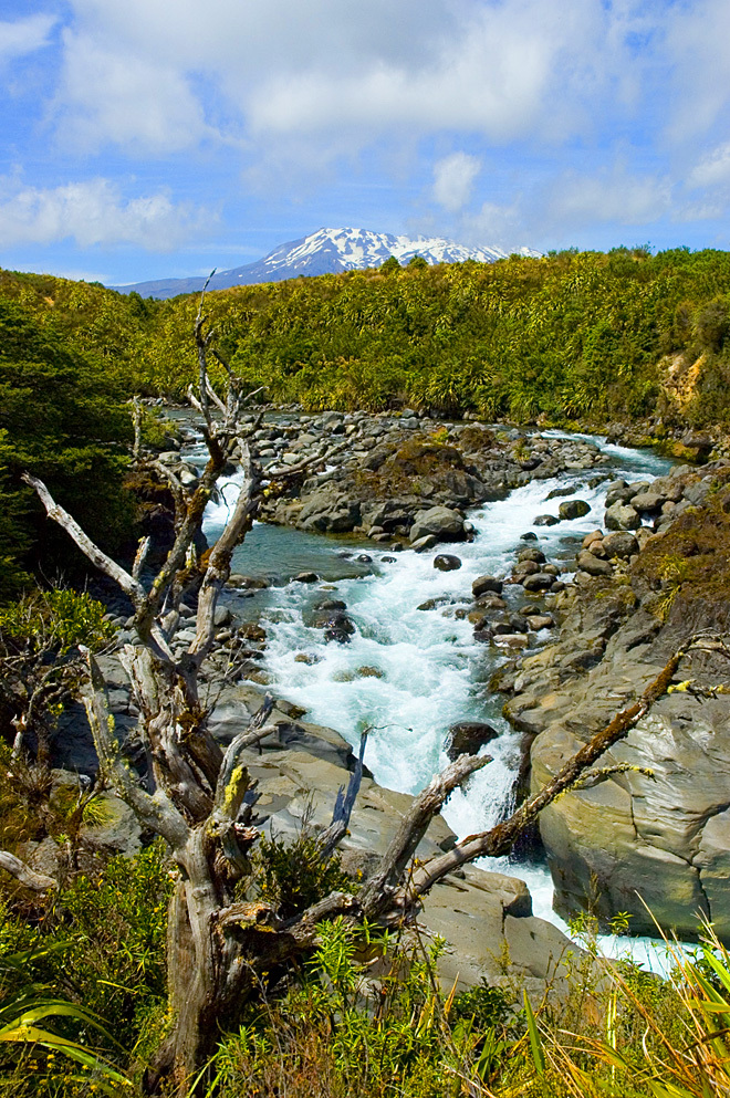
Tongariro National Park, situated in the central North Island of New Zealand, is a remarkable testament to the harmonious coexistence of cultural heritage and breathtaking natural beauty. Established in 1887, it was the first national park in the country and the sixth globally. In 1990, it was inscribed as a UNESCO World Heritage Site, making it one of the few sites worldwide that hold such distinction based on their mixed cultural and natural values.
More to come…
UNESCO Description of the World Heritage Site
In 1993 Tongariro became the first property to be inscribed on the World Heritage List under the revised criteria describing cultural landscapes. The mountains at the heart of the park have cultural and religious significance for the Maori people and symbolize the spiritual links between this community and its environment. The park has active and extinct volcanoes, a diverse range of ecosystems and some spectacular landscapes.
Encyclopedia Record: Tongariro National Park
Tongariro National Park, located in the central North Island, is the oldest national park in New Zealand and the sixth national park established in the world. It has been recognised by UNESCO as a World Heritage Site for its mixed cultural and natural values.
UNESCO Criteria:
(vi) — Directly associated with events or living traditions (vii) — Contains superlative natural phenomena or beauty (viii) — Outstanding example representing major earth stages
Coordinates:
-39.29083333 , 175.5622222
IUCN World Heritage Outlook
The 2025 Conservation Outlook on Tongariro National Park reports the following assessment:
Good
Source: International Union for Conservation of Nature (IUCN)
·
View assessment
World Heritage Explorer is an independent educational project designed to uncover and share the richness of our world’s cultural and natural heritage.
Dive into detailed site profiles, immersive imagery, interactive maps, and tools that help you explore UNESCO World Heritage Sites across the globe.
Drawing extensively on open data sources, the project delivers authoritative, well-structured information for
learners, educators, travelers, and younger explorers alike.
Volcanic processes have shaped some of the most geologically significant and ecologically dynamic landscapes on Earth. The UNESCO World Heritage List recognizes numerous sites formed or profoundly influenced by volcanism, acknowledging their outstanding geological value, ecological processes, scenic grandeur, and biodiversity significance.
From remote atolls in the Pacific Ocean to volcanic islands in the Atlantic, Mediterranean island cities, and vast archipelagic seas, islands appear in many different forms across the UNESCO World Heritage List. Their geographic separation has fostered exceptional biodiversity, shaped cultural identities, encouraged maritime exchange, and created landscapes unlike those found on continental landmasses.
Portions of the page Tongariro National Park are based on data from UNESCO —
World Heritage List Dataset and on text from the Wikipedia article Tongariro National Park, licensed under CC BY-SA 4.0.
Changes made. Additional original content by World Heritage Explorer (WHE), licensed under CC BY-SA 4.0.
WHE is not affiliated with UNESCO or the World Heritage Committee.
Legal Notice. Privacy Policy.