World Heritage Identification Number: 1518
World Heritage since: 2016
Category: Cultural Heritage
WHE Type: Archaeological Sites
Transboundary Heritage: No
Endangered Heritage: No
Country: 🇹🇷 Türkiye
Continent: Asia
UNESCO World Region: Europe and North America
Map
Ani: A Medieval City of Architectural Innovation
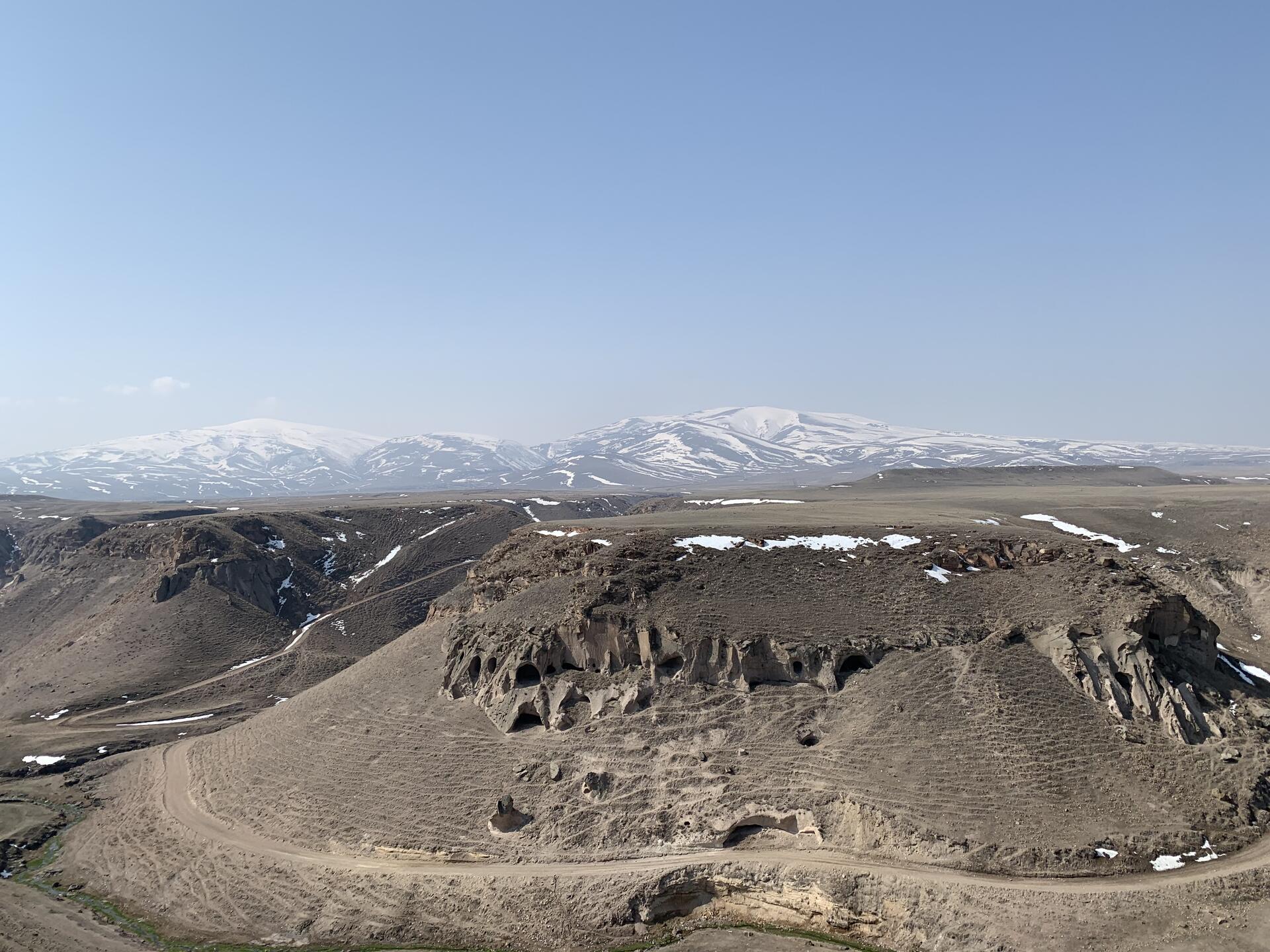
The Archaeological Site of Ani, inscribed as a UNESCO World Heritage Site in 2016, offers a captivating glimpse into the rich history and architectural evolution of the Middle Ages. Situated on a secluded plateau in northeastern Turkey, this ancient city overlooks a ravine that serves as a natural border with Armenia.
More to come…UNESCO Description of the World Heritage Site
This site is located on a secluded plateau of northeast Turkey overlooking a ravine that forms a natural border with Armenia. This medieval city combines residential, religious and military structures, characteristic of a medieval urbanism built up over the centuries by Christian and then Muslim dynasties. The city flourished in the 10th and 11th centuries CE when it became the capital of the medieval Armenian kingdom of the Bagratides and profited from control of one branch of the Silk Road. Later, under Byzantine, Seljuk and Georgian sovereignty, it maintained its status as an important crossroads for merchant caravans. The Mongol invasion and a devastating earthquake in 1319 marked the beginning of the city’s decline. The site presents a comprehensive overview of the evolution of medieval architecture through examples of almost all the different architectural innovations of the region between the 7th and 13th centuries CE.
UNESCO Justification of the World Heritage Site
Criterion (ii): Ani was a meeting place for Armenian, Georgian and diverse Islamic cultural traditions that were reflected in the architectural design, material and decorative details of the monuments. New styles, which emerged as a result of cross-cultural interactions, have turned into a new architectural language peculiar to Ani. The creation of this new language expressed in the design, craftsmanship and decoration of Ani has also been influential in the wider region of Anatolia and Caucasia.
Criterion (iii): Ani bears exceptional testimony to Armenian cultural, artistic, architectural and urban design development and it is an extraordinary representation of Armenian religious architecture known as the “Ani school”, reflecting its techniques, style and material characteristics.
Criterion (iv): With its military, religious and civil buildings, Ani offers a wide panorama of medieval architectural development thanks to the presence at the site of almost all the architectural types that emerged in the region in the course of the six centuries from 7th to 13th centuries AD. It is also considered a rare settlement where nearly all of the plan types developed in Armenian Church architecture between the 4th and 8th centuries AD can be seen together. The urban enclosure of Ani is also an important example of a medieval architectural ensemble with its monumentality, design and quality, as well as the tunnels and caves beneath Ani plateau, which connect to the surrounding volcanic tufa setting of deep river valleys.
Encyclopedia Record: Ani
Ani is a ruined medieval Armenian city now situated in Turkey's province of Kars, next to the closed border with Armenia.Additional Site Details
Area: 250.7 hectares
Number of Components: 1
(iii) — Unique or exceptional testimony to a cultural tradition
(iv) — Outstanding example of a type of building or landscape
Coordinates: 40.5 , 43.5666666667
Image
© Héctor Ochoa 'Robot8A', CC BY-SA 4.0 Resized from original. (This derivative is under the same CC BY-SA license.)
