World Heritage Identification Number: 960
World Heritage since: 2000
Category: Cultural Heritage
WHE Type: Religious Sites & Sacred Architecture
Transboundary Heritage: No
Endangered Heritage: No
Country: 🇦🇲 Armenia
Continent: Asia
UNESCO World Region: Europe and North America
Map
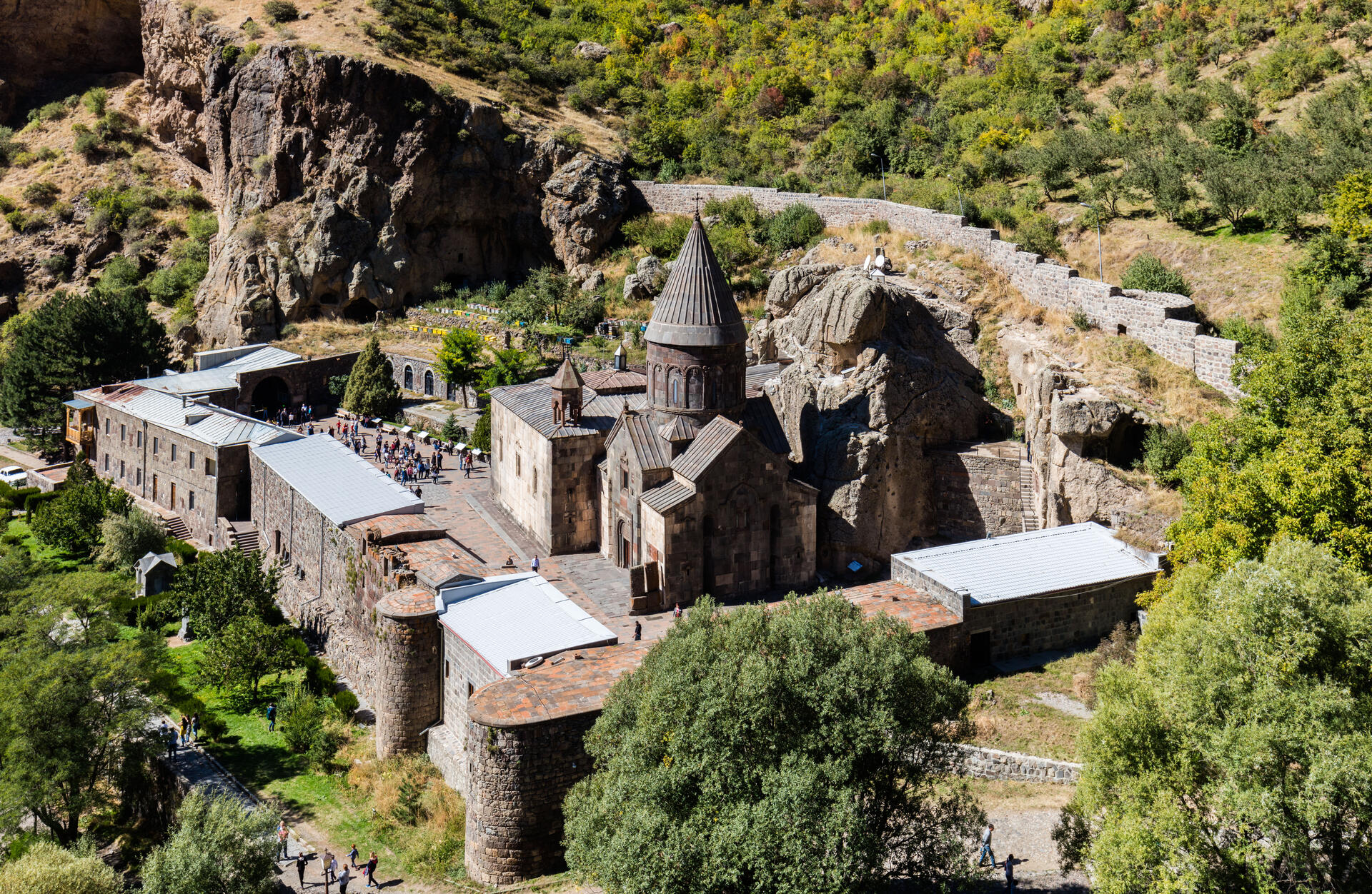
The Monastery of Geghard and the Upper Azat Valley: A Testament to Armenian Medieval Architecture
The Monastery of Geghard, nestled within the picturesque Upper Azat Valley in the Kotayk Province of Armenia, stands as a remarkable testament to the pinnacle of Armenian medieval architecture. This architectural marvel, enshrined as a UNESCO World Heritage Site since 2000, offers a captivating blend of history, culture, and breathtaking natural beauty.
More to come…UNESCO Description of the World Heritage Site
The monastery of Geghard contains a number of churches and tombs, most of them cut into the rock, which illustrate the very peak of Armenian medieval architecture. The complex of medieval buildings is set into a landscape of great natural beauty, surrounded by towering cliffs at the entrance to the Azat Valley.
UNESCO Justification of the World Heritage Site
Criterion (ii): The Monastery of Geghard, with its remarkable rock-cut churches and tombs, is an exceptionally well preserved and complete example of medieval Armenian monastic architecture and decorative art, with many innovatory features which had a profound influence on subsequent developments in the region.
Encyclopedia Record: Geghard
Geghard is a medieval monastery in the Kotayk province of Armenia, being partially carved out of the adjacent mountain, surrounded by cliffs. It is listed as a UNESCO World Heritage Site with enhanced protection status.Additional Site Details
Area: 2.7 hectares
Number of Components: 1
Coordinates: 40.140439 , 44.818525
Image
© Diego Delso, CC BY-SA 4.0 Resized from original. (This derivative is under the same CC BY-SA license.)
