World Heritage Identification Number: 1007
World Heritage since: 2004
Category: Natural Heritage
WHE Type: Protected Areas & National Parks
Transboundary Heritage: No
Endangered Heritage: No
Country: 🇿🇦 South Africa
Continent: Africa
UNESCO World Region: Africa
Map
Cape Floral Region Protected Areas: A Global Biodiversity Hotspot
The Cape Floral Region Protected Areas (CFRPA) is a remarkable testament to the richness and diversity of life on Earth. Inscribed on the World Heritage List in 2004, this South African site is recognized as one of the world's richest centers of terrestrial biodiversity. Spanning across various protected areas including national parks, nature reserves, wilderness areas, state forests, and mountain catchment areas, the CFRPA encompasses a vast expanse of unique ecosystems that harbor a wealth of endemic species.
More to come…UNESCO Description of the World Heritage Site
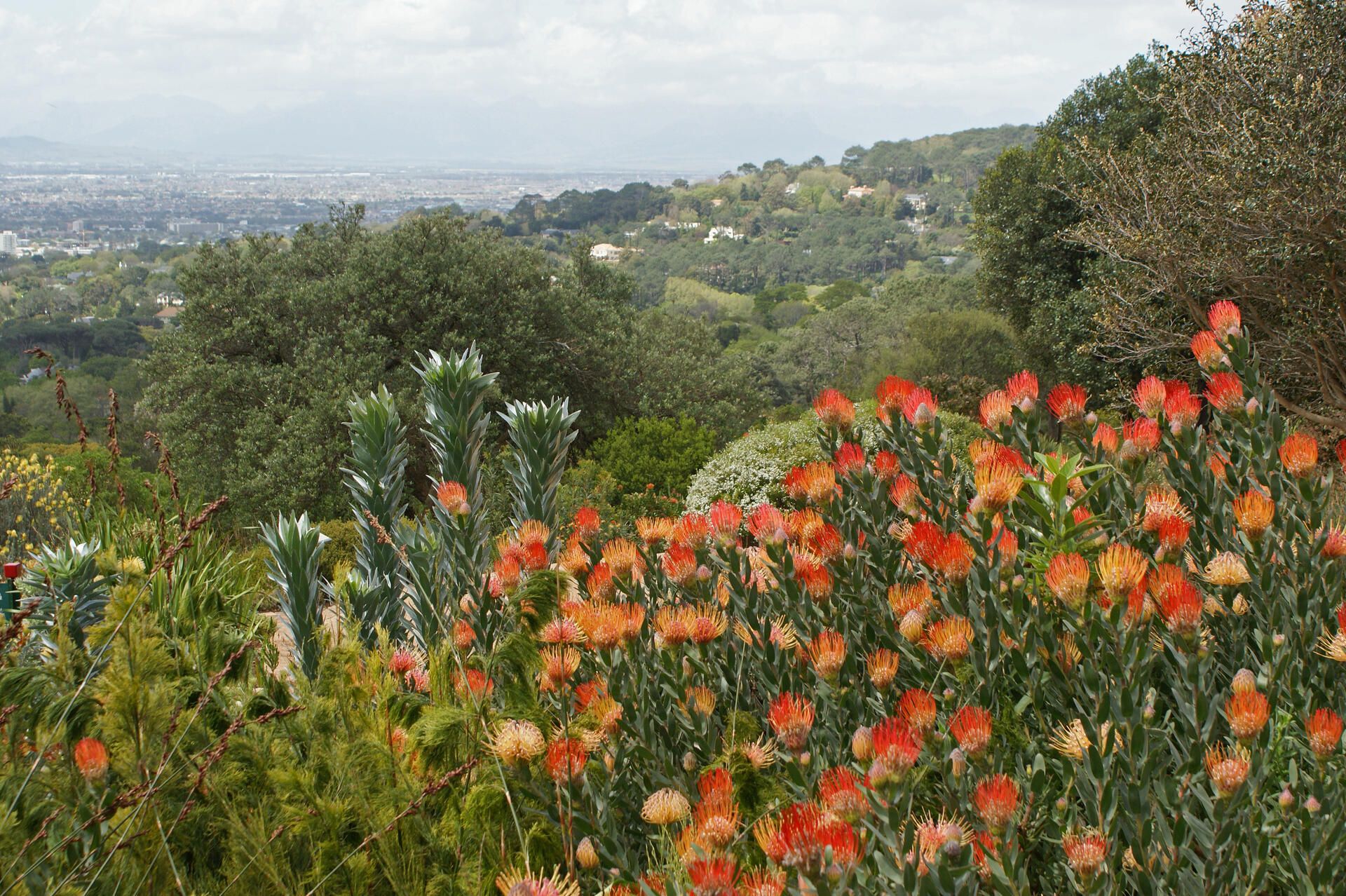
Inscribed on the World Heritage List in 2004, the property is located at the south-western extremity of South Africa. It is one of the world’s great centres of terrestrial biodiversity. The extended property includes national parks, nature reserves, wilderness areas, State forests and mountain catchment areas. These elements add a significant number of endemic species associated with the Fynbos vegetation, a fine-leaved sclerophyllic shrubland adapted to both a Mediterranean climate and periodic fires, which is unique to the Cape Floral Region.
UNESCO Justification of the World Heritage Site
Criterion (ix): The property is considered of Outstanding Universal Value for representing ongoing ecological and biological processes associated with the evolution of the unique Fynbos biome. These processes are represented generally within the Cape Floral Region and captured in the component areas that make up the 13 protected area clusters. Of particular scientific interest are the adaptations of the plants to fire and other natural disturbances; seed dispersal by ants and termites; the very high level of plant pollination by insects, mainly beetles and flies, birds and mammals; and high levels of adaptive radiation and speciation. The pollination biology and nutrient cycling are other distinctive ecological processes found in the site. The Cape Floral Region forms a centre of active speciation where interesting patterns of endemism and adaptive radiation are found in the flora.
Criterion (x): The Cape Floral Region is one of the richest areas for plants when compared to any similar sized area in the world. It represents less than 0.5% of the area of Africa but is home to nearly 20% of the continent’s flora. The outstanding diversity, density and endemism of the flora are among the highest worldwide. Some 69% of the estimated 9,000 plant species in the region are endemic, with 1,736 plant species identified as threatened and with 3,087 species of conservation concern. The Cape Floral Region has been identified as one of the world’s 35 biodiversity hotspots.
Encyclopedia Record: Cape Floristic Region
The Cape Floral Region is a floristic region located near the southern tip of South Africa. It is the only floristic region of the Cape Floristic Kingdom, and includes only one floristic province, known as the Cape Floristic Province.Additional Site Details
Area: 1,094,742 hectares
Number of Components: 1
(x) — Contains most important habitats for biodiversity
Coordinates: -34.3558051153 , 18.4750321846
IUCN World Heritage Outlook
The 2025 Conservation Outlook on Cape Floral Region Protected Areas reports the following assessment:
Source: International Union for Conservation of Nature (IUCN) · View assessment
Image
© Rialfver at nl.wikipedia, CC BY-SA 3.0 Resized from original. (This derivative is under the same CC BY-SA license.)
