World Heritage Identification Number: 500
World Heritage since: 1988
Category: Cultural Heritage
WHE Type: Historic Cities & Urban Areas
Transboundary Heritage: No
Endangered Heritage: No
Country: 🇵🇪 Peru
Continent: Americas
UNESCO World Region: Latin America and the Caribbean
Map
The Historic Centre of Lima: A Legacy of Colonial Architecture
The Historic Centre of Lima, officially recognized as a UNESCO World Heritage Site since 1988, stands as a testament to the rich history and cultural fusion that has shaped the city over centuries. Situated in the Rímac Valley, this area serves as the heart of Lima, the capital city of Peru.
More to come…UNESCO Description of the World Heritage Site
Although severely damaged by earthquakes, this 'City of the Kings' was, until the middle of the 18th century, the capital and most important city of the Spanish dominions in South America. Many of its buildings, such as the Convent of San Francisco (the largest of its type in this part of the world), are the result of collaboration between local craftspeople and others from the Old World.
Encyclopedia Record: Historic Centre of Lima
The Historic Centre of Lima is the historic city centre of the city of Lima, the capital of Peru. Located in the city's districts of Lima and Rímac, both in the Rímac Valley, it consists of two areas: the first is the Monumental Zone established by the Peruvian government in 1972, and the second one—contained within the first one—is the World Heritage Site established by UNESCO in 1988, whose buildings are marked with the organisation's black-and-white shield.Additional Site Details
Area: 277.99 hectares
Number of Components: 3
Coordinates: -12.046542 , -77.0304
Image
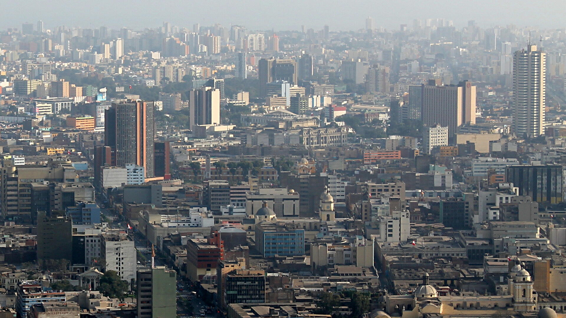
© Thomas S., CC BY-SA 2.0 Resized from original. (This derivative is under the same CC BY-SA license.)
World Heritage Research
Discover scientific research and academic studies that deepen our understanding of Historic Centre of Lima from its history and significance to its conservation, management, and contemporary challenges.
-
Between the liberators and deactivators: Place, power and protest in Lima’s memoryscape
Lima’s public spaces serve as a battleground for competing narratives of Peruvian nationhood, where protest and commemoration challenge dominant militaristic, colonial, and patriarchal imagery. The study reveals that acts of civil disobedience and remembrance of Peru’s internal armed conflict (1980–2000) actively contest the government’s and tourism industry’s portrayal of Lima as a historic and gastronomic hub. Through two case studies, it demonstrates how protest reinforces or undermines rival narratives of political violence, exposing tensions in Lima’s memoryscape. The research employs qualitative analysis of public symbols, protest acts, and commemorative practices to uncover these dynamics.
Willis, D. (2022). Between the liberators and deactivators: Place, power and protest in Lima’s memoryscape. European Review of Latin American and Caribbean Studies, (113), 181–199. https://doi.org/10.32992/erlacs.10894
View Publication Record | Read Publication -
Mercado y centro gastronómico - centro histórico de Lima
A new architectural approach to market halls is proposed, transforming them from static commercial spaces into dynamic gastronomic and cultural hubs that enrich urban centers. By leveraging Lima's gastronomic boom, the study introduces a redesigned market concept that integrates educational activities, fosters community development, and adapts to modern societal needs. This innovative perspective goes beyond traditional market functions, offering a multifaceted experience that aligns with contemporary urban requirements while preserving historical significance.
Sánchez Guerra, C. E. Mercado y centro gastronómico - centro histórico de Lima. https://doi.org/10.19083/tesis/625277
View Publication Record | Read Publication -
Proposal for structural evaluation of historical churches at Lima, Peru
A structured approach to assessing seismic vulnerability in Lima's historic churches, part of the UNESCO-listed Historic Centre of Lima, has been proposed. This method combines a general diagnosis of urban and building issues with a preliminary survey to evaluate structural conditions, aiming to enhance earthquake safety. The study serves as a foundational framework for detailed investigations into preserving these heritage buildings, with potential applications beyond Lima to other historic cities in Peru. By establishing guidelines for vulnerability evaluation, the research contributes to broader efforts in urban security and conservation.
Cuadra, C. (2018). Proposal for structural evaluation of historical churches at Lima, Peru. International Journal of Safety and Security Engineering, 8(2), 320–328. https://doi.org/10.2495/safe-v8-n2-320-328
View Publication Record | Read Publication -
From state agencies to ordinary citizens: reframing risk-mitigation investments and their impact to disrupt urban risk traps in Lima, Peru
Urban risk traps, characterized by cycles of everyday risks and small-scale disasters, disproportionately affect impoverished urban dwellers. A study on Lima, Peru, reveals that such traps persist not due to a lack of risk-mitigation investments but because these investments often have unintended consequences that erode the capacity of at-risk communities to act, thereby perpetuating risk accumulation cycles. The research, based on the action-research project cLIMA sin Riesgo, analyzed state agency and community-led investment actions in Barrios Altos (historic center) and José Carlos Mariátegui (periphery). It argues for a re-evaluation of risk-mitigation strategies to disrupt these cycles effectively.
Allen, A., Zilbert Soto, L., Wesely, J., Belkow, T., Ferro, V., Lambert, R., Langdown, I., & Samanamú, A. (2017). From state agencies to ordinary citizens: reframing risk-mitigation investments and their impact to disrupt urban risk traps in Lima, Peru. Environment and Urbanization, 29(2), 477–502. https://doi.org/10.1177/0956247817706061
View Publication Record | Read Publication -
Participatory Mapping to Disrupt Unjust Urban Trajectories in Lima
Participatory mapping emerged as a powerful tool to challenge unjust urban development trajectories in Lima, Peru, offering a spatially and socially grounded approach for co-producing knowledge that bridges marginalized communities and policymakers. Two action research projects, ReMap Lima and cLIMA sin Riego, demonstrated how community-led mapping—combining advanced technologies with grassroots engagement—can make invisible urban issues visible, foster dialogue among stakeholders, and lead to collectively negotiated actions. By focusing on Barrios Altos (a historic district) and José Carlos Mariátegui (an edge-of-city area), the study revealed distinct pathways for interrogating urban spaces, promoting spatial co-learning that disrupts traditional power dynamics between claimants and the state. This methodology not only addresses immediate planning challenges but also lays the groundwork for just urban futures.
Lambert, R., & Allen, A. (2016). Participatory Mapping to Disrupt Unjust Urban Trajectories in Lima. Geospatial Technology - Environmental and Social Applications. https://doi.org/10.5772/64303
View Publication Record | Read Publication -
O centro histórico de Lima, Peru: novos usos da Rua Jirón de La Unión
A predominant commercial use characterizes the current landscape of Jirón de la Unión Street, a central artery within Lima's Historic Centre. This finding emerges from a study that employed bibliographical, cartographic, photographic, and documentary surveys alongside fieldwork to analyze land use and urban scenery. The research, conducted by Gregório de Andrade and Morais Soares (2013), sheds light on the evolving dynamics of this UNESCO World Heritage Site, where patrimonial management policies have been in place since the 1980s. By examining these new uses, the study offers insights into the complex spatial organization challenges faced by Lima's historic urban core.
Gregório de Andrade, R. D. C., & Morais Soares, M. S. (2013). O centro histórico de Lima, Peru: novos usos da Rua Jirón de La Unión. GeoTextos, 9(2). https://doi.org/10.9771/1984-5537geo.v9i2.8460
View Publication Record | Read Publication