World Heritage Identification Number: 700
World Heritage since: 1994
Category: Cultural Heritage
WHE Type: Archaeological Sites
Transboundary Heritage: No
Endangered Heritage: No
Country: 🇵🇪 Peru
Continent: Americas
UNESCO World Region: Latin America and the Caribbean
Map
Deciphering the Enigma: The Lines and Geoglyphs of Nasca and Palpa
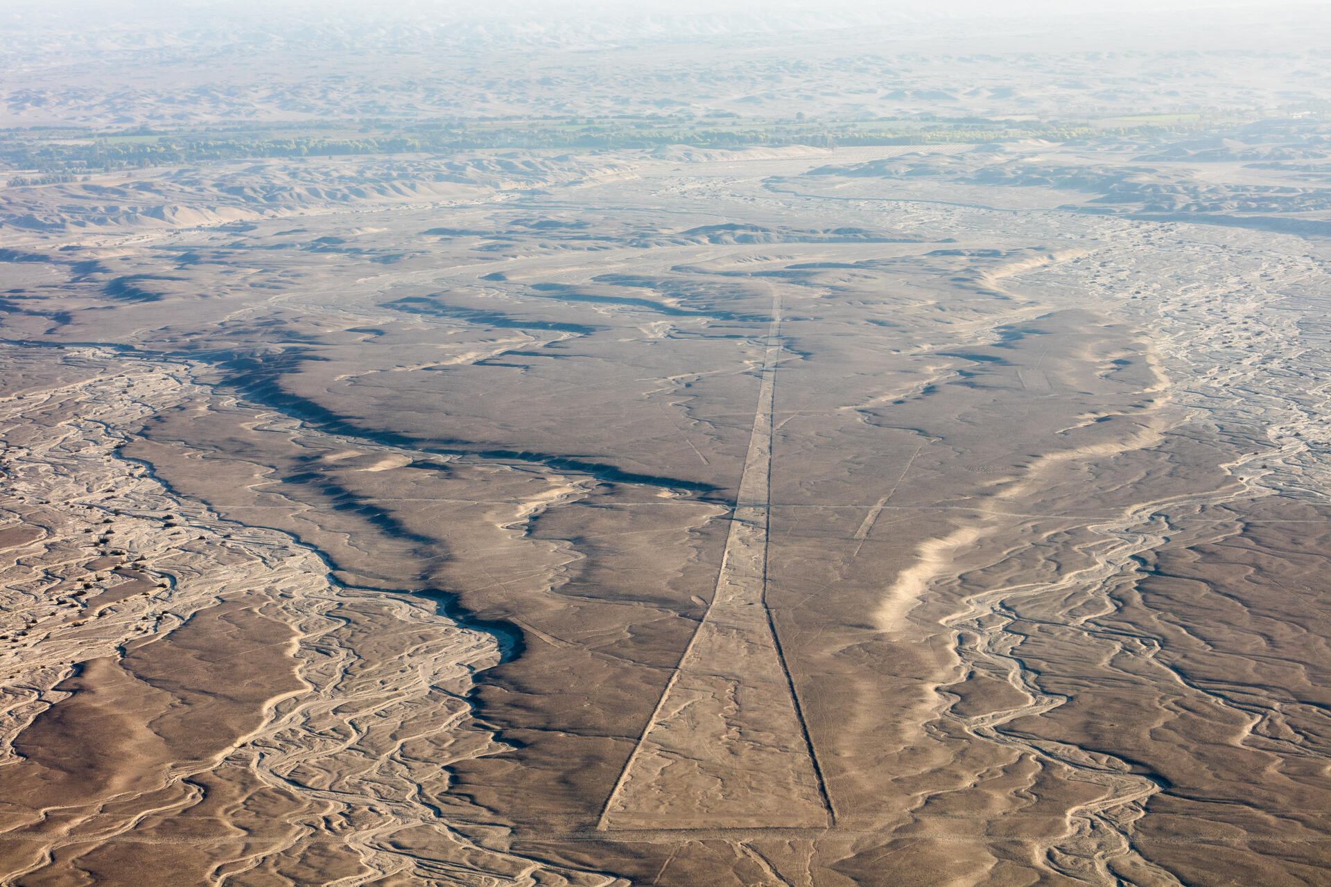
The Lines and Geoglyphs of Nasca and Palpa, inscribed as a UNESCO World Heritage Site in 1994, present one of the most intriguing mysteries in the realm of archaeology. Situated in the arid coastal plain of Peru, approximately 400 kilometers south of Lima, these enigmatic lines span around 450 square kilometers.
More to come…UNESCO Description of the World Heritage Site
Located in the arid Peruvian coastal plain, some 400 km south of Lima, the geoglyphs of Nasca and the pampas of Jumana cover about 450 km2 . These lines, which were scratched on the surface of the ground between 500 B.C. and A.D. 500, are among archaeology's greatest enigmas because of their quantity, nature, size and continuity. The geoglyphs depict living creatures, stylized plants and imaginary beings, as well as geometric figures several kilometres long. They are believed to have had ritual astronomical functions.
UNESCO Justification of the World Heritage Site
Criterion (i): The Nasca Lines and Geoglyphs form a unique and magnificent artistic achievement of the Andean culture that is unrivalled in its extension, dimensions and diversity and long existence anywhere in the prehistoric world.
Criterion (iii): The Nasca and Pampas de Jumana Lines and Geoglyphs, through its unique form of land use, are an exceptional testimony of the culture and magical-religious tradition and beliefs of the societies that developed in Pre-Columbian South America between the 8th BC and 8th AD centuries.
Criterion (iv): The system of lines and geoglyphs, which has survived intact for more than two millennia, evidences an unusual way of using the land and the natural environment that represent a highly symbolic cultural landscape, using a construction technology that allowed them to design large-scale figures with outstanding geometric precision.
Encyclopedia Record: Nazca lines
The Nazca lines are a group of over 700 geoglyphs made in the soil of the Nazca Desert in southern Peru. They were created between 500 BC and 500 AD by people making depressions or shallow incisions in the desert floor, removing pebbles and leaving different-colored dirt exposed. There are two major phases of the Nazca lines, Paracas phase, from 400 to 200 BC, and Nazca phase, from 200 BC to 500 AD. In the 21st century, several hundred new figures had been found with the use of drones, and archaeologists believe that there are more to be found.Additional Site Details
Area: 75,358.47 hectares
Number of Components: 1
(iii) — Unique or exceptional testimony to a cultural tradition
(iv) — Outstanding example of a type of building or landscape
Coordinates: -14.72583 , -75.14861
Image
© Diego Delso, CC BY-SA 4.0 Resized from original. (This derivative is under the same CC BY-SA license.)
