World Heritage Identification Number: 1016
World Heritage since: 2000
Category: Cultural Heritage
WHE Type: Historic Cities & Urban Areas
Transboundary Heritage: No
Endangered Heritage: No
Country: 🇵🇪 Peru
Continent: Americas
UNESCO World Region: Latin America and the Caribbean
Map
Architectural Marvel and Cultural Legacy: The Historical Centre of Arequipa
The Historical Centre of Arequipa, nestled in the heart of Peru, stands as a testament to the harmonious fusion of European and native architectural styles. Inscribed as a UNESCO World Heritage Site in 2000, this architectural marvel offers a unique insight into the creative collaboration between European and native craftsmanship.
More to come…UNESCO Description of the World Heritage Site
The historic centre of Arequipa, built in volcanic sillar rock, represents an integration of European and native building techniques and characteristics, expressed in the admirable work of colonial masters and Criollo and Indian masons. This combination of influences is illustrated by the city's robust walls, archways and vaults, courtyards and open spaces, and the intricate Baroque decoration of its facades.
UNESCO Justification of the World Heritage Site
Criterion (i): The ornamented architecture in the historical centre of Arequipa represents a masterpiece of the creative integration of European and native characteristics, crucial for the cultural expression of the entire region.
Criterion (iv): The historical centre of Arequipa is an outstanding example of a colonial settlement, challenged by the natural conditions, the indigenous influences, the process of conquest and evangelization, as well as the spectacular nature of its setting.
Encyclopedia Record: Historic Centre of Arequipa
In December 2000, UNESCO declared the historical center of Arequipa a World Heritage Site, stating the following:"The historical center of Arequipa is an example of ornamented architecture, represents a masterpiece of the creative coalition of European and native characteristics. A colonial town challenged by the conditions of nature, the indigenous influences, the conquest process and evangelism as well as for a spectacular natural scenario."Additional Site Details
Area: 166.52 hectares
Number of Components: 1
(iv) — Outstanding example of a type of building or landscape
Coordinates: -16.398353 , -71.536777
Image
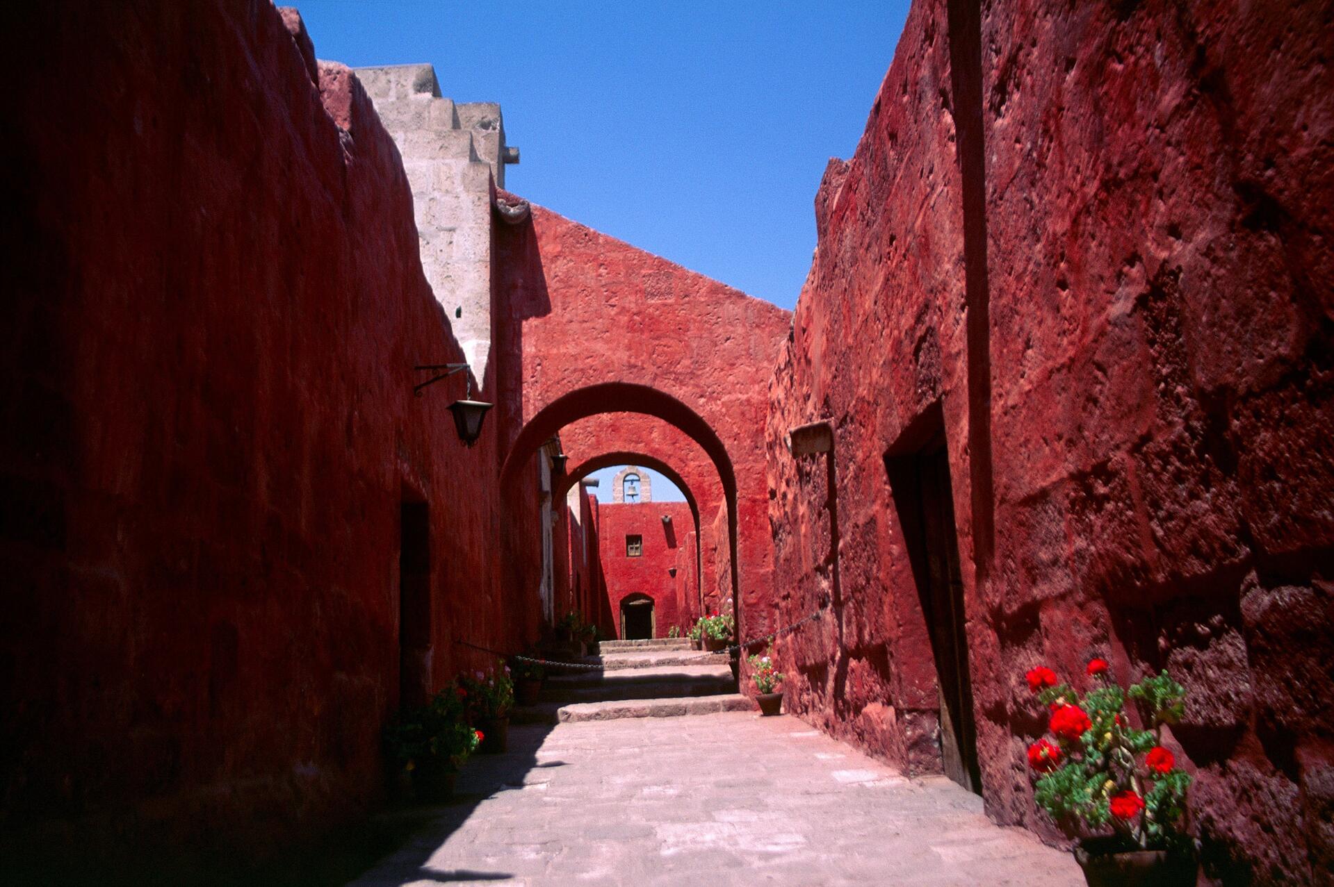
© Unknown, CC BY-SA 2.5 es Resized from original. (This derivative is under the same CC BY-SA license.)
World Heritage Research
Discover scientific research and academic studies that deepen our understanding of Historical Centre of the City of Arequipa from its history and significance to its conservation, management, and contemporary challenges.
-
La paradoja del patrimonio cultural: perspectivas arequipeñas entre la salvaguarda identitaria y las demandas del crecimiento económico
Arequipa's historic center faces a growing tension between cultural identity preservation and economic development pressures. This study reveals that while tourism offers economic opportunities, it also poses risks to authenticity, highlighting the need for balanced heritage policies. Through qualitative interviews with 31 stakeholders, researchers identified divergent perceptions of authenticity and the potential of participatory strategies, advanced technologies, and multisectoral governance to mitigate these risks. The findings integrate preservation and adaptive conservation approaches, providing a framework for more inclusive and sustainable heritage management that harmonizes identity safeguarding with economic growth.
Romario Aranibar, E., Velarde Lam, D. M., Medina Llerena, D. A., & Tupa Ortiz, A. X. (2026). La paradoja del patrimonio cultural: perspectivas arequipeñas entre la salvaguarda identitaria y las demandas del crecimiento económico. Turismo Y Patrimonio, (26), 7–25. https://doi.org/10.24265/turpatrim.2026.n26.01
View Publication Record | Read Publication -
Walkability index for world heritage cities in developing countries
A novel Walkability Index framework, applicable to UNESCO World Heritage Cities in developing countries, demonstrates significant potential for enhancing urban planning and sustainability. This approach integrates connectivity, proximity, land use mix, and retail density—factors initially identified in historical contexts but proven universally adaptable. The study employs a Multiple Criteria Spatial Decision Support System (GIS-MCDA) structured in four stages, offering a practical solution for governments and decision-makers facing data limitations. Applied to the Historical Centre of Arequipa, Peru, this method effectively balances objective and subjective elements, providing actionable insights for sustainable mobility infrastructure development and supporting UNESCO World Heritage nominations.
Valverde-Caballero, L. S., Mendoza-Salazar, L. M., Butron-Revilla, C. L., Suarez-Lopez, E., & Aguilar-Ruiz, J. S. (2024). Walkability index for world heritage cities in developing countries. Environment and Planning B: Urban Analytics and City Science, 52(1), 76–96. https://doi.org/10.1177/23998083241250265
View Publication Record | Read Publication -
Volcanic risk ranking and regional mapping of the Central Volcanic Zone of the Andes
A new volcanic risk ranking (VRR) methodology identifies high-risk volcanoes in the Central Volcanic Zone of the Andes, prioritizing those with potential for significant impact on urban areas and critical infrastructure. The study highlights 19 out of 59 active or potentially active volcanoes—including Cerro Blanco in Argentina and Yucamane, Huaynaputina, Tutupaca, and Ticsani in Peru—as requiring urgent risk mitigation measures. This approach integrates hazard, exposure, vulnerability, and resilience factors to address challenges posed by limited accessibility, scarce historical records, and extreme arid conditions. Regional mapping further emphasizes volcanoes like El Misti and Ubinas (Peru) due to their frequent eruptions and proximity to densely populated cities such as Arequipa and Moquegua.
Reyes-Hardy, M.-P., Di Maio, L. S., Dominguez, L., Frischknecht, C., Biass, S., Guimarães, L. F., Nieto-Torres, A., Elissondo, M., Pedreros, G., Aguilar, R., Amigo, Á., García, S., Forte, P., & Bonadonna, C. (2024). Volcanic risk ranking and regional mapping of the Central Volcanic Zone of the Andes. Natural Hazards and Earth System Sciences, 24(12), 4267–4291. https://doi.org/10.5194/nhess-24-4267-2024
View Publication Record | Read Publication