World Heritage Identification Number: 411
World Heritage since: 1987
Category: Cultural Heritage
WHE Type: Archaeological Sites
Transboundary Heritage: No
Endangered Heritage: No
Country: 🇲🇽 Mexico
Continent: Americas
UNESCO World Region: Latin America and the Caribbean
Map
Exploring the Ancient Wonders of the Pre-Hispanic City and National Park of Palenque
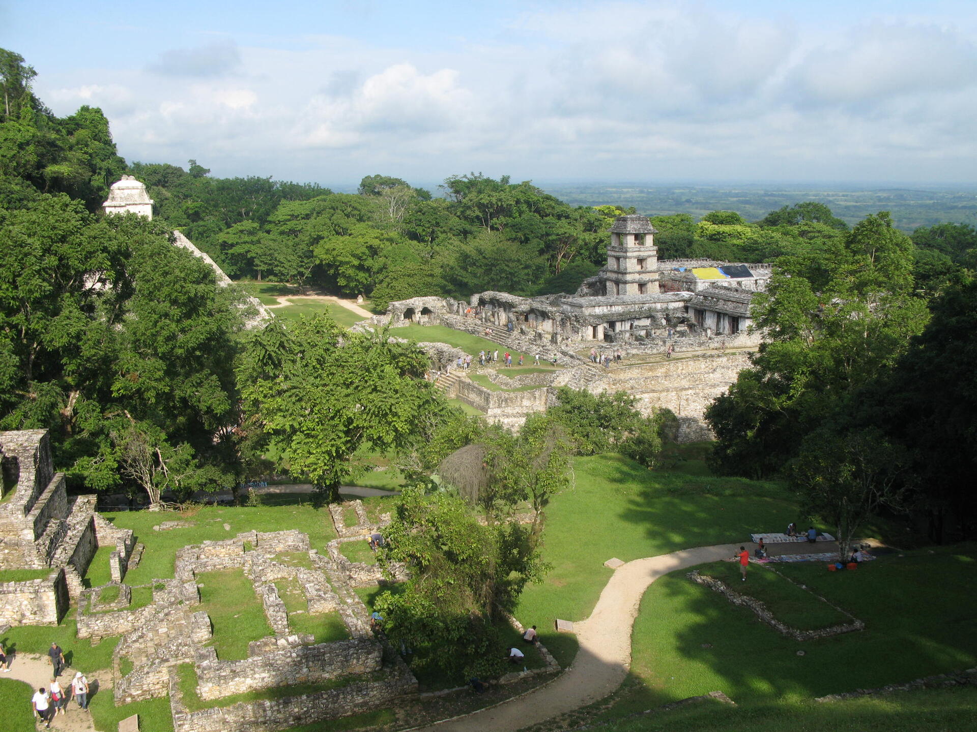
The Pre-Hispanic City and National Park of Palenque, located in the heart of the dense tropical rainforest of Chiapas, Mexico, offers a captivating glimpse into the rich cultural heritage of the ancient Maya civilization. Inscribed as a UNESCO World Heritage Site in 1987, Palenque stands as a testament to the artistic, architectural, and intellectual prowess of this remarkable civilization.
More to come…UNESCO Description of the World Heritage Site
A prime example of a Mayan sanctuary of the classical period, Palenque was at its height between AD 500 and 700, when its influence extended throughout the basin of the Usumacinta River. The elegance and craftsmanship of the buildings, as well as the lightness of the sculpted reliefs with their Mayan mythological themes, attest to the creative genius of this civilization.
UNESCO Justification of the World Heritage Site
Criteria (i): Palenque is an incomparable achievement of Mayan art. The structures are characterized by a lightness which resulted from the new construction techniques and drainage methods that were developed in order to reduce the thickness of the walls. The expanded interior space, multiple openings, and the use of galleries give the architecture a rare elegance, richly decorated with sculptures and stucco of a type never previously seen.
Criteria (ii): The influence exerted by Palenque was considerable throughout the basin of the Usumacinta, extending even as far away as Comalcalco, on the western border of the Mayan cultural zone.
Criteria (iii): Palenque bears a unique testimony to the mythology and the rites of the Mayas, notably in the incredible number of sculpted reliefs on interior walls of the palaces and temples.
Criteria (iv): Older than the ensemble at Tikal, whose major monuments were constructed a hundred years later, the group of ceremonial buildings at Palenque is an outstanding example of a ceremonial and civic site corresponding to the middle of the Classic period in the Maya area.
Encyclopedia Record: Palenque
Palenque, also anciently known in the Itza Language as Lakamha, was a Maya city-state in southern Mexico that perished in the 8th century. The Palenque ruins date from ca. 226 BC to ca. 799 AD. After its decline, it was overgrown by the jungle of cedar, mahogany, and sapodilla trees, but has since been excavated and restored. It is located near the Usumacinta River in the Mexican state of Chiapas, about 130 km (81 mi) south of Ciudad del Carmen, 150 meters (490 ft) above sea level. It is adjacent to the modern town of Palenque, Chiapas. It averages a humid 26 °C (79 °F) with roughly 2,160 millimeters (85 in) of rain a year.Additional Site Details
Area: 1,772 hectares
Number of Components: 1
(ii) — Significant interchange of human values
(iii) — Unique or exceptional testimony to a cultural tradition
(iv) — Outstanding example of a type of building or landscape
Coordinates: 17.48333 , -92.05
Image
© Ljuba brank at Slovenian Wikipedia, CC BY-SA 3.0 Resized from original. (This derivative is under the same CC BY-SA license.)
