World Heritage Identification Number: 1709
World Heritage since: 2025
Category: Cultural Heritage
WHE Type: Cultural Landscapes
Transboundary Heritage: No
Endangered Heritage: No
Country: 🇦🇺 Australia
Continent: Oceania
UNESCO World Region: Asia and the Pacific
Map
Murujuga Cultural Landscape: A Journey Through Time and Culture
The Murujuga Cultural Landscape, inscribed as a UNESCO World Heritage Site in 2025, offers a remarkable glimpse into the rich cultural history of Australia's indigenous peoples. This significant site, spanning the Burrup Peninsula, the Dampier Archipelago's 42 islands, and adjacent marine areas, is a testament to the enduring connection between the land, sea, and the Ngarda-Ngarli, the Traditional Owners and Custodians of this sacred territory.
More to come…UNESCO Description of the World Heritage Site
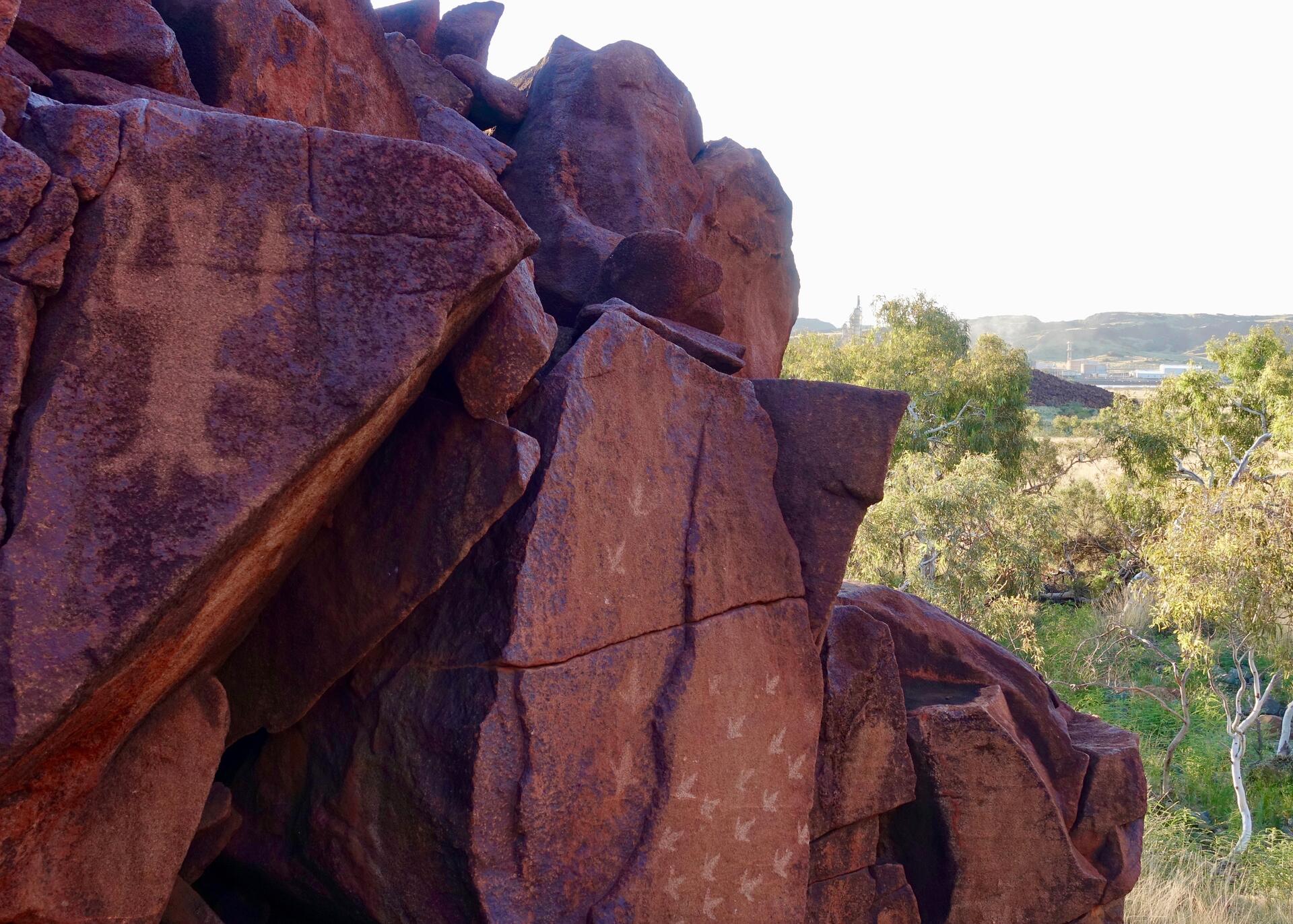
Murujuga is a landscape of ancient rocks located in northwest Australia, which encompasses the Burrup Peninsula, the Dampier Archipelago’s 42 islands, and nearby marine areas. It is shaped by the Lore—rules and narratives that were put in place to create the Country—and the enduring presence of the Ngarda-Ngarli, Traditional Owners and Custodians of the site. The property holds profound cultural and spiritual significance, reflecting over 50,000 years of continuous care and use. Murujuga is renowned for its dense concentration of petroglyphs, featuring unique motifs that display artistic and technical mastery.
Encyclopedia Record: Murujuga National Park
Murujuga National Park is a national park on Burrup Peninsula in the Pilbara region in the north-west of Western Australia, covering an area of 48.51 km2 (18.73 sq mi).Additional Site Details
Area: 99.881 hectares
Number of Components: 1
(iii) — Unique or exceptional testimony to a cultural tradition
(v) — Outstanding example of traditional human settlement
Coordinates: -20.5650277778 , 116.6685277778
Image
© Marius Fenger, CC BY-SA 4.0 Resized from original. (This derivative is under the same CC BY-SA license.)
