World Heritage Identification Number: 1240
World Heritage since: 2008
Category: Cultural Heritage
WHE Type: Agriculture Landscapes, Parks & Gardens
Transboundary Heritage: No
Endangered Heritage: No
Country: 🇭🇷 Croatia
Continent: Europe
UNESCO World Region: Europe and North America
Map
Stari Grad Plain: A Remarkable Cultural Landscape in Croatia
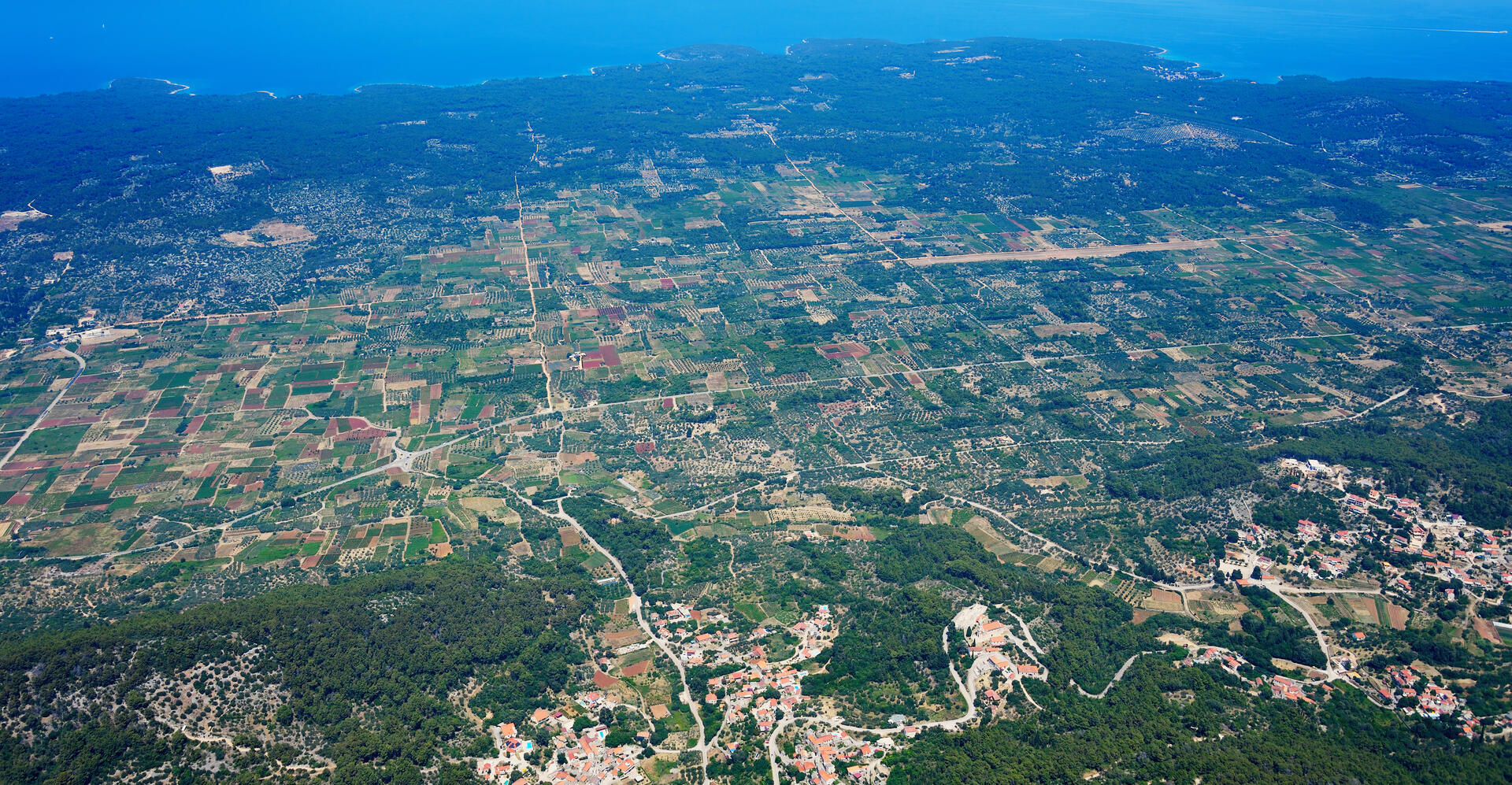
The Stari Grad Plain, located on the Adriatic island of Hvar, Croatia, is a unique cultural landscape that has remained largely unchanged for over two millennia. Inscribed as a UNESCO World Heritage Site in 2008, this fertile plain is a testament to the enduring legacy of the ancient Greek civilization.
More to come…UNESCO Description of the World Heritage Site
Stari Grad Plain on the Adriatic island of Hvar is a cultural landscape that has remained practically intact since it was first colonized by Ionian Greeks from Paros in the 4th century BC. The original agricultural activity of this fertile plain, mainly centring on grapes and olives, has been maintained since Greek times to the present. The site is also a natural reserve. The landscape features ancient stone walls and trims, or small stone shelters, and bears testimony to the ancient geometrical system of land division used by the ancient Greeks, the chora which has remained virtually intact over 24 centuries.
UNESCO Justification of the World Heritage Site
Criterion (ii): The land parcel system, dating from the 4th century BC, of Stari Grad Plain bears witness to the dissemination of the Greek geometrical model for the dividing up of agricultural land in the Mediterranean world.
Criterion (iii): The agricultural plain of Stari Grad has remained in continuous use, with the same initial crops being produced, for 2400 years. This bears witness to its permanency and sustainability down the centuries.
Criterion (v): The agricultural plain of Stari Grad and its environment are an example of very ancient traditional human settlement, which is today under threat from modern economic development, particularly from rural depopulation and the abandonment of traditional farming practices.
Encyclopedia Record: Stari Grad Plain
The Stari Grad Plain, near the town of Stari Grad on the island of Hvar, Croatia, is an agricultural landscape that was set up by the ancient Greek colonists in the 4th century BC, and remains in use. The plain is the largest agricultural area on any of the Adriatic islands, and is remarkably fertile due to Ice Age loess deposition.Additional Site Details
Area: 1,376.53 hectares
Number of Components: 1
(iii) — Unique or exceptional testimony to a cultural tradition
(v) — Outstanding example of traditional human settlement
Coordinates: 43.1816666667 , 16.6386111111
Image
© Carsten Steger, CC BY-SA 4.0 Resized from original. (This derivative is under the same CC BY-SA license.)
