World Heritage Identification Number: 1267
World Heritage since: 2008
Category: Natural Heritage
WHE Type: Natural Landscapes & Geographic Features
Transboundary Heritage: No
Endangered Heritage: No
Country: 🇮🇸 Iceland
Continent: Europe
UNESCO World Region: Europe and North America
Map
Surtsey: A Volcanic Island Laboratory
Surtsey, a volcanic island situated approximately 32 kilometers from the south coast of Iceland, offers a unique insight into the natural processes that govern the formation and colonization of new land. Inscribed as a UNESCO World Heritage Site in 2008, Surtsey stands as a pristine natural laboratory, free from human intervention, providing valuable data on the evolution of ecosystems over time.
More to come…UNESCO Description of the World Heritage Site
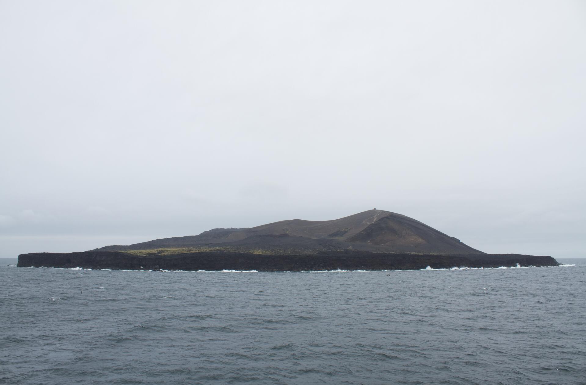
Surtsey, a volcanic island approximately 32 km from the south coast of Iceland, is a new island formed by volcanic eruptions that took place from 1963 to 1967. It is all the more outstanding for having been protected since its birth, providing the world with a pristine natural laboratory. Free from human interference, Surtsey has been producing unique long-term information on the colonisation process of new land by plant and animal life. Since they began studying the island in 1964, scientists have observed the arrival of seeds carried by ocean currents, the appearance of moulds, bacteria and fungi, followed in 1965 by the first vascular plant, of which there were 10 species by the end of the first decade. By 2004, they numbered 60 together with 75 bryophytes, 71 lichens and 24 fungi. Eighty-nine species of birds have been recorded on Surtsey, 57 of which breed elsewhere in Iceland. The 141 ha island is also home to 335 species of invertebrates.
UNESCO Justification of the World Heritage Site
Criterion (ix): Ongoing biological and ecological processes: Surtsey was born as a new volcanic island in 1963-67 and since that time has played a major role in studies of succession and colonisation. It has been the site of one of the few long term studies worldwide on primary succession, providing a unique scientific record of the process of colonisation of land by plants, animals and marine organisms. Not only is it geographically isolated, but it has been legally protected from its birth, providing the world with a pristine natural laboratory, free from human interference. Above all, because of its continuing protection, Surtsey will continue to provide invaluable data on biological colonisation long into the future.
Encyclopedia Record: Surtsey
Surtsey is an uninhabited volcanic island located in the Vestmannaeyjar archipelago off the southern coast of Iceland. At 63.303°N 20.605°W Surtsey is the southernmost point of Iceland. It was formed in a volcanic eruption which began 130 metres below sea level, and reached the surface on 14 November 1963. The eruption lasted until 5 June 1967, when the island reached its maximum size of 2.7 km2 (1.0 sq mi). Since then, wave erosion has caused the island to steadily diminish in size: as of 2012, its surface area was 1.3 km2 (0.50 sq mi). The most recent survey (2007) shows the island's maximum elevation at 155 m (509 ft) above sea level.Additional Site Details
Area: 3,370 hectares
Number of Components: 1
Coordinates: 63.3030555556 , -20.6022222222
IUCN World Heritage Outlook
The 2025 Conservation Outlook on Surtsey reports the following assessment:
Source: International Union for Conservation of Nature (IUCN) · View assessment