World Heritage Identification Number: 452
World Heritage since: 1987
Category: Natural Heritage
WHE Type: Protected Areas & National Parks
Transboundary Heritage: No
Endangered Heritage: No
Country: 🇮🇳 India
Continent: Asia
UNESCO World Region: Asia and the Pacific
Map
Sundarbans National Park: A Unique Mangrove Ecosystem and Home to Endangered Species
The Sundarbans National Park, spanning over 10,000 square kilometers across the Bay of Bengal, is a unique and vital ecosystem that straddles the border between India and Bangladesh. This vast expanse of interconnected waterways, islands, and mangrove forests forms the world's largest single block of tidal halophytic mangrove forest, making it a globally significant habitat.
More to come…UNESCO Description of the World Heritage Site
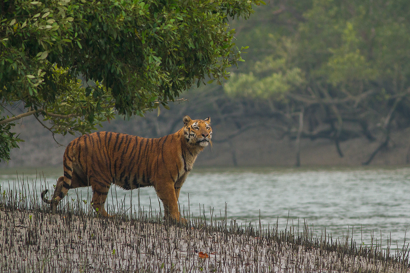
The Sundarbans covers 10,000 km2 of land and water (more than half of it in India, the rest in Bangladesh) in the Ganges delta. It contains the world's largest area of mangrove forests. A number of rare or endangered species live in the park, including tigers, aquatic mammals, birds and reptiles.
UNESCO Justification of the World Heritage Site
Criterion (ix): The Sundarbans is the largest area of mangrove forest in the world and the only one that is inhabited by the tiger. The land area in the Sundarbans is constantly being changed, moulded and shaped by the action of the tides, with erosion processes more prominent along estuaries and deposition processes along the banks of inner estuarine waterways influenced by the accelerated discharge of silt from sea water. Its role as a wetland nursery for marine organisms and as a climatic buffer against cyclones is a unique natural process.
Criterion (x): The mangrove ecosystem of the Sundarbans is considered to be unique because of its immensely rich mangrove flora and mangrove-associated fauna. Some 78 species of mangroves have been recorded in the area making it the richest mangrove forest in the world. It is also unique as the mangroves are not only dominant as fringing mangroves along the creeks and backwaters, but also grow along the sides of rivers in muddy as well as in flat, sandy areas. The Sundarbans support a wealth of animal species including the single largest population of tiger and a number of other threatened aquatic mammals such as the Irrawaddy and Ganges River dolphins. The site also contains an exceptional number of threatened reptiles including the king cobra and significant populations of the endemic river terrapin which was once believed to be extinct. The property provides nesting grounds for marine turtles including the olive riley, green and hawksbill. Two of the four species of highly primitive horseshoe crab (Tachypleus gigas and Carcinoscorpius rotundicauda) are found here. The Sajnakhali area, listed as an Important Bird Area, contains a wealth of waterfowl and is of high importance for migratory birds.
Encyclopedia Record: Sundarbans National Park
Sundarbans National Park is a national park in West Bengal, India, and core part of tiger reserve and biosphere reserve. It is part of the Sundarbans on the Ganges Delta and adjacent to the Sundarban Reserve Forest in Bangladesh. It is located to south-west of Bangladesh. The delta is densely covered by mangrove forests, and is one of the largest reserves for the Bengal tiger. It is also home to a variety of bird, reptile and invertebrate species, including the salt-water crocodile. The present Sundarban National Park was declared as the core area of Sundarban Tiger Reserve in 1973 and a wildlife sanctuary in 1977. On 4 May 1984 it was declared a national park. It is a UNESCO World Heritage Site inscribed in 1987, and it has been designated as a Ramsar site since 2019. It is considered as a World Network of Biosphere Reserve from 10 November 2001.Additional Site Details
Area: 133,010 hectares
Number of Components: 1
(x) — Contains most important habitats for biodiversity
Coordinates: 21.945 , 88.89583333
IUCN World Heritage Outlook
The 2025 Conservation Outlook on Sundarbans National Park reports the following assessment:
Source: International Union for Conservation of Nature (IUCN) · View assessment
Image
© Soumyajit Nandy, CC BY-SA 4.0 Resized from original. (This derivative is under the same CC BY-SA license.)
