World Heritage Identification Number: 321
World Heritage since: 1985
Category: Cultural Heritage
WHE Type: Historic Cities & Urban Areas
Transboundary Heritage: No
Endangered Heritage: No
Country: 🇧🇩 Bangladesh
Continent: Asia
UNESCO World Region: Asia and the Pacific
Map
The Historic Mosque City of Bagerhat: A Testament to Islamic Architecture in Medieval Bengal
The Historic Mosque City of Bagerhat, located in the Bagerhat District of Bangladesh, stands as a remarkable example of Islamic architecture that flourished during the Bengal Sultanate era (1204–1576). Inscribed as a UNESCO World Heritage Site in 1985, this ancient city, originally known as Khalifatabad, showcases the architectural prowess and cultural richness of medieval Bengal.
More to come…UNESCO Description of the World Heritage Site
Situated in the suburbs of Bagerhat, at the meeting-point of the Ganges and Brahmaputra rivers, this ancient city, formerly known as Khalifatabad, was founded by the Turkish general Ulugh Khan Jahan in the 15th century. The city’s infrastructure reveals considerable technical skill and an exceptional number of mosques and early Islamic monuments, many built of brick, can be seen there.
UNESCO Justification of the World Heritage Site
Criterion (iv): The Historic Mosque City of Bagerhatrepresents the vestiges of a medieval Muslim town in the northern peripheral land of the Sundarbans. It contains some of the most significant buildings of the initial period of the development of Muslim architecture in Bengal. Shait-Gumbad is one of the largest mosques and represents the flavour of the traditional orthodox mosque plan and it is the only example of its kind in the whole of Bengal. The second important monument, Khan Jahan's tomb, is an extraordinary representation of this type of architecture as well as calligraphic parlance. The site exhibits a unique architectural style, known as Khan-e-Jahan (15th Century A.D.), which is the only known example in the history of architecture.
Encyclopedia Record: Mosque City of Bagerhat
The Mosque City of Bagerhat is a UNESCO World Heritage Site in Bagerhat District, Bangladesh. It contains 360 mosques, public buildings, mausoleums, bridges, roads, water tanks and other public buildings constructed from baked brick. The mosques were built during the Bengal Sultanate in the 15th century, of which the Sixty Dome Mosque is the largest. Other mosques include the Singar Mosque, the Nine Dome Mosque, the Tomb of Khan Jahan, the Bibi Begni Mosque and the Ronvijoypur Mosque. The mosques were built during the governorship of Ulugh Khan Jahan, a Turkic military officer appointed as governor in the Sundarbans by Sultan Mahmud Shah of Bengal.Additional Site Details
Area: Not available
Number of Components: 1
Coordinates: 22.66667 , 89.8
Image
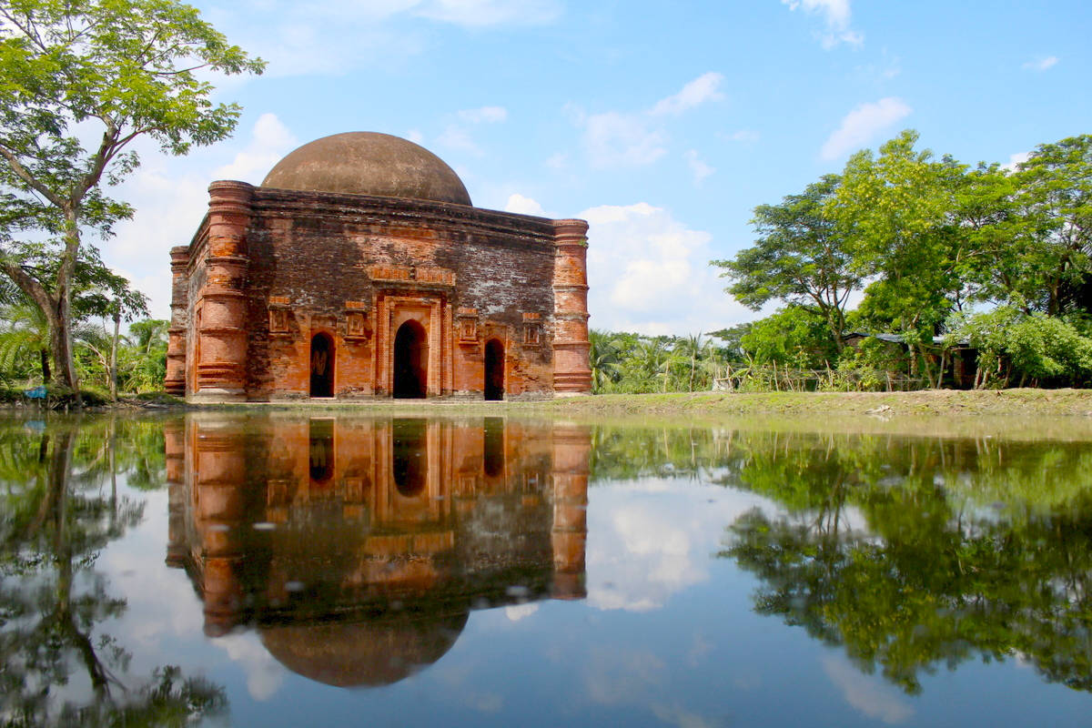
© Dr Amit Biswas, CC BY-SA 4.0 Resized from original. (This derivative is under the same CC BY-SA license.)
