World Heritage Identification Number: 322
World Heritage since: 1985
Category: Cultural Heritage
WHE Type: Archaeological Sites
Transboundary Heritage: No
Endangered Heritage: No
Country: 🇧🇩 Bangladesh
Continent: Asia
UNESCO World Region: Asia and the Pacific
Map
The Ruins of the Buddhist Vihara at Paharpur: A Testament to Ancient Bengali Architecture and Buddhist Culture
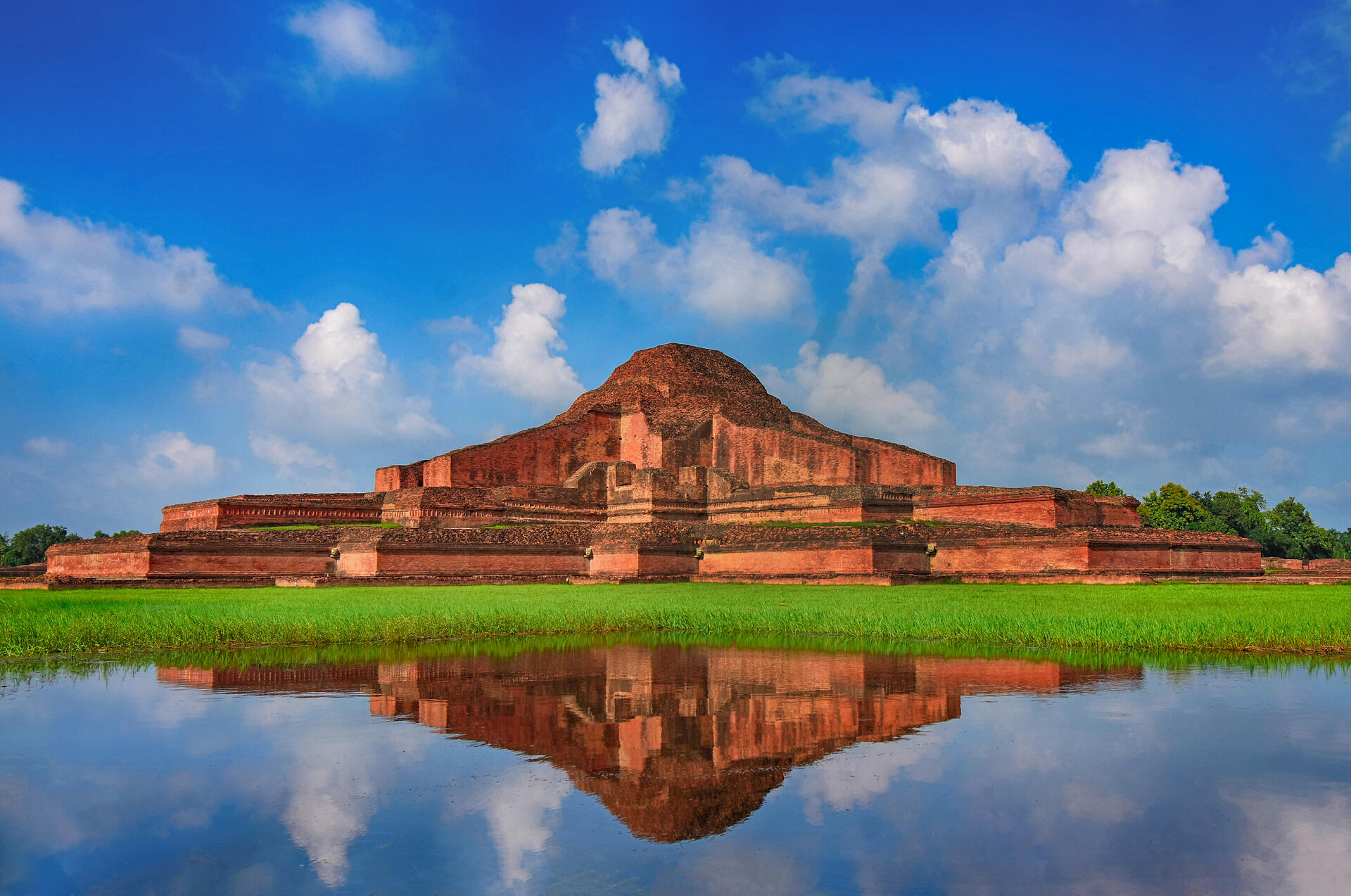
The Ruins of the Buddhist Vihara at Paharpur, located in the district of Naogaon in present-day Bangladesh, stand as a significant reminder of the historical and cultural richness of ancient Bengal. Inscribed as a UNESCO World Heritage Site in 1985, this monumental complex offers valuable insights into the development of Mahayana Buddhism in the region during the 7th to 12th centuries.
More to come…UNESCO Description of the World Heritage Site
Evidence of the rise of Mahayana Buddhism in Bengal from the 7th century onwards, Somapura Mahavira, or the Great Monastery, was a renowned intellectual centre until the 12th century. Its layout perfectly adapted to its religious function, this monastery-city represents a unique artistic achievement. With its simple, harmonious lines and its profusion of carved decoration, it influenced Buddhist architecture as far away as Cambodia.
UNESCO Justification of the World Heritage Site
Criterion (i) : This monastery-city represents a unique artistic achievement. The symmetrical layout and massively built single unit of the monastery was perfectly adapted to its religious function. Its simple, harmonious lines and its profusion of carved decoration, in stone and terracotta, are important artistic masterpieces.
Criterion (ii) : The striking architectural form introduced at Paharpur on a grand scale for the first time in Asia, profoundly influenced the subsequent construction of temples of Pagan in Myanmar and Loro-Jongrang and Chandi Sewer temples in central Java. It also continued to influence Buddhist architecture as far away as Cambodia. The craftsmanship of Paharpur terracotta still endures since the 8 th century A.D. in the whole of deltaic lands around.
Criterion (vi) : Somapura Mahavihara, the Great Monastery evidences the rise of Maharaja Buddhism in Bengal from the 7 th century onwards. It became a renowned centre of Buddhist religion and culture during the royal Patronage of Pala Dynasty and was a renowned intellectual centre until the 17 th century.
Encyclopedia Record: Somapura Mahavihara
Somapura Mahavihara, also known as Paharpur Buddhist Vihara, is a major Buddhist monastery (mahavihara) in Paharpur, Badalgachhi, Naogaon, Bangladesh. It is among the best known Buddhist viharas in the Indian Subcontinent and is one of the most important archaeological sites in the country. It was designated as a UNESCO World Heritage Site in 1985.Additional Site Details
Area: Not available
Number of Components: 1
(ii) — Significant interchange of human values
(vi) — Directly associated with events or living traditions
Coordinates: 25.03333333 , 88.98333333
Image
© Abdulmominbd, CC BY-SA 4.0 Resized from original. (This derivative is under the same CC BY-SA license.)
