World Heritage Identification Number: 798
World Heritage since: 1997
Category: Natural Heritage
WHE Type: Protected Areas & National Parks
Transboundary Heritage: No
Endangered Heritage: No
Country: 🇧🇩 Bangladesh
Continent: Asia
UNESCO World Region: Asia and the Pacific
Map
The Sundarbans: A Unique Mangrove Forest Ecosystem in South Asia
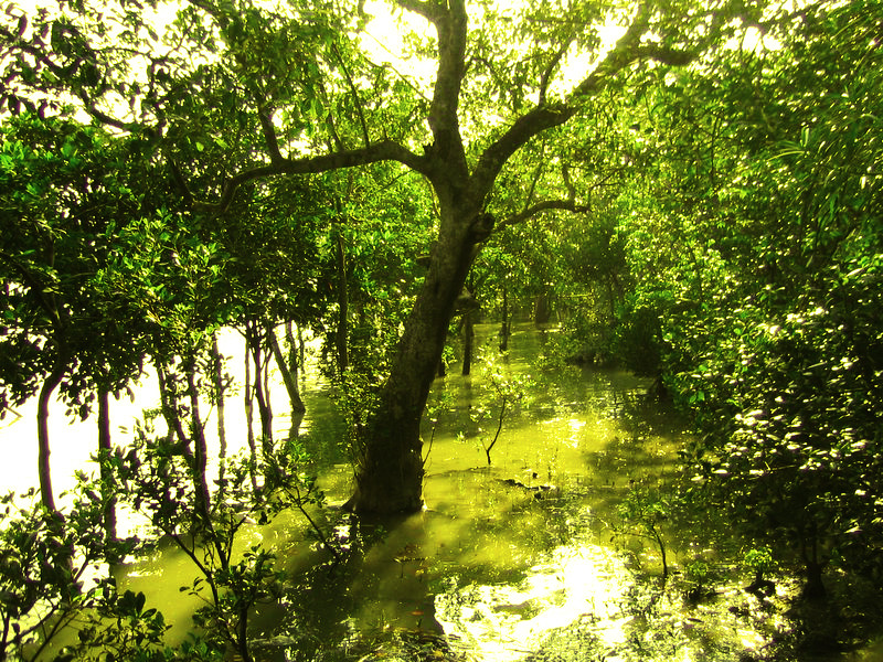
The Sundarbans, located in the Bay of Bengal, is a remarkable mangrove forest that straddles the border between India and Bangladesh. This extensive forest, covering approximately 10,000 square miles, is the world's largest single block of mangrove forest, making it a significant global ecosystem.
More to come…UNESCO Description of the World Heritage Site
The Sundarbans mangrove forest, one of the largest such forests in the world (140,000 ha), lies on the delta of the Ganges, Brahmaputra and Meghna rivers on the Bay of Bengal. It is adjacent to the border of India’s Sundarbans World Heritage site inscribed in 1987. The site is intersected by a complex network of tidal waterways, mudflats and small islands of salt-tolerant mangrove forests, and presents an excellent example of ongoing ecological processes. The area is known for its wide range of fauna, including 260 bird species, the Bengal tiger and other threatened species such as the estuarine crocodile and the Indian python.
UNESCO Justification of the World Heritage Site
Criterion (ix): The Sundarbans provides a significant example of on-going ecological processes as it represents the process of delta formation and the subsequent colonization of the newly formed deltaic islands and associated mangrove communities. These processes include monsoon rains, flooding, delta formation, tidal influence and plant colonization. As part of the world’s largest delta, formed from sediments deposited by three great rivers; the Ganges, Brahmaputra and Meghna, and covering the Bengal Basin, the land has been moulded by tidal action, resulting in a distinctive physiology.
Criterion (x): One of the largest remaining areas of mangroves in the world, the Sundarbans supports an exceptional level of biodiversity in both the terrestrial and marine environments, including significant populations of globally endangered cat species, such as the Royal Bengal Tiger. Population censuses of Royal Bengal Tigers estimate a population of between 400 to 450 individuals, a higher density than any other population of tigers in the world. The property is the only remaining habitat in the lower Bengal Basin for a wide variety of faunal species. Its exceptional biodiversity is expressed in a wide range of flora; 334 plant species belonging to 245 genera and 75 families, 165 algae and 13 orchid species. It is also rich in fauna with 693 species of wildlife which includes; 49 mammals, 59 reptiles, 8 amphibians, 210 white fishes, 24 shrimps, 14 crabs and 43 mollusks species. The varied and colourful bird-life found along the waterways of the property is one of its greatest attractions, including 315 species of waterfowl, raptors and forest birds including nine species of kingfisher and the magnificent white-bellied sea eagle.
Encyclopedia Record: Sundarbans
Sundarbans is a mangrove forest area in the Ganges Delta formed by the confluence of the Ganges, Brahmaputra and Meghna Rivers in the Bay of Bengal. It spans the area from the Hooghly River in India's state of West Bengal to the Baleswar River in Bangladesh's Khulna Division. It comprises closed and open mangrove forests, land used for agricultural purpose, mudflats and barren land, and is intersected by multiple tidal streams and channels. Spread across 10,000 km2 (3,900 sq mi), it is the world's largest mangrove forest. The islands are also of great economic importance as a storm barrier, shore stabiliser, nutrient and sediment trap, a source of timber and natural resources, and support a wide variety of aquatic, benthic and terrestrial organisms. They are an excellent example of the ecological processes of monsoon rain flooding, delta formation, tidal influence and plant colonisation. Covering 133,010 ha, the area is estimated to comprise about 55% forest land and 45% wetlands in the form of tidal rivers, creeks, canals and vast estuarine mouths of the river. About 66% of the entire mangrove forest area is estimated to occur in Bangladesh, with the remaining 34% in India.Additional Site Details
Area: 139,500 hectares
Number of Components: 3
(x) — Contains most important habitats for biodiversity
Coordinates: 21.95 , 89.18333
IUCN World Heritage Outlook
The 2025 Conservation Outlook on The Sundarbans reports the following assessment:
Source: International Union for Conservation of Nature (IUCN) · View assessment
Image
© Monster eagle, CC BY-SA 3.0 Resized from original. (This derivative is under the same CC BY-SA license.)
