World Heritage Identification Number: 1633
World Heritage since: 2021
Category: Cultural Heritage
WHE Type: Infrastructure & Industry
Transboundary Heritage: No
Endangered Heritage: No
Country: 🇬🇧 United Kingdom of Great Britain and Northern Ireland
Continent: Europe
UNESCO World Region: Europe and North America
Map
The Slate Landscape of Northwest Wales: A Testament to Industrial Transformation
The Slate Landscape of Northwest Wales, inscribed as a UNESCO World Heritage Site in 2021, stands as a testament to the profound transformation wrought by industrial slate quarrying and mining during the Industrial Revolution (1780-1914). This expansive territory, spanning from the snow-capped peaks of the Snowdon massif to the rugged coastline, bears witness to the intricate interplay between natural resources, human ingenuity, and economic forces that shaped this region into a global hub for slate production.
More to come…UNESCO Description of the World Heritage Site
The Slate Landscape of Northwest Wales illustrates the transformation that industrial slate quarrying and mining brought about in the traditional rural environment of the mountains and valleys of the Snowdon massif. The territory, extending from mountain-top to sea-coast, presented opportunities and constraints that were used and challenged by the large-scale industrial processes undertaken by landowners and capital investors, which reshaped the agricultural landscape into an industrial centre for slate production during the Industrial Revolution (1780-1914). The serial property comprises six components each encompassing relict quarries and mines, archaeological sites related to slate industrial processing, historical settlements, both living and relict, historic gardens and grand country houses, ports, harbours and quays, and railway and road systems illustrating the functional and social linkages of the relict slate industrial landscape. The property was internationally significant not only for the export of slates, but also for the export of technology and skilled workers from the 1780s to the early 20th century. It played a leading role in the field and constituted a model for other slate quarries in different parts of the world. It offers an important and remarkable example of interchange of materials, technology and human values.
UNESCO Justification of the World Heritage Site
Criterion (ii): The Slate Landscape of Northwest Wales exhibits an important interchange, particularly in the period from 1780 to 1940, on developments in architecture and technology. Slate has been quarried in the mountains of Northwest Wales since Roman times, but sustained large-scale production from the late 18th to the early 20th centuries dominated the global market as a roofing element. This led to major transcontinental developments in building and architecture. Technology, skilled workers and knowledge transfer from this cultural landscape was fundamental to the development of the slate industry of continental Europe and the United States. Moreover, its narrow-gauge railways – which remain in operation under steam today – served as the model for successive systems which contributed substantially to the social and economic development of regions in many other parts of the world.
Criterion (iv): The Slate Landscape of Northwest Wales is an outstanding example of a stone quarrying and mining landscape which illustrates the extent of transformation of an agricultural environment during the Industrial Revolution. Massive deposits of high-quality slate defined the principal geological resource of the challenging mountainous terrain of the Snowdon massif. Their dispersed locations represent concentrated nodes of exploitation and settlement, of sustainable power generated by prolific volumes of water that was harnessed in ingenious ways, and brought into being several innovative and technically advanced railways that made their way to new coastal ports built to serve this transcontinental export trade. The property comprises the most exceptional distinct landscapes that, together, illustrate the diverse heritage of a much wider landscape that was created during the era of British industrialisation.
Encyclopedia Record: Slate industry in Wales
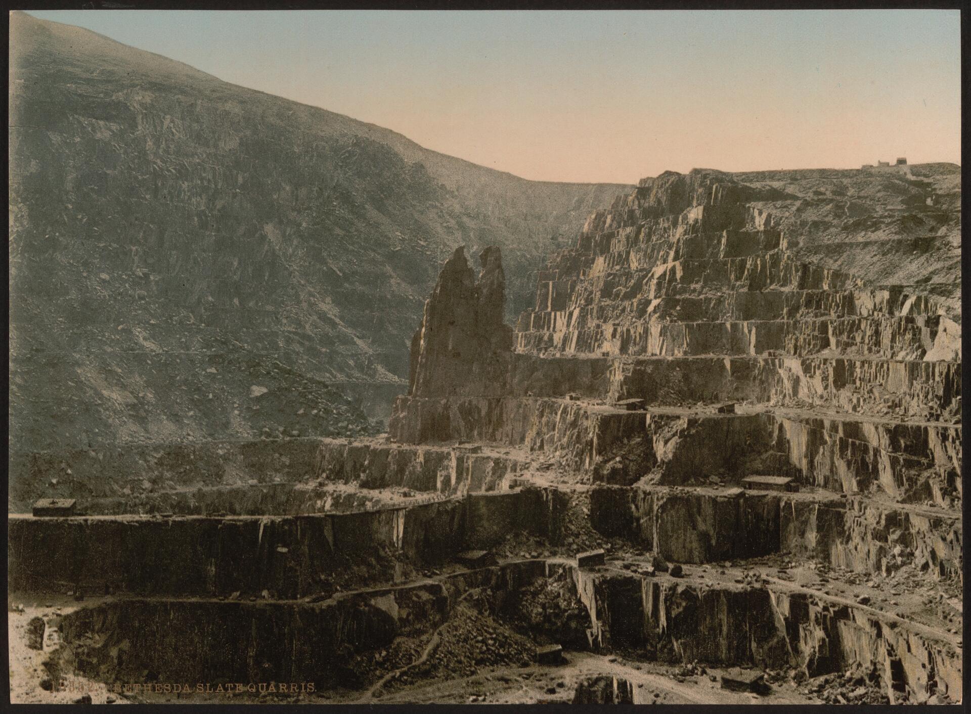
The existence of a slate industry in Wales is attested since the Roman period, when slate was used to roof the fort at Segontium, now Caernarfon. The slate industry grew slowly until the early 18th century, then rapidly during the Industrial Revolution in Wales until the late 19th century, at which time the most important slate producing areas were in northwest Wales. These sites included the Penrhyn Quarry near Bethesda, the Dinorwic Quarry near Llanberis, the Nantlle Valley quarries, and Blaenau Ffestiniog, where the slate was mined rather than quarried. Penrhyn and Dinorwig were the two largest slate quarries in the world, and the Oakeley mine at Blaenau Ffestiniog was the largest slate mine in the world. Slate is mainly used for roofing, but is also produced as thicker slab for a variety of uses including flooring, worktops, headstones as well as high quality surfaces for games such as shove ha'penny, snooker and billiards.Additional Site Details
Area: 3,259.01 hectares
Number of Components: 6
(iv) — Outstanding example of a type of building or landscape
Coordinates: 53.1208333333 , -4.115
Image
Unknown author, Public domain
