World Heritage Identification Number: 1580
World Heritage since: 2019
Category: Cultural Heritage
WHE Type: Infrastructure & Industry
Transboundary Heritage: No
Endangered Heritage: No
Country: 🇩🇪 Germany
Continent: Europe
UNESCO World Region: Europe and North America
Map
The Water Management System of Augsburg: A Pioneering Hydraulic Engineering Legacy
The Water Management System of Augsburg, inscribed as a UNESCO World Heritage Site in 2019, stands as a testament to the city's historical significance in hydraulic engineering. This intricate network of canals, water towers, fountains, and hydroelectric power stations has been evolving since the 14th century, making it one of the most comprehensive and well-preserved examples of urban water management in Europe.
The heart of the system lies in its extensive network of canals, which distributed water throughout the city from springs, rivers, and wells. The network also exemplifies early efforts to maintain hygiene by keeping drinking water separate from water used for industrial processes, a principle introduced in Augsburg around 1545. These canals fed various waterworks, ensuring a reliable supply for both domestic use and urban operations.
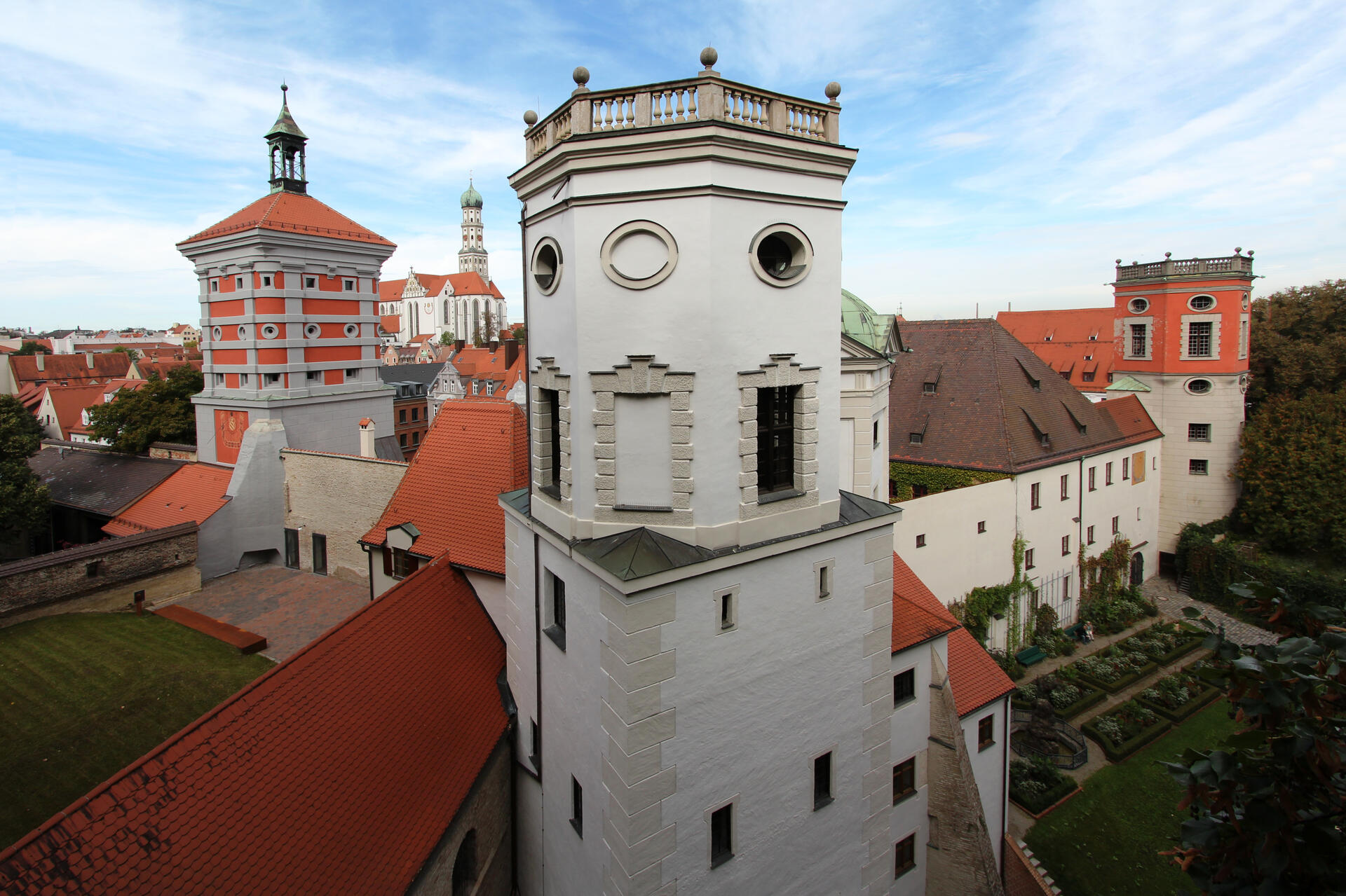
One of the key components of the Water Management System is the series of water towers that date back to the 15th to 17th centuries. These structures housed pumping machinery, essential for lifting water to higher elevations within the city. The towers not only played a crucial role in supplying water but also contributed to the city's aesthetic appeal, standing tall amidst the urban landscape.
The system’s sheer scale is equally impressive, featuring roughly 200 kilometers of waterways and more bridges than Venice. These structures document a 500-year evolution of pumping technology, showcasing a transition from simple bucket chains to advanced Archimedean screws and piston pumps that once made Augsburg a global leader in hydraulic innovation.
Another notable feature of the system is the water-cooled Butchers' Hall (Stadtmetzg), constructed in the early 17th century. This innovative design allowed for efficient cooling of meat during the summer months, ensuring food safety before refrigeration was widely available. The hall's unique architecture, combining functional and decorative elements, reflects the advanced understanding of hygiene practices during the Renaissance period.
Three monumental fountains are scattered across the city, serving both practical and ornamental purposes. They provided drinking water for the citizens while also contributing to the city's visual appeal. The fountains showcase various stages of the water management system's evolution, from simple stone basins to more complex structures incorporating sculptures and intricate designs.
In addition to these historical features, the Water Management System continues to play a vital role in modern Augsburg through its hydroelectric power stations. These stations harness the potential energy of flowing water to generate electricity, providing sustainable energy solutions for the city. This integration of historic waterworks with later technological innovations underscores the enduring relevance of the Water Management System.
The Water Management System of Augsburg represents a remarkable legacy in hydraulic engineering. Its intricate network of canals, water towers, fountains, and hydroelectric power stations offers valuable insights into the city's past while demonstrating the continued importance of effective water management in the face of modern challenges. As a UNESCO World Heritage Site, it celebrates Augsburg’s pioneering role and inspires future innovation in urban water systems
UNESCO Description of the World Heritage Site
The water management system of the city of Augsburg has evolved in successive phases from the 14th century to the present day. It includes a network of canals, water towers dating from the 15th to 17th centuries, which housed pumping machinery, a water-cooled butchers’ hall, a system of three monumental fountains and hydroelectric power stations, which continue to provide sustainable energy today. The technological innovations generated by this water management system have helped establish Augsburg as a pioneer in hydraulic engineering.
UNESCO Justification of the World Heritage Site
Criterion (ii): The Water Management System of Augsburg has generated significant technological innovations, which sustained Augsburg’s leading position as a pioneer in hydraulic engineering. The strict separation between drinking and process water was introduced as early as 1545, long before research into hygiene matters established as a fact that impure water was the reason for many diseases. An international exchange of ideas regarding water supply and water generation evolved which, in turn, inspired local engineers in their drive for innovations many of which were tested and implemented in Augsburg for the first time.
Criterion (iv): The Water Management System of Augsburg illustrates the use of water resources and the production of highly pure water as the basis for the continual growth of a city and its prosperity since the Middle Age. The architectural and technological monuments preserve successive socio-technical ensembles that are vivid testimony to the City’s urban administration and management of water that brought pre-eminence in two key stages in human history: the water “art” of the Renaissance, and the Industrial Revolution.
Encyclopedia Record: Augsburg Water Management System
Under the name Augsburg Water Management System, structural objects in Augsburg and the surrounding area that testify to the importance and history of Augsburg's historic water management were declared a UNESCO World Heritage Site on July 6, 2019. The World Heritage Site comprises a compilation of technical-architectural cultural assets that attest to various ways of using water in the historically rich southern German city from different eras.Additional Site Details
Area: 112.83 hectares
Number of Components: 1
(iv) — Outstanding example of a type of building or landscape
Coordinates: 48.3654722222 , 10.902
Image
© Regio Augsburg Tourismus GmbH, Fotograf: Reinhard Paland, CC BY-SA 3.0 de Resized from original. (This derivative is under the same CC BY-SA license.)
