World Heritage Identification Number: 1510
World Heritage since: 2016
Category: Natural Heritage
WHE Type: Natural Landscapes & Geographic Features
Transboundary Heritage: No
Endangered Heritage: No
Country: 🇲🇽 Mexico
Continent: Americas
UNESCO World Region: Latin America and the Caribbean
Map
Archipiélago de Revillagigedo: A Remote Pacific Treasure
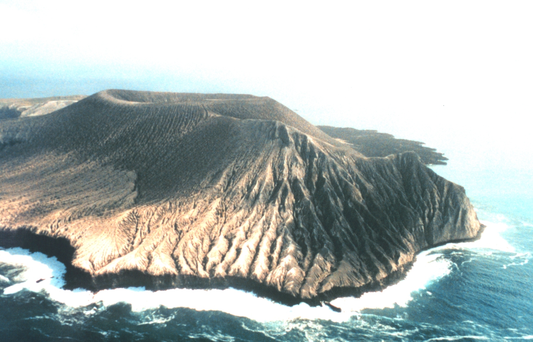
The Archipiélago de Revillagigedo, inscribed as a UNESCO World Heritage Site in 2016, stands as a testament to the extraordinary biodiversity found within its remote Pacific Ocean location. Comprising four volcanic islands—San Benedicto, Socorro, Roca Partida, and Clarión—the archipelago lies approximately 458 kilometers south and southwest of Cabo San Lucas, the southern tip of the Baja California Peninsula, and 698 to 1,092 kilometers west of Manzanillo. Historically linked to the Mexican state of Colima, these islands are now under Mexican federal property and jurisdiction.
More to come…UNESCO Description of the World Heritage Site
Located in the eastern Pacific Ocean, this archipelago is made up of four remote islands and their surrounding waters: San Benedicto, Socorro, Roca Partida and Clarión. This archipelago is part of a submerged mountain range, with the four islands representing the peaks of volcanoes emerging above sea level. The islands provide critical habitat for a range of wildlife and are of particular importance for seabirds. The surrounding waters have a remarkable abundance of large pelagic species, such as manta rays, whales, dolphins and sharks.
UNESCO Justification of the World Heritage Site
Criterion (vii): Both the landscape and seascape of the Archipiélago de Revillagigedo exhibit impressive active volcanos, arches, cliffs, and isolated rock outcrops emerging from the middle of the ocean. The clear surrounding waters create exceptional scenic vistas with large aggregations of fish gathering around the steep walls and seamounts, as well as large pelagic marine species including Giant Manta Rays, whales, dolphins and sharks. One of the most remarkable aspects of the property is the concentration the Giant Manta Rays which aggregate around the islands and interact with divers in a special way that is rarely found anywhere in the world. Furthermore, the property encompasses an underwater seascape with abyssal plains at depths close to 4,000 meters and sheer drops in crystal clear water, all contributing to an awe-inspiring underwater experience. A large population of up to 2,000 Humpback Whales visits the islands. The songs of these majestic cetaceans can be heard during the winter months and while diving, add another sensory dimension to the marine seascape.
Criterion (ix): The Archipiélago de Revillagigedo is located in the northern part of the Tropical East Pacific Province, a transitional zone influenced mainly by the California current but mixed with the warm waters from the North Equatorial Current. This location results in the convergence of a multitude of fauna and flora, and creates a unique set of biological and ecological processes. The isolation and relatively pristine state of these islands has supported evolutionary processes which result in a high degree of endemicity in both the terrestrial as well as marine realms. In the marine realm the waters surrounding these islands are composed of majestic aggregations of sharks, rays, cetaceans, turtles and fish, a number of which are endemic or near-endemic. On land, important evolutionary processes have led to the speciation of 2 endemic lizards, 2 endemic snakes, 4 endemic birds, at least 33 endemic plant species, and innumerable invertebrates. In addition, 11 endemic subspecies of birds have evolved on the islands, indicating the potential for future evolution on these remote and well protected islands.
Criterion (x): The geographic isolation of the Archipiélago de Revillagigedo, shaped by the prevailing oceanographic conditions, results in high marine productivity, rich biodiversity and exceptional levels of endemism, both terrestrial and marine. The islands are the only breeding site for the Townsend’s Shearwater, one of the rarest seabirds in the world. The Archipiélago de Revillagigedo is also home to the endemic Socorro Dove, Socorro Mockingbird, Socorro Wren, Clarion Wren (as well as 11 endemic bird subspecies), 2 lizards, 2 snakes and numerous endemic plants and invertebrates, all of which contribute to the importance of these islands in conserving terrestrial biodiversity. In the marine realm at least 10 reef fish species have been identified as endemic or near-endemic including the spectacular Clarión Angelfish, which can be observed in ‘cleaning stations’ feeding on the ectoparasites of the Giant Manta Rays. These rays, some of them unusually completely black, aggregate in some of the largest numbers known worldwide. The property is a haven for a rich diversity of shark species with up to 20 having been recorded. Up to 2,000 Humpback Whales also migrate through these nutrient rich and productive waters. The islands are also of significant importance to seabirds notably Masked, Blue-footed, Red-footed and Brown Boobies, Red-billed Tropicbirds, Magnificent Frigatebirds and many other species which can be seen soaring around the rocky outcrops where they nest and fish in the sea.
Encyclopedia Record: Revillagigedo Islands
The Revillagigedo Islands or Revillagigedo Archipelago are a group of four volcanic islands in the Pacific Ocean, known for their unique ecosystem. They lie approximately 458 kilometres (285 mi) from Socorro Island south and southwest of Cabo San Lucas, the southern tip of the Baja California Peninsula, and 698 to 1,092 kilometres west of Manzanillo. Historically linked to the Mexican state of Colima, to which they were granted in 1861 to establish a penal colony, the islands are under Mexican federal property and jurisdiction.Additional Site Details
Area: 636,685.4 hectares
Number of Components: 4
(ix) — Outstanding example representing ecological and biological processes
(x) — Contains most important habitats for biodiversity
Coordinates: 18.7880555556 , -110.9752777778
IUCN World Heritage Outlook
The 2025 Conservation Outlook on Archipiélago de Revillagigedo reports the following assessment:
Source: International Union for Conservation of Nature (IUCN) · View assessment
Image
Lieutenant Debora Barr, NOAA Corps, Public domain
