World Heritage Identification Number: 198
World Heritage since: 1982
Category: Cultural Heritage
WHE Type: Archaeological Sites
Transboundary Heritage: No
Endangered Heritage: No
Country: 🇺🇸 United States of America
Continent: Americas
UNESCO World Region: Europe and North America
Map
Cahokia Mounds State Historic Site: A Preeminent Pre-Columbian Settlement in North America
The Cahokia Mounds State Historic Site, located approximately 13 kilometers northeast of St. Louis, Missouri, stands as a testament to the rich cultural heritage and architectural prowess of the indigenous peoples who inhabited the region during the Mississippian period (800–1400). Inscribed as a UNESCO World Heritage Site in 1982, this expansive archaeological park offers a unique glimpse into the lives of the ancient inhabitants who once thrived in this bustling metropolis.
More to come…UNESCO Description of the World Heritage Site
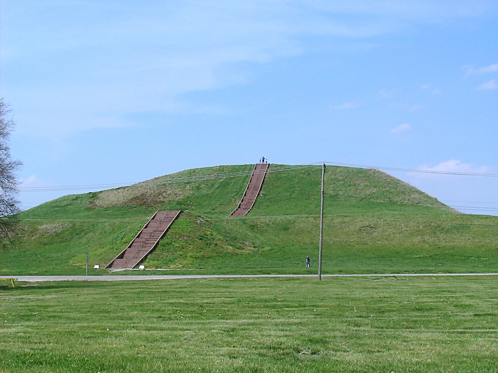
Cahokia Mounds, some 13 km north-east of St Louis, Missouri, is the largest pre-Columbian settlement north of Mexico. It was occupied primarily during the Mississippian period (800–1400), when it covered nearly 1,600 ha and included some 120 mounds. It is a striking example of a complex chiefdom society, with many satellite mound centres and numerous outlying hamlets and villages. This agricultural society may have had a population of 10–20,000 at its peak between 1050 and 1150. Primary features at the site include Monks Mound, the largest prehistoric earthwork in the Americas, covering over 5 ha and standing 30 m high.
UNESCO Justification of the World Heritage Site
Criterion (iii): Dating from the Mississippian period (800–1350 at this site), Cahokia Mounds is the largest pre-Columbian archaeological site north of Mexico; it is also the earliest of the large Mississippian settlements. It is the pre-eminent example of a cultural, religious, and economic center of the prehistoric Mississippian cultural tradition.
Criterion (iv): Cahokia graphically demonstrates the existence of a pre-urban society in which a powerful political and economic hierarchy was responsible for the organization of labor, communal agriculture, and trade. This is reflected in the size and layout of the settlement and the nature and structure of the public and private buildings.
Encyclopedia Record: Cahokia
Cahokia Mounds is the site of a Native American city directly across the Mississippi River from present-day St. Louis. The state archaeology park lies in south-western Illinois between East St. Louis and Collinsville. The park covers 2,200 acres (890 ha), or about 3.5 square miles (9 km2), and contains about 80 manmade mounds, but the ancient city was much larger. At its apex around 1100 CE, the city covered about 6 square miles (16 km2), included about 120 earthworks in a wide range of sizes, shapes, and functions, and had a population of between 15,000 and 20,000 people.Additional Site Details
Area: 541 hectares
Number of Components: 1
(iv) — Outstanding example of a type of building or landscape
Coordinates: 38.65861111 , -90.06138889
Image
© Skubasteve834, CC BY-SA 3.0 Resized from original. (This derivative is under the same CC BY-SA license.)
