World Heritage Identification Number: 1335
World Heritage since: 2010
Category: Natural Heritage
WHE Type: Natural Landscapes & Geographic Features
Transboundary Heritage: No
Endangered Heritage: No
Country: 🇨🇳 China
Continent: Asia
UNESCO World Region: Asia and the Pacific
Map
Exploring the Spectacular Landscapes of China Danxia: A Unique Geological Wonder
The China Danxia landscape, inscribed as a UNESCO World Heritage Site in 2010, offers a breathtaking display of nature's grandeur and geological complexity. Comprising six distinct areas scattered across southwestern China, these regions are characterized by their striking red cliffs, towering pillars, deep ravines, and cascading waterfalls. This article delves into the unique geological features, formation processes, and biodiversity of this remarkable landform.
More to come…UNESCO Description of the World Heritage Site
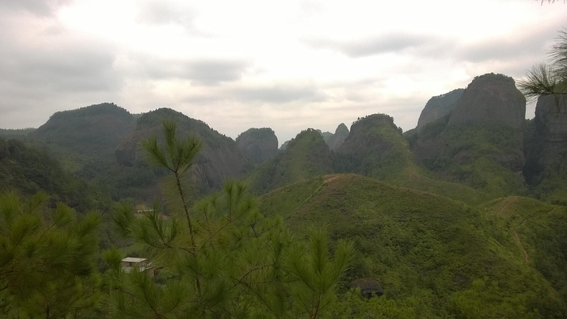
China Danxia is the name given in China to landscapes developed on continental red terrigenous sedimentary beds influenced by endogenous forces (including uplift) and exogenous forces (including weathering and erosion). The inscribed site comprises six areas found in the sub-tropical zone of south-west China. They are characterized by spectacular red cliffs and a range of erosional landforms, including dramatic natural pillars, towers, ravines, valleys and waterfalls. These rugged landscapes have helped to conserve sub-tropical broad-leaved evergreen forests, and host many species of flora and fauna, about 400 of which are considered rare or threatened.
UNESCO Justification of the World Heritage Site
Criterion (vii): China Danxia is an impressive and unique landscape of great natural beauty. The reddish conglomerate and sandstone that form this landscape of exceptional natural beauty have been shaped into spectacular peaks, pillars, cliffs and imposing gorges. Together with the contrasting forests, winding rivers and majestic waterfalls, China Danxia presents a significant natural phenomenon.
Criterion (viii): China Danxia contains a wide variety of well developed red-beds landforms such as peaks, towers, mesas, cuestas, cliffs, valleys, caves and arches. Being shaped by both endogenous forces (including uplift) and exogenous forces (including weathering and erosion), China Danxia provides a range of different aspects of the phenomenon of physical landscape developed from continental (terrestrial) reddish conglomerate and sandstone in a warm, humid monsoon climate, illustrating both the range of landforms in relation to the forces and processes that formed them. The component parts represent the best examples of least eroded to most eroded Danxia landforms, displaying a clear landform sequence from young through mature to old age, and with each component site displaying characteristic geomorphologic features of a given stage.
Encyclopedia Record: Danxia landform
The Danxia landform is a set of landscapes found in southeast, southwest and northwest China that "consist of a red bed characterized by steep cliffs". It is a unique type of petrographic geomorphology found in China. Danxia landform is formed from red-coloured sandstones and conglomerates of largely Cretaceous age. The landforms look very much like karst topography that forms in areas underlain by limestones, but since the rocks that form danxia are sandstones and conglomerates, they have been called "pseudo-karst" landforms. They were formed by endogenous forces and exogenous forces.Additional Site Details
Area: 82,151 hectares
Number of Components: 9
(viii) — Outstanding example representing major earth stages
Coordinates: 28.4219444444 , 106.0425
IUCN World Heritage Outlook
The 2025 Conservation Outlook on China Danxia reports the following assessment:
Source: International Union for Conservation of Nature (IUCN) · View assessment
Image
© Sino Yu, CC BY-SA 4.0 Resized from original. (This derivative is under the same CC BY-SA license.)
