World Heritage Identification Number: 1640
World Heritage since: 2023
Category: Cultural Heritage
WHE Type: Historic Cities & Urban Areas
Transboundary Heritage: No
Endangered Heritage: No
Country: 🇹🇳 Tunisia
Continent: Africa
UNESCO World Region: Arab States
Map
Djerba: A Unique Island Settlement Pattern in North Africa
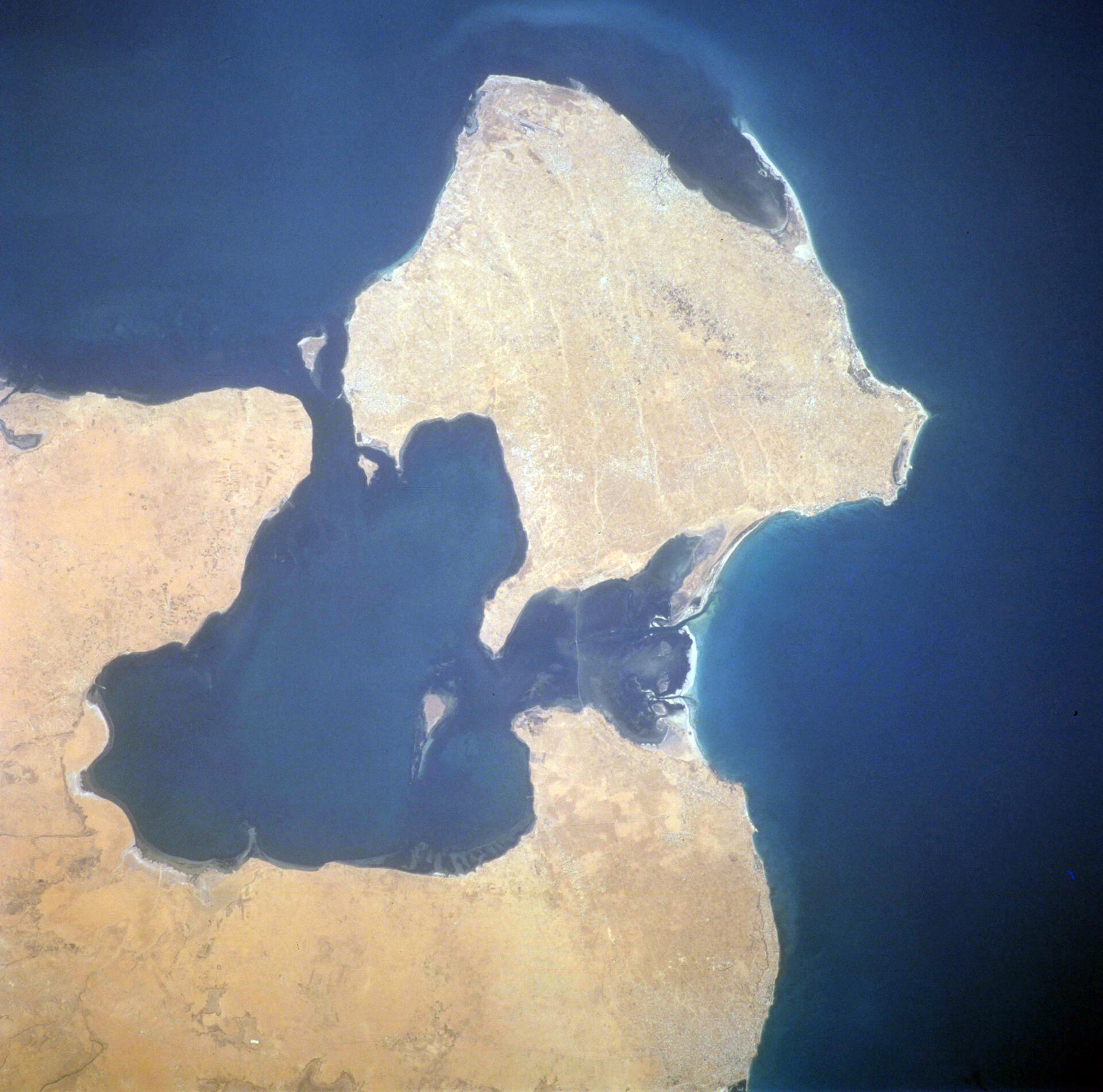
Djerba, located in the Gulf of Gabès off the coast of Tunisia, is the largest island in North Africa, spanning an area of 514 square kilometers (198 square miles). This island, home to a rich history and unique settlement pattern, was officially recognized as a UNESCO World Heritage Site in 2023.
More to come…UNESCO Description of the World Heritage Site
This serial property is a testimony to a settlement pattern that developed on the island of Djerba around the 9th century CE amidst the semi-dry and water-scarce environment. Low‑density was its key characteristic: it involved the division of the island into neighbourhoods, clustered together, that were economically self-sustainable, connected to each other and to the religious and trading places of the island, through a complex network of roads. Resulting from a mixture of environmental, socio-cultural and economic factors, the distinctive human settlement of Djerba demonstrates the way local people adapted their lifestyle to the conditions of their water-scarce natural environment.UNESCO Justification of the World Heritage Site
Criterion (v): Djerba: Testimony to a settlement pattern in an island territory is an eminent example of spatial organization based on a dispersed settlement pattern that extended over the entire territory of the island of Djerba. The socio-economic system induced by this distinctive settlement pattern, featuring both urban and rural characteristics and dependant on complementary economic activities, is an exceptional testimony to human interaction with the water-scarce environment, and to the way the local population adapted to the challenges of insular life. It has become vulnerable to the socio-cultural and economic changes resulting from contemporary development, making its safeguarding extremely important.
Encyclopedia Record: Djerba
Djerba, also transliterated as Jerba or Jarbah, is a Tunisian island and the largest island of North Africa at 514 square kilometers (198 sq mi), in the Gulf of Gabès, off the coast of Tunisia. Administratively, it is part of Medenine Governorate. The island had a population of 139,544 at the 2004 census, which rose to 163,726 at the 2014 census. Citing its long and unique history, Tunisia has sought UNESCO World Heritage status protections for the island, and, in 2023, Djerba was officially designated a World Heritage Site.Additional Site Details
Area: 5,460.477 hectares
Number of Components: 30
Coordinates: 33.7924194444 , 11.0039583333
Image
Unknown, Public domain
