World Heritage Identification Number: 631
World Heritage since: 1992
Category: Cultural Heritage
WHE Type: Historic Cities & Urban Areas
Transboundary Heritage: No
Endangered Heritage: No
Country: 🇲🇽 Mexico
Continent: Americas
UNESCO World Region: Latin America and the Caribbean
Map
El Tajin, Pre-Hispanic City: A Testimony to Ancient Mesoamerican Civilization
El Tajin, located in the state of Veracruz, Mexico, stands as a remarkable testament to the grandeur and sophistication of pre-Hispanic Mesoamerican civilizations. Inscribed as a UNESCO World Heritage Site in 1992, it represents an exceptional example of the architectural, artistic, and cultural achievements that marked the Classic era of Mesoamerica (600 to 1200 AD).
More to come…UNESCO Description of the World Heritage Site
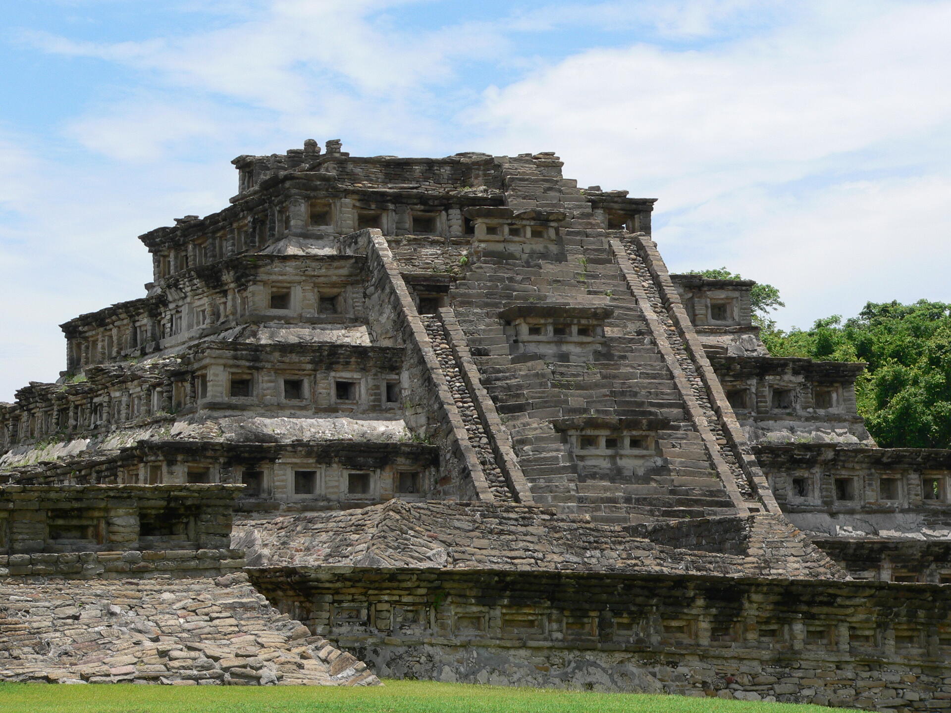
Located in the state of Veracruz, El Tajin was at its height from the early 9th to the early 13th century. It became the most important centre in north-east Mesoamerica after the fall of the Teotihuacan Empire. Its cultural influence extended all along the Gulf and penetrated into the Maya region and the high plateaux of central Mexico. Its architecture, which is unique in Mesoamerica, is characterized by elaborate carved reliefs on the columns and frieze. The 'Pyramid of the Niches', a masterpiece of ancient Mexican and American architecture, reveals the astronomical and symbolic significance of the buildings. El Tajin has survived as an outstanding example of the grandeur and importance of the pre-Hispanic cultures of Mexico.
UNESCO Justification of the World Heritage Site
Criterion (iii): El Tajín supplies unique information on Epiclassic and early Post Classic Mesoamerica and it is the most important site on the Gulf Coast of Mexico in that epoch. The artistic, architectural, and historical values of El Tajín combine to make this a highly significant site. The reliefs and paintings discovered at the site contain important information on society, ritual and daily life. Although there is still uncertainty concerning the origin of this culture, it has been attributed to the huastecos and totonacos, the latter being the indigenous people that are currently living in the area.
Criterion (iv): The site is furthermore exceptional in that its urban layout is based on the form of the Xicalcoliuhqui (the schematic representation of the cross section of a marine shell) and uses the different levels of the terrain to differentiate access to certain areas. Other exceptional elements are the large quantity of ball courts (17), public buildings (168), temples (27), residences (58), altars (3), and domestic houses (46).
Encyclopedia Record: El Tajín
El Tajín is a pre-Columbian archeological site in southern Mexico and is one of the largest and most important cities of the Classic era of Mesoamerica. A part of the Classic Veracruz culture, El Tajín flourished from 600 to 1200 AD and during this time numerous temples, palaces, ballcourts, and pyramids were built. From the time the city fell, in 1230, to 1785, no European seems to have known of its existence, until a government inspector chanced upon the Pyramid of the Niches.Additional Site Details
Area: 240 hectares
Number of Components: 1
(iv) — Outstanding example of a type of building or landscape
Coordinates: 20.446095 , -97.377642
Image
© Photograph: Frank C. Müller, Baden-Baden, CC BY-SA 3.0 Resized from original. (This derivative is under the same CC BY-SA license.)
