World Heritage Identification Number: 1692
World Heritage since: 2023
Category: Natural Heritage
WHE Type: Natural Landscapes & Geographic Features
Transboundary Heritage: No
Endangered Heritage: No
Country: 🇮🇹 Italy
Continent: Europe
UNESCO World Region: Europe and North America
Map
Evaporitic Karst and Caves of Northern Apennines: A Unique Geological Phenomenon
The Evaporitic Karst and Caves of Northern Apennines, inscribed as a UNESCO World Heritage Site in 2023, presents a unique geological phenomenon that has been captivating scientists for centuries. Situated within the Apennine Mountains, this region spans approximately 1,200 kilometers along the Italian Peninsula, making it one of the longest mountain ranges in Europe.
More to come…UNESCO Description of the World Heritage Site
This serial property is an unusually well-preserved and extensive epigenic gypsum karst terrain. It includes a very high density of caves: over 900 caves in a relatively small area, with over 100 km of caves in total. It is the first and the best studied evaporitic karst in the world, with academic work beginning in the 16th century. It also includes some of the deepest gypsum caves in existence, reaching 265 meters below the surface.UNESCO Justification of the World Heritage Site
Criterion (viii): The property comprises a globally exceptional and complete illustration of gypsum-anhydrite karst systems. It can be considered as the area with the most well-studied, most accessible, more comprehensively displayed and better protected epigenic gypsum cave systems in the world. The property contains an exceptional diversity of well-documented chemical deposits and minerals associated with gypsum caves and karst. It also holds an outstanding density of caves in its relatively small area, with 900 caves totalling a combined length of over 100 km, including the longest epigenic cave in gypsum (11.5 km long, Spipola-Aquafredda-Prete Santo cave system), among the deepest known cave in gypsum in the world (-265 m) and one of the largest hydrogeological tunnels in gypsum worldwide (over 7 km long). The property also contains an unusually high density of superficial karst forms, the largest gypsum cones described (2 m in diameter and 2 m high), as well as salt springs, minerals, speleothems, and hypogean bends. It represents a complete collection of epigean and hypogean karst morphologies, from the dissolution surfaces in vertically exposed gypsum cliffs to the speleothems in the abysses of the caves.
Encyclopedia Record: Apennine Mountains
The Apennines or Apennine Mountains are a mountain range consisting of parallel smaller chains extending c. 1,200 km (750 mi) the length of peninsular Italy. In the northwest they join the Ligurian Alps at Altare. In the southwest they end at Reggio di Calabria, the coastal city at the tip of the peninsula. Since 2000 the Environment Ministry of Italy, following the recommendations of the Apennines Park of Europe Project, has defined the Apennines System to include the mountains of north Sicily, a total distance of 1,500 kilometres (930 mi). The system forms an arc enclosing the east of the Ligurian and Tyrrhenian seas.Additional Site Details
Area: 3,680 hectares
Number of Components: 9
Coordinates: 44.3799444444 , 10.3889166667
IUCN World Heritage Outlook
The 2025 Conservation Outlook on Evaporitic Karst and Caves of Northern Apennines reports the following assessment:
Source: International Union for Conservation of Nature (IUCN) · View assessment
Image
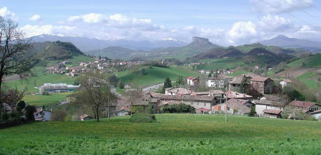
© No machine-readable author provided. Paolo da Reggio~commonswiki assumed (based on copyright claims)., CC BY-SA 3.0 Resized from original. (This derivative is under the same CC BY-SA license.)
World Heritage Research
Discover scientific research and academic studies that deepen our understanding of Evaporitic Karst and Caves of Northern Apennines from its history and significance to its conservation, management, and contemporary challenges.
-
Karst record of Holocene climate and human-induced changes in surface processes in the northern Apennines of Italy
A new study reveals that human land-use changes, particularly the slash-and-burn technique practiced since the Copper Age, significantly increased soil erosion and sediment flux into karst systems in the northern Apennines of Italy. The research, conducted on sediments from Tana della Mussina Cave (TdMC), shows that clastic sedimentation surged after 5500 years BP due to deforestation, leading to higher charcoal and heated soil remnants in the cave's deposits. This finding underscores early human impact on Earth's Critical Zone processes, with implications for understanding long-term environmental changes. The study combines sediment analysis, speleothem records, and archaeological evidence to reconstruct Holocene hydrological and anthropogenic influences on karst dynamics.
Cremaschi, M., Regattieri, E., Zanchetta, G., Isola, I., Hellstrom, J. C., & Zerboni, A. (2026). Karst record of Holocene climate and human-induced changes in surface processes in the northern Apennines of Italy. Catena, 266, 109960. https://doi.org/10.1016/j.catena.2026.109960
View Publication Record | Read Publication -
Genetic Diversity and Distribution of Italian Cave Crickets (Dolichopoda): Toward a Better Understanding of Lineage Structure
Research on Italian cave crickets (Dolichopoda) reveals two previously unrecognized lineages within the species D. geniculata, refining our understanding of their genetic diversity and distribution across the Apennines. By sequencing mitochondrial markers (cox1 and 16S) from 18 populations, scientists identified distinct lineages and updated the known ranges for D. geniculata, D. letitiae, and D. schiavazzii in the northern Apennines. These findings contribute to ongoing efforts toward a taxonomic revision of the group, highlighting the importance of cave crickets as key indicators of subterranean biodiversity. The study underscores the need for further exploration to unravel the complex lineage structure of these species.
Garzia, M., Berrilli, E., Lunghi, E., Coppari, L., Delcour, N., & Salvi, D. (2025). Genetic Diversity and Distribution of Italian Cave Crickets (Dolichopoda): Toward a Better Understanding of Lineage Structure. Animals, 15(16), 2429. https://doi.org/10.3390/ani15162429
View Publication Record | Read Publication -
Combining the 3D Geological and Geostatistical Modelling of Gypsum Concentration, Using Historical Borehole and Blasthole Information
A novel integration of 3D geological and geostatistical modeling enhances the precision of gypsum concentration estimation at the UNESCO-listed 'Monte Tondo' quarry, Italy. By combining historical borehole data with blasthole information, researchers achieved a more accurate representation of gypsum deposits, reducing geological risk and improving mining efficiency. This approach addresses long-standing challenges in small-scale operations, offering a sustainable solution that aligns with environmental regulations. The study demonstrates the potential of geostatistical techniques beyond large metal mines, paving the way for broader adoption in industrial mineral extraction.
Merli, S., Kasmaee, S., Barbalucca, C., Cellini, V., & Tinti, F. (2025). COMBINING THE 3D GEOLOGICAL AND GEOSTATISTICAL MODELLING OF GYPSUM CONCENTRATION, USING HISTORICAL BOREHOLE AND BLASTHOLE INFORMATION. Rudarsko-Geološko-Naftni Zbornik, 40(5), 115–126. https://doi.org/10.17794/rgn.2025.5.9
View Publication Record | Read Publication -
Geological Map of the Frasassi Gorge (Northern Apennines, Italy)
A new 1:10,000-scale geological map of the Frasassi Gorge (Northern Apennines, Italy) reveals intricate tectono-sedimentary contacts and structural features that refine our understanding of Jurassic paleogeography and post-Jurassic deformation in the region. The study integrates surface and cave surveys to provide a detailed subdivision of the Calcare Massiccio Formation (MAS), improving correlations with adjacent Jurassic units and the Maiolica Formation. Notably, it documents neptunian dykes both at the surface and within caves, suggesting that the Frasassi high was an elongated NW–SE block bounded by conjugate oblique-slip normal faults later reactivated during folding. This updated framework offers valuable insights for future geological research in this UNESCO-listed evaporitic karst system.
Galdenzi, S. (2025). Geological Map of the Frasassi Gorge (Northern Apennines, Italy). Geosciences, 15(12), 454. https://doi.org/10.3390/geosciences15120454
View Publication Record | Read Publication -
Long-Term Dynamics of a Cave Salamander Population in a Region under Changing Climate
A 27-year study of Strinati's Cave Salamanders (Speleomantes strinatii) in the Northern Apennines reveals that their population dynamics remain stable despite regional climate change. While local temperatures have risen steadily, precipitation has stayed constant, yet no directional trends were detected in salamander abundance, adult sex ratio, recruitment, or growth rates. The population's complex fluctuations suggest interactions between lagged density dependence and external factors, likely buffered by the thermal inertia of their subterranean habitat. This finding highlights the resilience of long-lived cave-dwelling species to aboveground climate signals.
Costa, A., Oneto, F., Pastorino, M. V., Rosa, G., & Salvidio, S. (2024). Long-Term Dynamics of a Cave Salamander Population in a Region under Changing Climate. Herpetologica, 80(3), 209–220. https://doi.org/10.1655/herpetologica-d-23-00029
View Publication Record | Read Publication -
Gypsum cave notches and their palaeoenvironmental significance: A combined morphometric study using terrestrial laser scanning, traditional cave mapping, and geomorphological observations
A multidisciplinary study on gypsum cave notches in the northern Apennines reveals a consistent paleocurrent flow direction from ESE to WNW, supporting the ancient resurgence nature of the cave system. Despite inconclusive results from individual methods—such as terrestrial laser scanning and traditional cave mapping—the collective evidence suggests that water flow gently inclined toward the present main entrance, corroborated by sediment imbrication patterns. This research highlights the potential of combining geostatistical analyses with geomorphological observations to unravel paleoenvironmental dynamics in karst systems.
Sevil-Aguareles, J., Pisani, L., Chiarini, V., Santagata, T., & De Waele, J. (2025). Gypsum cave notches and their palaeoenvironmental significance: A combined morphometric study using terrestrial laser scanning, traditional cave mapping, and geomorphological observations. Geomorphology, 471, 109576. https://doi.org/10.1016/j.geomorph.2024.109576
View Publication Record | Read Publication -
Different patterns of introgression in a three species hybrid zone among European cave salamanders
A previously undocumented three-species hybrid zone among European cave salamanders (Plethodontid) has been identified in the Northern Apennines, involving Speleomantes strinatii, S. ambrosii, and S. italicus. This discovery expands the known distribution of these species by 21 new sites and reveals complex introgression patterns, with asymmetric genetic exchange favoring S. italicus mitogenome in hybrids. The study employed mitochondrial (Cytb, ND2) and nuclear markers (NCX1 SNPs) to uncover strong mitonuclear discordance, where mitochondrial genes show geographic structure while nuclear alleles coexist across species boundaries. This finding suggests that behavioral, genetic, and ecological factors collectively influence hybridization dynamics in this unique system.
Bruni, G., Chiocchio, A., Nascetti, G., & Cimmaruta, R. (2023). Different patterns of introgression in a three species hybrid zone among European cave salamanders. Ecology and Evolution, 13(8). Portico. https://doi.org/10.1002/ece3.10437
View Publication Record | Read Publication