World Heritage Identification Number: 1367
World Heritage since: 2012
Category: Cultural Heritage
WHE Type: Buildings & Architectural Ensembles
Transboundary Heritage: No
Endangered Heritage: No
Country: 🇵🇹 Portugal
Continent: Europe
UNESCO World Region: Europe and North America
Map
Garrison Border Town of Elvas and Its Fortifications: A Testament to Military Architecture
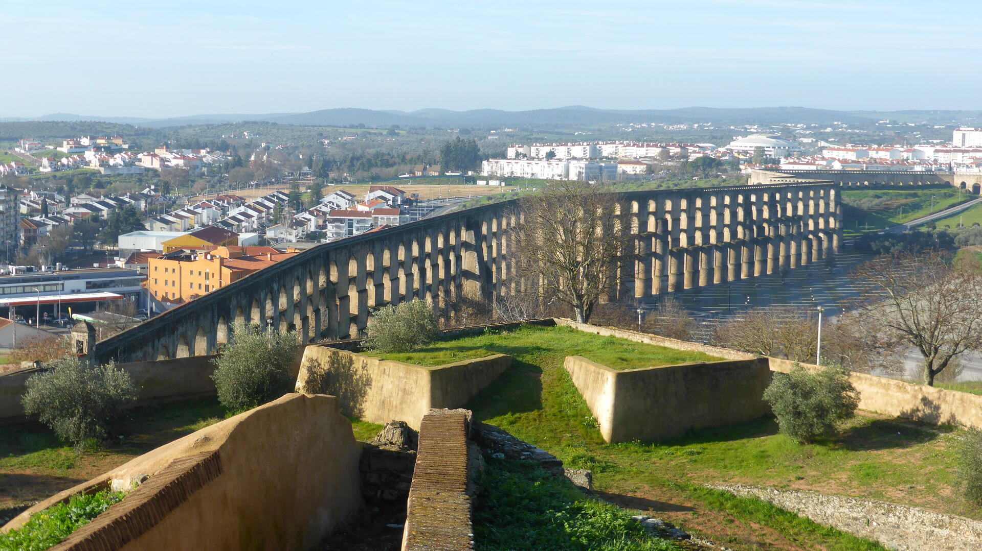
The Garrison Border Town of Elvas and Its Fortifications, inscribed as a UNESCO World Heritage Site in 2012, stands as a remarkable testament to military architecture and strategic planning. Located in the district of Portalegre in Alentejo, Portugal, this historic town boasts one of the most extensive bulwarked dry-ditch systems globally.
More to come…UNESCO Description of the World Heritage Site
The site, extensively fortified from the 17th to 19th centuries, represents the largest bulwarked dry-ditch system in the world. Within its walls, the town contains barracks and other military buildings as well as churches and monasteries. While Elvas contains remains dating back to the 10th century ad, its fortification began when Portugal regained independence in 1640. The fortifications designed by Dutch Jesuit padre Cosmander represent the best surviving example of the Dutch school of fortifications anywhere. The site also contains the Amoreira aqueduct, built to enable the stronghold to withstand lengthy sieges.
UNESCO Justification of the World Heritage Site
Criterion (iv) : Elvas is an outstanding example of a garrison town and its dry-ditched bulwarked defence system, which developed in response to disruptions in the balance of power within 17th century Europe. Elvas can thus be seen as representing the universal aspirations of European nation States in the 16th-17th centuries for autonomy and land.
Encyclopedia Record: Elvas
Elvas, officially the City of Elvas, is a Portuguese municipality, former episcopal city and frontier fortress of easternmost central Portugal, located in the district of Portalegre in Alentejo. It is situated about 200 kilometres (120 mi) east of Lisbon, and about 8 kilometres (5.0 mi) west of the Spanish fortress of Badajoz, by the Madrid-Badajoz-Lisbon railway. The municipality population as of 2011 was 23,078, in an area of 631.29 square kilometres (243.74 sq mi). The city itself had a population of 16,640 as of 2011.Additional Site Details
Area: 179.3559 hectares
Number of Components: 7
Coordinates: 38.8806194444 , -7.1633222222