World Heritage Identification Number: 1376
World Heritage since: 2011
Category: Cultural Heritage
WHE Type: Historic Cities & Urban Areas
Transboundary Heritage: No
Endangered Heritage: No
Country: 🇧🇧 Barbados
Continent: Americas
UNESCO World Region: Latin America and the Caribbean
Map
Historic Bridgetown and Its Garrison: A Unique Colonial Legacy in Barbados
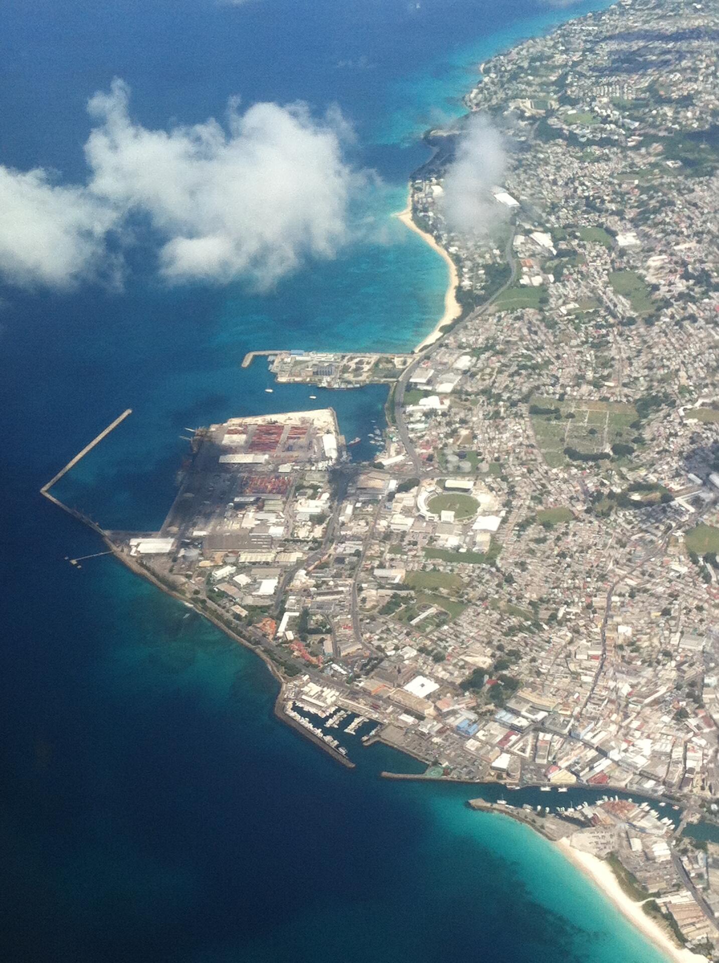
Historic Bridgetown and Its Garrison, inscribed as a UNESCO World Heritage Site in 2011, offers a unique insight into the architectural legacy of British colonialism in the Caribbean. Located in the parish of Saint Michael, Bridgetown, the capital and largest city of Barbados, presents a well-preserved urban landscape that dates back to the 17th, 18th, and 19th centuries. This site serves as a testament to the expansion of Great Britain's Atlantic colonial empire.
More to come…UNESCO Description of the World Heritage Site
Historic Bridgetown and its Garrison, an outstanding example of British colonial architecture consisting of a well-preserved old town built in the 17th, 18th and 19th centuries, which testifies to the spread of Great Britain's Atlantic colonial empire. The property also includes a nearby military garrison which consists of numerous historic buildings. With its serpentine urban lay-out the property testifies to a different approach to colonial town-planning compared to the Spanish and Dutch colonial cities of the region which were built along a grid plan.
UNESCO Justification of the World Heritage Site
Criterion (ii): Historic Bridgetown and its Garrison had a pivotal role in the development of the English colonies in the Atlantic World and was a centre for transmission of ideas concerning administration, trade, communications, science, culture and technology in the British Empire. While the Garrison can be said to have absorbed military ideas from Europe and transmitted them to other areas of the Caribbean, the social stratification of Bridgetown illustrates the interchange of several occupational, religious, ethnic, free and enslaved groups; a meeting of cultures, which created a hybridized Creole culture in the Anglophone Caribbean. This hybridized culture, which did not wholly abandon either European or African ways, lives on in the ways in which the urban space functions today.
Criterion (iii): Historic Bridgetown and its Garrison is an exceptional testimony of British colonial trade and defence in the Caribbean and the Americas. The historic town has retained its original footprint, based on its English medieval serpentine street layout, for almost 400 years, which bears exceptional testimony to British town layouts in foreign soil. St. Ann’s Garrison and its fortifications, which protected the town and its port, constitute the most complete complex of a 18th-19th century British garrison ensemble in the Atlantic World. As an integrated semi-planned urban landscape, with a strong brick architectural testimony, and a collection of colonial warehouses and dock facilities, it has remained essentially unchanged for 200 years, and provides an outstanding glimpse into a pivotal period of British imperial rule and culture.
Criterion (iv): St Ann’s Garrison is the earliest type of British navy and army base in the Caribbean and in its architectural layout and urban composition influenced later British presence in the region. The relation between the Historic Bridgetown and its Garrison is characterized by urban and architectural elements, which illustrate the continuous interaction between the commercial and military interests that dominated the evolution of functions in the colonial and post-colonial space. This is most evident in the tension between military order and economic resourcefulness, expressed among other by the Screw Dock, an outstanding but highly vulnerable structure, and the 18th and 19th century warehouses, built to withstand hurricanes and other threats in the tropical environment.
Encyclopedia Record: Bridgetown
Bridgetown is the capital and largest city of Barbados. Formerly The Town of Saint Michael, the Greater Bridgetown area is located within the parish of Saint Michael. Bridgetown is sometimes locally referred to as "The City", but the most common reference is simply "Town". As of 2014, its metropolitan population stands at roughly 110,000.Additional Site Details
Area: 187 hectares
Number of Components: 1
(iii) — Unique or exceptional testimony to a cultural tradition
(iv) — Outstanding example of a type of building or landscape
Coordinates: 13.0966666667 , -59.6138888889