World Heritage Identification Number: 940
World Heritage since: 2002
Category: Cultural Heritage
WHE Type: Historic Cities & Urban Areas
Transboundary Heritage: No
Endangered Heritage: Yes
Country: 🇸🇷 Suriname
Continent: Americas
UNESCO World Region: Latin America and the Caribbean
Map
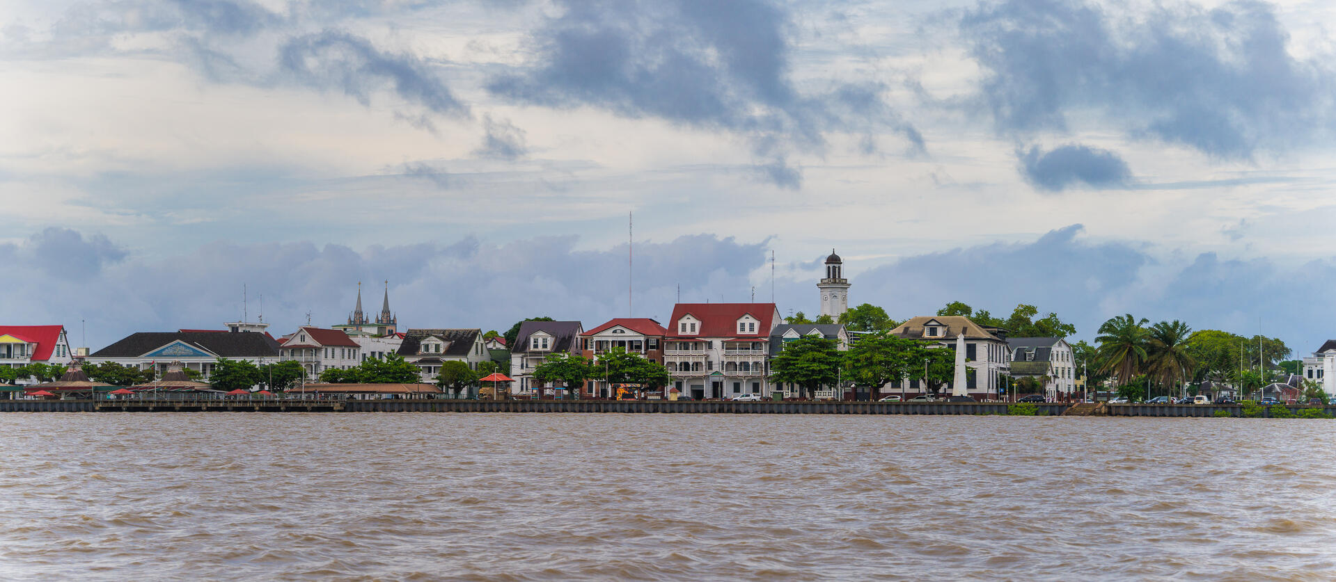
The Historic Inner City of Paramaribo: A Fusion of Cultures and Architecture
The Historic Inner City of Paramaribo, located in the heart of Suriname's capital, offers a unique blend of cultural diversity and architectural charm that has earned it a place on the prestigious UNESCO World Heritage List since 2002. This historic center, nestled along the banks of the Suriname River, presents a captivating snapshot of the city's rich history, showcasing the harmonious fusion of Dutch colonial architecture with indigenous building techniques and materials.
More to come…UNESCO Description of the World Heritage Site
Paramaribo is a former Dutch colonial town from the 17th and 18th centuries planted on the northern coast of tropical South America. The original and highly characteristic street plan of the historic centre remains intact. Its buildings illustrate the gradual fusion of Dutch architectural influence with traditional local techniques and materials.
UNESCO Justification of the World Heritage Site
Criterion (ii): Paramaribo is an exceptional example of the gradual fusion of European architecture and construction techniques with indigenous South American materials and crafts to create a new architectural idiom.
Criterion (iv): Paramaribo is a unique example of the contact between the European culture of the Netherlands and the indigenous cultures and environment of South America in the years of intensive colonization of this region in the 16th and 17th centuries.
Encyclopedia Record: Paramaribo
Paramaribo, locally nicknamed Foto, is the capital and largest city of Suriname, located on the banks of the Suriname River in the Paramaribo District. Paramaribo has a population of roughly 252,581 people as of the 2025 estimate, almost half of Suriname's population. The historic inner city of Paramaribo has been a UNESCO World Heritage Site since 2002.Additional Site Details
Area: 30 hectares
Number of Components: 1
(iv) — Outstanding example of a type of building or landscape
Coordinates: 5.82611 , -55.15
Image
© Rafaeljantz, CC BY-SA 4.0 Resized from original. (This derivative is under the same CC BY-SA license.)
