World Heritage Identification Number: 1140
World Heritage since: 2004
Category: Cultural Heritage
WHE Type: Historic Cities & Urban Areas
Transboundary Heritage: Yes
Endangered Heritage: No
Country: Benin, Togo
Continent: Africa
UNESCO World Region: Africa
Map
The Cultural Landscape of Koutammakou, the Land of the Batammariba
The cultural landscape of Koutammakou, situated along the border between northern Togo and Benin, stands as a unique testament to the rich cultural heritage of the Batammariba people. Inscribed as a UNESCO World Heritage Site in 2004, this region showcases a distinctive architectural style that reflects the social structure, spiritual beliefs, and deep connection between the people and their environment.
More to come…UNESCO Description of the World Heritage Site
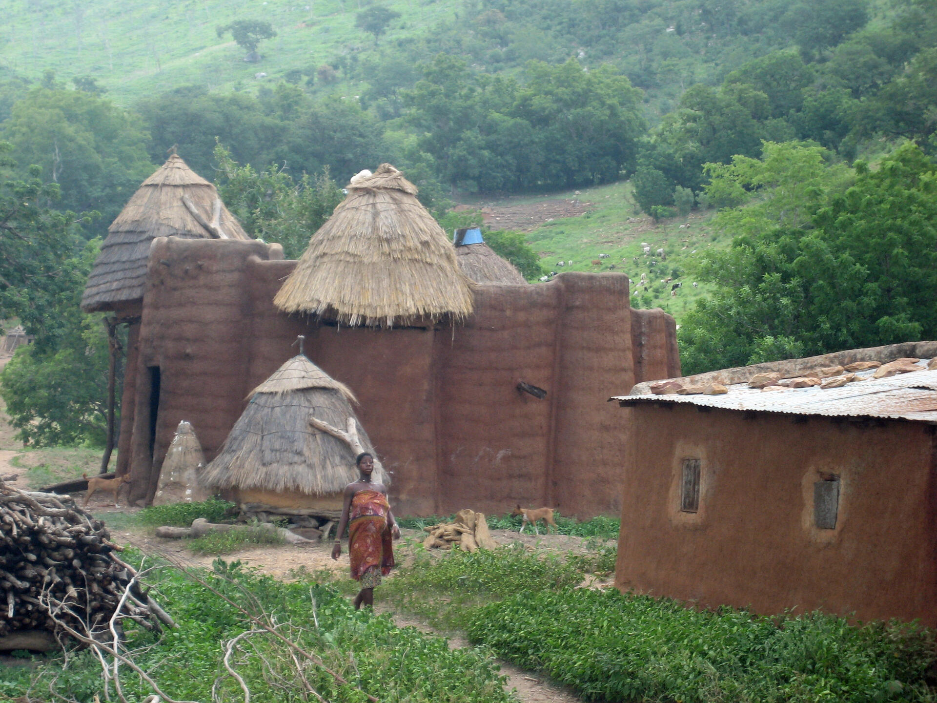
The Koutammakou landscape in north-eastern Togo and neighbouring Benin is home to the Batammariba, whose remarkable mud tower-houses are known as takienta (sikien in the plural). Nature is strongly associated with the rituals and beliefs of society here. The landscape is exceptional due to the architecture of the tower-houses which reflect the social structure; its farmland and forest; and the associations between people and landscape. The buildings are grouped in villages, which also include ceremonial spaces, springs, sacred rocks and sites reserved for initiation ceremonies.
UNESCO Justification of the World Heritage Site
Criterion (v): Koutammakou is an outstanding example of a traditional settlement system that is still going strong to this day, is subject to traditional and sustainable systems and practices, and reflects the unique culture of the Batammariba, particularly the mud tower-houses known as sikien (takienta in the singular).
Criterion (vi): Koutammakou is an eloquent testimony to the strength of the spiritual association between people and landscape, as manifested in the harmony between the Batammariba and the surrounding natural resources.
Encyclopedia Record: Koutammakou
Koutammakou, the Land of the Batammariba is a cultural landscape designated in 2004 as a UNESCO World Heritage Site at the border between northern Togo and Benin. The area features traditional mud tower-houses which remain the preferred style of living. The traditional mud houses are known as a national symbol of Togo. Many of the mud houses have two floors and some of them have flat roofs.Additional Site Details
Area: 271,826 hectares
Number of Components: 2
(vi) — Directly associated with events or living traditions
Coordinates: 10.1480833333 , 1.1002222222