World Heritage Identification Number: 1599
World Heritage since: 2019
Category: Cultural Heritage
WHE Type: Archaeological Sites
Transboundary Heritage: No
Endangered Heritage: No
Country: 🇵🇱 Poland
Continent: Europe
UNESCO World Region: Europe and North America
Map
Krzemionki Prehistoric Striped Flint Mining Region: A Unique Testimony of Human History
The Krzemionki Prehistoric Striped Flint Mining Region, inscribed as a UNESCO World Heritage Site in 2019, offers a captivating glimpse into the past, providing valuable insights into prehistoric life, work, and cultural traditions. Situated in the mountainous region of Świętokrzyskie, Poland, this unique ensemble comprises four mining sites that span the Neolithic to the Bronze Age, approximately 3900 to 1600 BCE.
More to come…UNESCO Description of the World Heritage Site
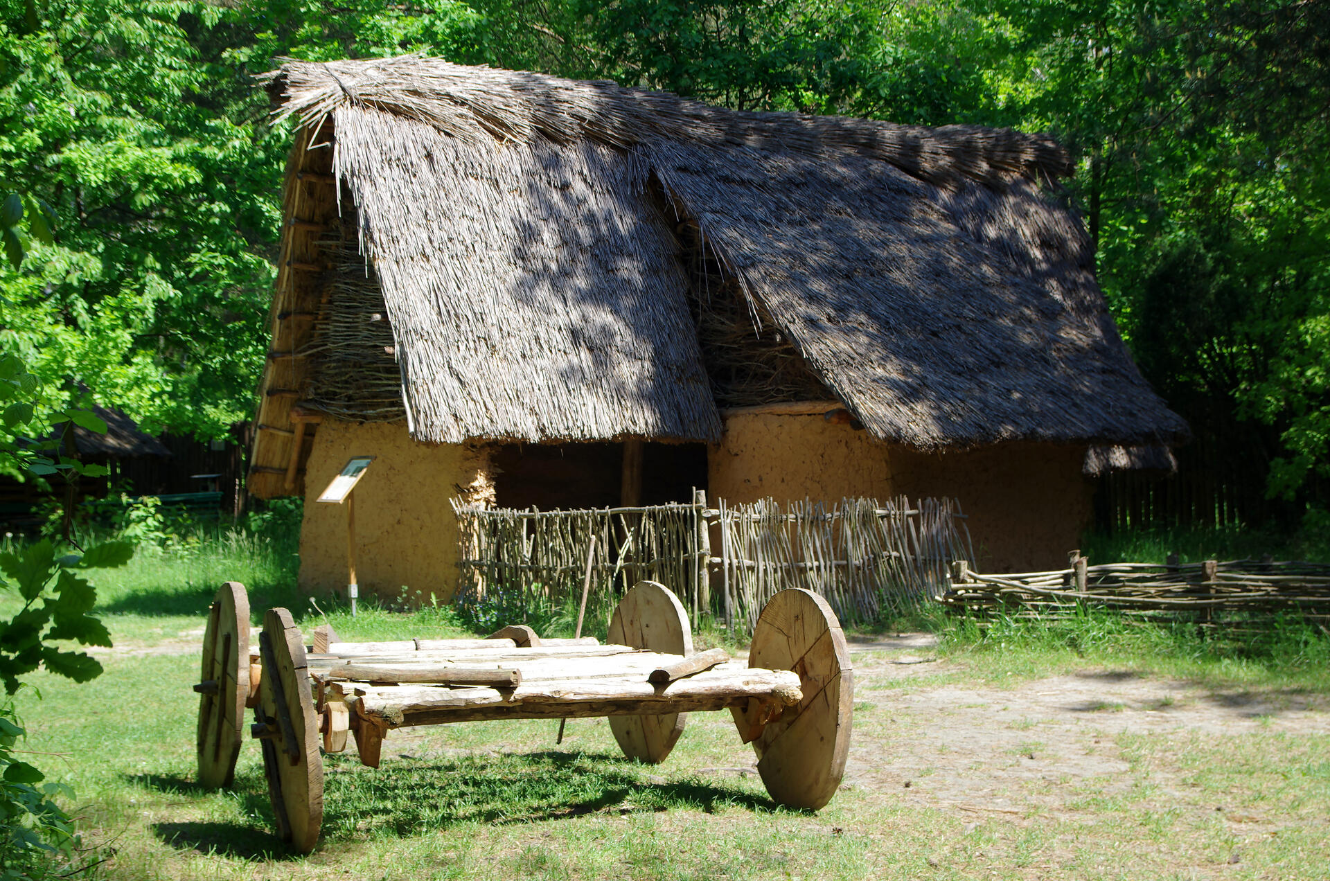
Located in the mountain region of Świętokrzyskie, Krzemionki is an ensemble of four mining sites, dating from the Neolithic to the Bronze Age (about 3900 to 1600 BCE), dedicated to the extraction and processing of striped flint, which was mainly used for axe-making. With its underground mining structures, flint workshops and some 4,000 shafts and pits, the property features one of the most comprehensive prehistoric underground flint extraction and processing systems identified to date. The property provides information about life and work in prehistoric settlements and bears witness to an extinct cultural tradition. It is an exceptional testimony of the importance of the prehistoric period and of flint mining for tool production in human history.UNESCO Justification of the World Heritage Site
Criterion (iii): Krzemionki Prehistoric Striped Flint Mining Region is illustrative of the living and working patterns of settled prehistoric communities that distinguish the Neolithic period from that which preceded it. The serial property bears witness to the economic and social organisation of segments of the Neolithic society, which were linked to the extraction of flint and its use for the production of polished axes. The attributes of the property, including the integral Gawroniec Settlement are further enhanced by the proven distribution of striped-flint axes that have been identified in a radius of over 650 km from the complex – the largest recorded range for prehistoric flint axes which act as significant indicators for prehistoric movements.
Criterion (iv): Krzemionki Prehistoric Striped Flint Mining Region represents an exceptional type of Neolithic mining landscape, bearing witness both to a complex technical and social system and to human adaptation to the conditions of natural resource exploitation that is a landmark in the history of mining. It provides evidence that the prehistoric period brought flint mining to produce tools in the largest known example for the prehistoric exploitation of flint. The serial property illustrates diverse underground prehistoric mining structures comprising open-pit, niche-gallery, gallery, pillar-chamber and chamber mines – and primary workshops, which survive intact in well over 4,000 shafts and pits.
Encyclopedia Record: Krzemionki
Krzemionki, also Krzemionki Opatowskie, is a Neolithic and early Bronze Age complex of flint mines for the extraction of Upper Jurassic (Oxfordian) banded flints located about eight kilometers north-east of the Polish city of Ostrowiec Świętokrzyski. It is one of the largest known complexes of prehistoric flint mines in Europe together with Grime's Graves in England and Spiennes in Belgium.Additional Site Details
Area: 349.2 hectares
Number of Components: 4
(iv) — Outstanding example of a type of building or landscape
Coordinates: 50.9679722222 , 21.5023055556
Image
© Jakub Hałun, CC BY-SA 4.0 Resized from original. (This derivative is under the same CC BY-SA license.)
