World Heritage Identification Number: 4
World Heritage since: 1978
Category: Cultural Heritage
WHE Type: Archaeological Sites
Transboundary Heritage: No
Endangered Heritage: No
Country: 🇨🇦 Canada
Continent: Americas
UNESCO World Region: Europe and North America
Map
Discovering the Past: A Journey to L’Anse aux Meadows National Historic Site
The L’Anse aux Meadows National Historic Site, situated on the northernmost tip of the island of Newfoundland, offers a unique glimpse into the past. This remarkable location, inscribed as a UNESCO World Heritage Site in 1978, holds significant historical importance as it represents the earliest known European presence in North America.
More to come…UNESCO Description of the World Heritage Site
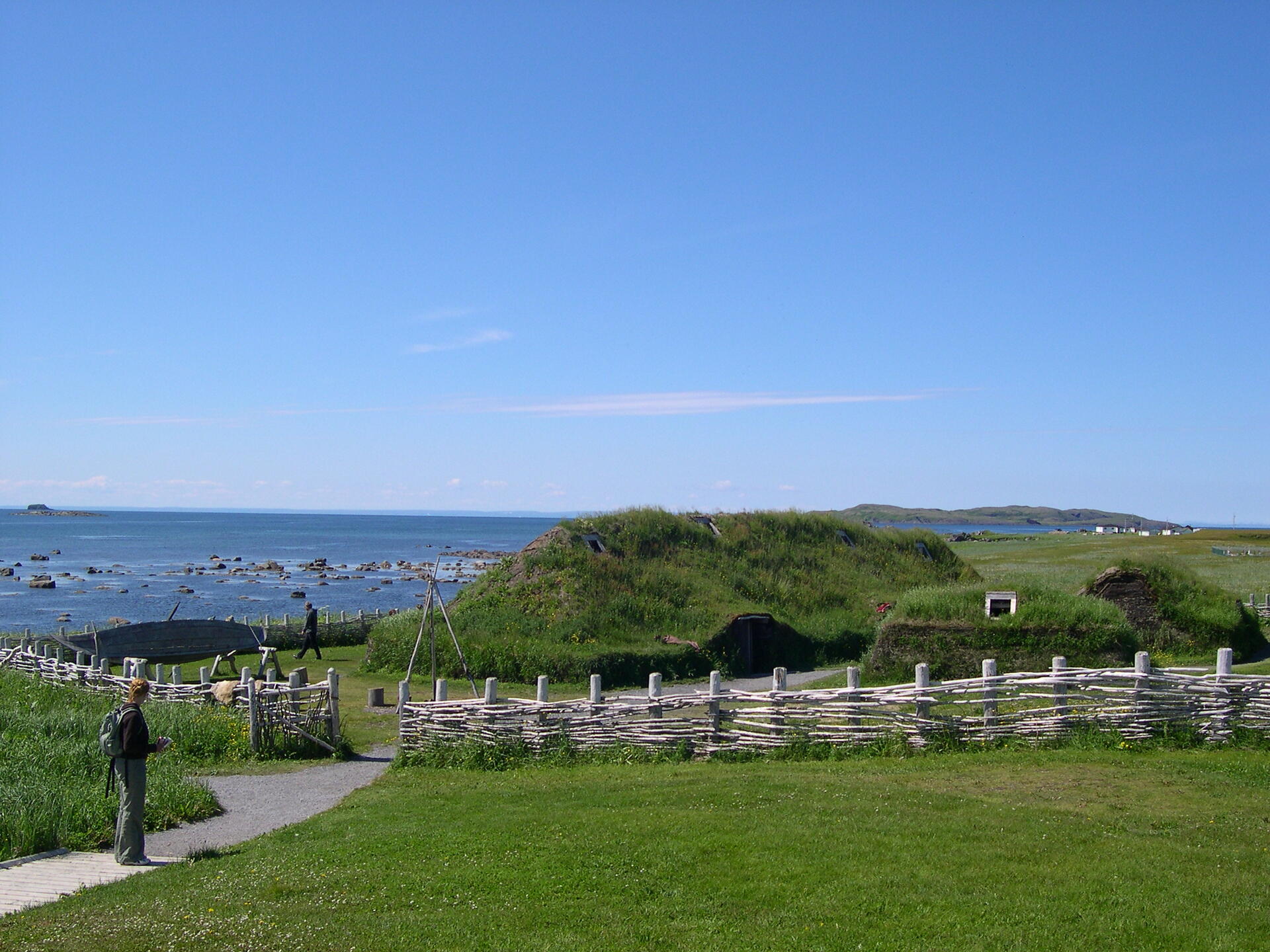
At the tip of the Great Northern Peninsula of the island of Newfoundland, the remains of an 11th-century Viking settlement are evidence of the first European presence in North America. The excavated remains of wood-framed peat-turf buildings are similar to those found in Norse Greenland and Iceland.
UNESCO Justification of the World Heritage Site
Criterion (vi): L’Anse aux Meadows is the first and only known site established by Vikings in North America and the earliest evidence of European settlement in the New World. As such, it is a unique milestone in the history of human migration and discovery.
Encyclopedia Record: L'Anse aux Meadows
L'Anse aux Meadows is an archaeological site, first excavated in the 1960s, of a Norse settlement dating to approximately 1,000 years ago. The site is located near St. Anthony on the northernmost tip of the island of Newfoundland in the Canadian province of Newfoundland and Labrador.Additional Site Details
Area: 7,991 hectares
Number of Components: 1
Coordinates: 51.5847222222 , -55.55