World Heritage Identification Number: 1497
World Heritage since: 2016
Category: Natural Heritage
WHE Type: Protected Areas & National Parks
Transboundary Heritage: No
Endangered Heritage: No
Country: 🇨🇦 Canada
Continent: Americas
UNESCO World Region: Europe and North America
Map
Mistaken Point: A Window into the Dawn of Complex Life
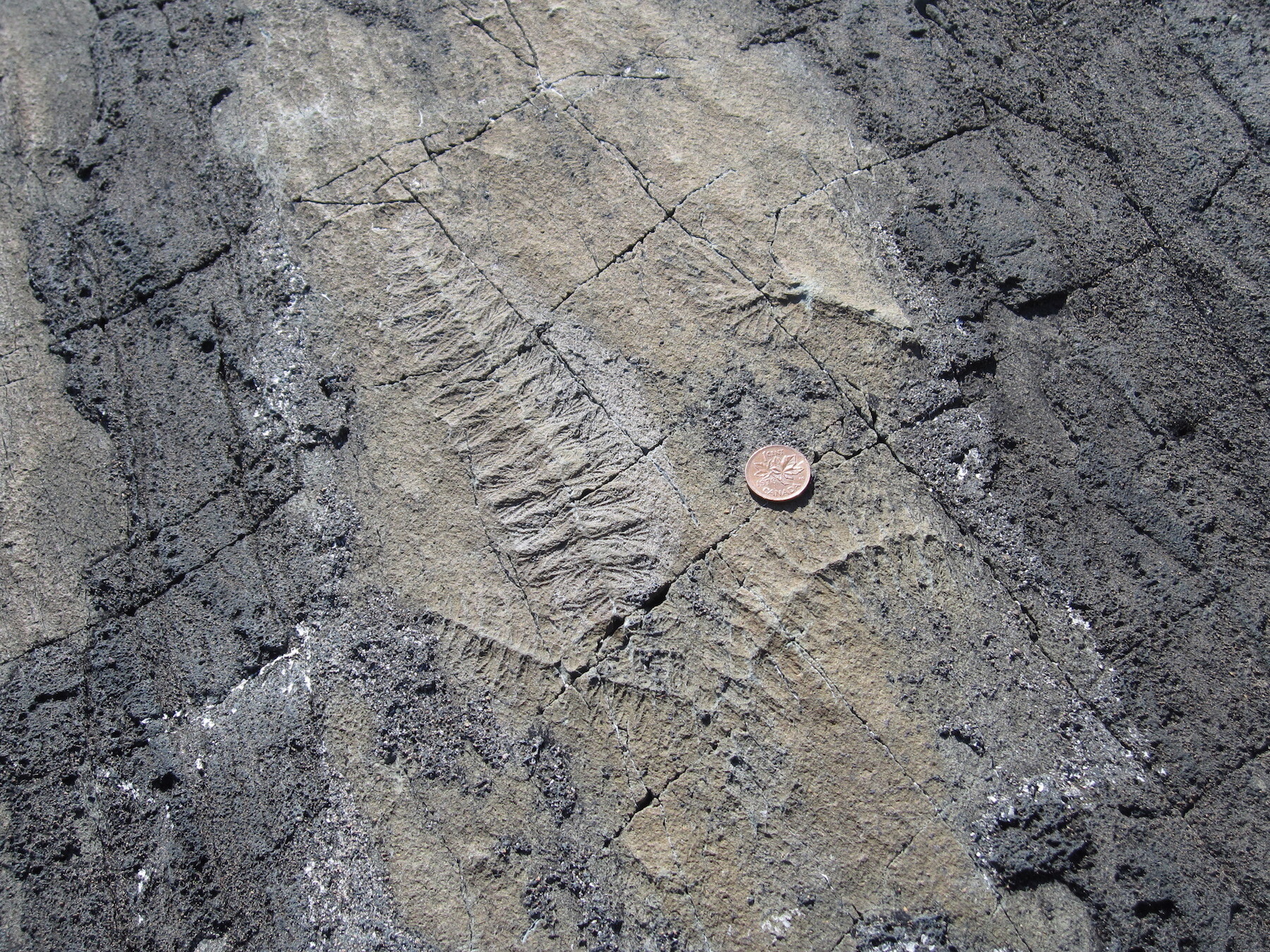
The Mistaken Point Ecological Reserve, situated at the southeastern tip of Newfoundland's Avalon Peninsula, is a unique and significant location that offers a glimpse into the early stages of life on Earth. Inscribed as a UNESCO World Heritage Site in 2016, this remote and rugged coastal region holds the oldest known assemblage of large fossils, providing valuable insights into the transition from simple microbial life to the emergence of complex organisms during the Ediacaran Period.
More to come…UNESCO Description of the World Heritage Site
This fossil site is located at the south-eastern tip of the island of Newfoundland, in eastern Canada. It consists of a narrow, 17 km-long strip of rugged coastal cliffs. Of deep marine origin, these cliffs date to the Ediacaran Period (580-560 million years ago), representing the oldest known assemblages of large fossils anywhere. These fossils illustrate a watershed in the history of life on earth: the appearance of large, biologically complex organisms, after almost three billion years of micro-dominated evolution.
UNESCO Justification of the World Heritage Site
Criterion (viii): Mistaken Point fossils constitute an outstanding record of a critical milestone in the history of life on Earth, “when life got big” after almost three billion years of microbe-dominated evolution. The fossils range in age from 580 to 560 million years, the longest continuous record of Ediacara-type megafossils anywhere, and predate by more than 40 million years the Cambrian explosion, being the oldest fossil evidence of ancestors of most modern animal groups. Mistaken Point contains the world’s oldest-known examples of large, architecturally complex organisms, including soft-bodied, ancestral animals. Ecologically, Mistaken Point contains the oldest and most diverse examples of Ediacaran deep-sea communities in the world thus preserving rare insights into the ecology of these ancestral animals and the early colonization of the deep-sea floor. Other attributes contributing to the property’s Outstanding Universal Value include the world’s first examples of metazoan locomotion, exceptional potential for radiometric dating of the assemblages, and evidence for the role of ancient oxygen levels in the regional and global appearance of complex multicellular life.
Encyclopedia Record: Mistaken Point Ecological Reserve
Mistaken Point Ecological Reserve is a wilderness area and a UNESCO World Heritage Site located at the southeastern tip of Newfoundland's Avalon Peninsula in the Canadian province of Newfoundland and Labrador. The reserve is home to the namesake Mistaken Point Formation, which contains one of the most diverse and well-preserved collections of Precambrian fossils in the world. Ediacaran fossils discovered at the site constitute the oldest known remnants of multicellular life on Earth.Additional Site Details
Area: 146 hectares
Number of Components: 1
Coordinates: 46.635 , -53.2111111111
IUCN World Heritage Outlook
The 2025 Conservation Outlook on Mistaken Point reports the following assessment:
Source: International Union for Conservation of Nature (IUCN) · View assessment
Image
© Alicejmichel, CC BY-SA 4.0 Resized from original. (This derivative is under the same CC BY-SA license.)
