World Heritage Identification Number: 475
World Heritage since: 1988
Category: Natural Heritage
WHE Type: Protected Areas & National Parks
Transboundary Heritage: No
Endangered Heritage: Yes
Country: 🇨🇫 Central African Republic
Continent: Africa
UNESCO World Region: Africa
Map
Manovo-Gounda St Floris National Park: A Biodiversity Haven in Central Africa
The Manovo-Gounda St Floris National Park, situated in the Bamingui-Bangoran prefecture of the Central African Republic (CAR), stands as a testament to the rich biodiversity that thrives across the African continent. Inscribed as a UNESCO World Heritage Site in 1988, this expansive protected area has been recognized for its extraordinary wealth of flora and fauna.
More to come…UNESCO Description of the World Heritage Site
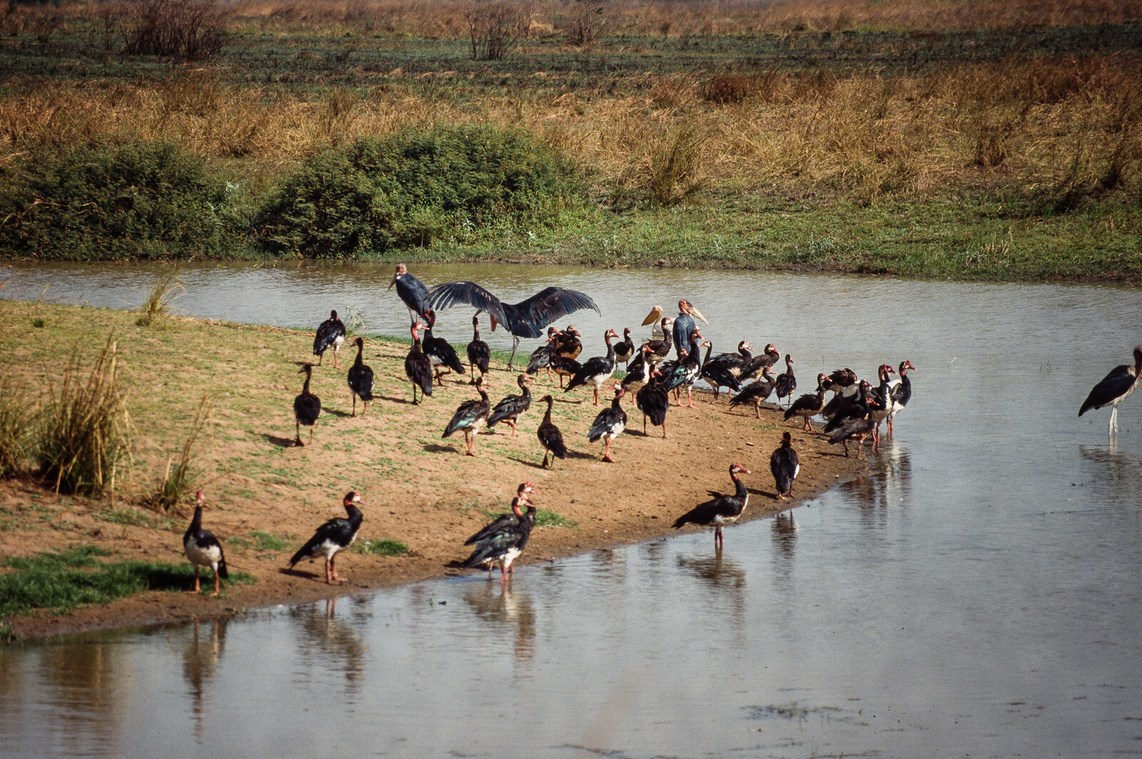
The importance of this park derives from its wealth of flora and fauna. Its vast savannahs are home to a wide variety of species: black rhinoceroses, elephants, cheetahs, leopards, wild dogs, red-fronted gazelles and buffalo, while various types of waterfowl are to be found in the northern floodplains.
UNESCO Justification of the World Heritage Site
Criterion (ix): The Manovo Gounda St Floris National Park contains extraordinary natural formations. The Park straddles the Sudano-Sahelian and Sudano-Guinean biogeographical zones. This results in a variety of habitats from grassy plains in the north to savannas with gallery forests in the south. The property encompasses the entire watershed of three major rivers (Manovo, Koumbala and Gounda) with grassy floodplains and wetlands. The plains are interspersed with small granitary inselbergs with, to the south, the rugged sandstone massif of the Bongos. This vast Park, surrounded by hunting areas and with a functional corridor to the National Park of Bamingui-Bangoran, protects the largest savanna of Central Africa. It represents a unique example of this type of ecosystem, home to viable populations of different species typical of this part of Africa and others from East and West Africa.
Criterion (x): The Park’s wildlife reflects its transitional position between East and West Africa, the Sahel and the rainforests. It contains the richest fauna of the country including about 57 species of mammals that have been well protected in the past. In this respect, it resembles the rich savannas of East Africa. Several important large mammal species in terms of conservation live in the Park, such as black rhino, elephant, hippopotamus, red-fronted gazelle (here at the southern limit of its range), lion, leopard, cheetah and wild dog. There are large concentrations of herbivores, including buffalo, Buffon’s kob, waterbuck, and red hartebeest. Some 320 species of birds have been recorded in the Park, of which at least 25 species of raptors. Flood plains to the north of the Park are largely adequate for water birds, and the shoebill has been observed in the Park.
Encyclopedia Record: Manovo-Gounda St. Floris National Park
Manovo-Gounda St Floris National Park is a national park and UNESCO World Heritage Site located in the Central African Republic prefecture Bamingui-Bangoran, near the Chad border. It was inscribed to the list of World Heritage Sites in 1988 as a result of the diversity of life present within it.Additional Site Details
Area: 1,740,000 hectares
Number of Components: 1
(x) — Contains most important habitats for biodiversity
Coordinates: 9 , 21.5
IUCN World Heritage Outlook
The 2025 Conservation Outlook on Manovo-Gounda St Floris National Park reports the following assessment:
Source: International Union for Conservation of Nature (IUCN) · View assessment
Image
© Garoa larrañeta, CC BY-SA 4.0 Resized from original. (This derivative is under the same CC BY-SA license.)
