World Heritage Identification Number: 938
World Heritage since: 1999
Category: Cultural Heritage
WHE Type: Cultural Landscapes
Transboundary Heritage: No
Endangered Heritage: No
Country: 🇳🇬 Nigeria
Continent: Africa
UNESCO World Region: Africa
Map
Exploring the Sukur Cultural Landscape: A Unique Blend of Culture, History, and Nature
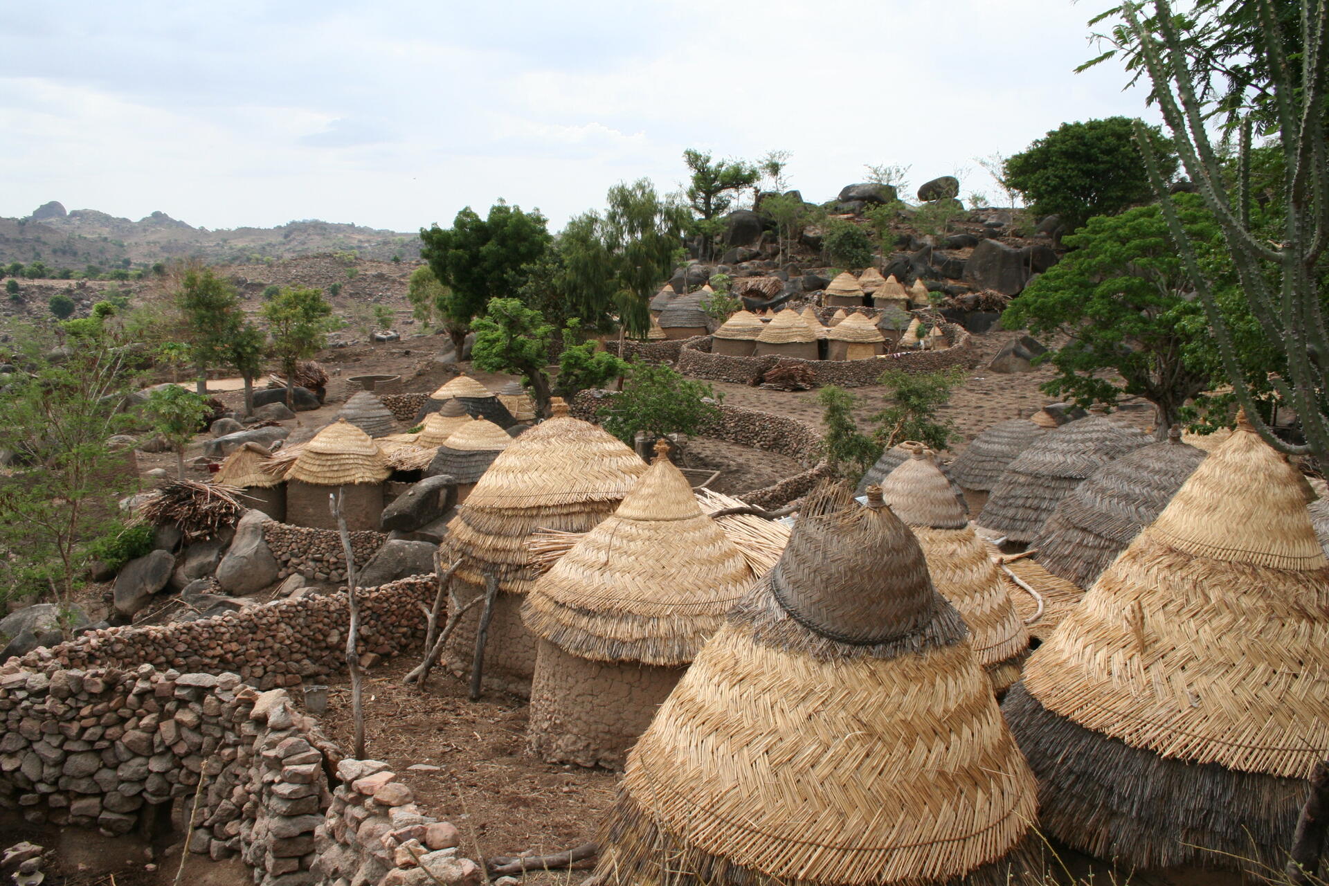
The Sukur Cultural Landscape, nestled within the Mandara Mountains of Nigeria's Adamawa State, stands as a testament to the harmonious fusion of culture, history, and nature. This remarkable site, inscribed as a UNESCO World Heritage Site in 1999, offers a captivating glimpse into the rich tapestry of African cultural heritage.
More to come…UNESCO Description of the World Heritage Site
The Sukur Cultural Landscape, with the Palace of the Hidi (Chief) on a hill dominating the villages below, the terraced fields and their sacred symbols, and the extensive remains of a former flourishing iron industry, is a remarkably intact physical expression of a society and its spiritual and material culture.
UNESCO Justification of the World Heritage Site
Criterion (iii): Sukur is an exceptional landscape that graphically illustrates a form of land-use that marks a critical stage in human settlement and its relationship with its environment.
Criterion (v): The cultural landscape of Sukur has survived unchanged for many centuries, and continues to do so at a period when this form of traditional human settlement is under threat in many parts of the world.
Criterion (vi): The cultural landscape of Sukur is eloquent testimony to a strong and continuing spiritual and cultural tradition that has endured for many centuries.
Encyclopedia Record: Sukur
Sukur or Sukur Cultural Landscape is a UNESCO World Heritage Site located on a hill above the village of Sukur in the Adamawa State of Nigeria. It is situated in the Mandara Mountains, close to the border with Cameroon. Its UNESCO inscription is based on the cultural heritage, material culture, and the naturally-terraced fields. Sukur is Africa's first cultural landscape to receive World Heritage List inscription.Additional Site Details
Area: 764.4 hectares
Number of Components: 1
(v) — Outstanding example of traditional human settlement
(vi) — Directly associated with events or living traditions
Coordinates: 10.74056 , 13.57194
Image
© DipoTayo, CC BY-SA 4.0 Resized from original. (This derivative is under the same CC BY-SA license.)
