World Heritage Identification Number: 1403
World Heritage since: 2014
Category: Natural Heritage
WHE Type: Protected Areas & National Parks
Transboundary Heritage: No
Endangered Heritage: No
Country: 🇵🇭 Philippines
Continent: Asia
UNESCO World Region: Asia and the Pacific
Map
Mount Hamiguitan Range Wildlife Sanctuary: A Biodiversity Haven in the Philippines
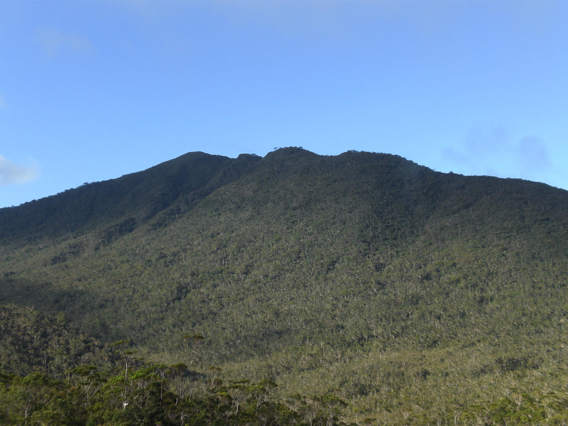
The Mount Hamiguitan Range Wildlife Sanctuary, inscribed as a UNESCO World Heritage Site in 2014, is nestled within the southeastern portion of the Eastern Mindanao Biodiversity Corridor in the province of Davao Oriental, Philippines. Stretching across a north-south mountain ridge, this sanctuary boasts an elevation range from 75 to 1,637 meters above sea level, providing a rich tapestry of terrestrial and aquatic habitats that cater to a myriad of plant and animal species.
More to come…UNESCO Description of the World Heritage Site
Forming a mountain ridge running north-south along the Pujada Peninsula in the south-eastern part of the Eastern Mindanao Biodiversity Corridor, the Mount Hamiguitan Range Wildlife Sanctuary has an elevation range of 75–1,637 m above sea level and provides critical habitat for a range of plant and animal species. The property showcases terrestrial and aquatic habitats at different elevations, and includes threatened and endemic flora and fauna species, eight of which are found only at Mount Hamiguitan. These include critically endangered trees, plants and the iconic Philippine eagle and Philippine cockatoo.
UNESCO Justification of the World Heritage Site
Criterion (x): The Mount Hamiguitan Range Wildlife Sanctuary represents a complete, substantially intact and highly diverse mountain ecosystem, in a significant biogeographic region of the Philippines. Its diversity of plants and animals include globally threatened species as well as a large number of endemic species including those species that exist only in the Philippines, only in Mindanao and only in the nominated property. The fragile tropical “bonsai” forest that crowns the Mount Hamiguitan Range Wildlife Sanctuary epitomizes nature’s bid to survive in adverse conditions. As a result of its semi-isolation and its varied habitat types growing in dissimilar soil and climate conditions, its biodiversity has shown a significantly high level of endemicity that has led scientists to believe that there may be more globally unique species waiting to be discovered in the area. The combination of terrestrial and aquatic ecosystems within the boundaries of the property and the large number of species inhabiting each makes the Mount Hamiguitan Range Wildlife Sanctuary home to a total of 1,380 species with 341 Philippine endemics that include critically endangered species such as the iconic Philippine Eagle (Pithecophaga jefferyi) and the Philippine Cockatoo (Cacatua haematuropygia), as well as the trees Shorea polysperma, Shorea astylosa, and the orchid Paphiopedilum adductum. Its high level of endemicity is well exemplified by the proportion of its amphibian (75% endemic) and reptile (84% endemic) species. The Mount Hamiguitan Range Wildlife Sanctuary exhibits segmentation of terrestrial habitats according to elevation. In the lower elevations the agro-ecosystem and remnants of dipterocarp forests house some 246 plant species including significant numbers of endemics such as the globally threatened dipterocarps of the genus Shorea. The dipterocarp forest ecosystem at 420-920 m asl is characterized by the presence of large trees and is home to 418 plant and 146 animal species, which include threatened species such as the Mindanao Bleeding-heart dove (Gallicolumba crinigera) and Philippine warty pig (Sus philippensis). At higher elevations the montane forest ecosystem exhibits numerous species of mosses, lichens and epiphytes. This ecosystem type houses 105 animal species representing all the animal groups found in the Mount Hamiguitan Range Wildlife Sanctuary as well as the relatively recently discovered rat species, Hamiguitan hairy-tailed rat (Batomys hamiguitan). The fourth ecosystem type is the typical mossy forest ecosystem characterized by thick mosses covering roots and tree trunks; it provides habitat for the Philippine pygmy fruit bat, (Haplonycteris fischeri) and the threatened Pointed-snouted tree frog (Philautus acutirostris). At the topmost (1160-1200m a.s.l.) is the mossy-pygmy forest ecosystem, adding a unique natural tropical bonsai forest layer to the property. It is the only known habitat in the world of the pitcher plant (Nepenthes hamiguitanensis) and the Delias butterfly (Delias magsadana).
Encyclopedia Record: Mount Hamiguitan
Mount Hamiguitan is a mountain located in the province of Davao Oriental, Philippines. It has a height of 1,620 metres (5,315 ft). The mountain and its vicinity has one of the most diverse wildlife populations in the country. Among the wildlife found in the area are Philippine eagles and several species of Nepenthes. Some of the latter, such as the Nepenthes peltata and Nepenthes micramphora, are endemic to the area. The mountain has a protected forest area of approximately 2,000 hectares. This woodland is noted for its unique pygmy forest of century-old trees in ultramafic soil, with many endangered, endemic and rare species of flora and fauna.Additional Site Details
Area: 16,923.07 hectares
Number of Components: 1
Coordinates: 6.7171694444 , 126.1734305556
IUCN World Heritage Outlook
The 2025 Conservation Outlook on Mount Hamiguitan Range Wildlife Sanctuary reports the following assessment:
Source: International Union for Conservation of Nature (IUCN) · View assessment
Image
© Kleomarlo, CC BY-SA 3.0 Resized from original. (This derivative is under the same CC BY-SA license.)
