World Heritage Identification Number: 1457
World Heritage since: 2014
Category: Cultural Heritage
WHE Type: Archaeological Sites
Transboundary Heritage: No
Endangered Heritage: No
Country: 🇹🇷 Türkiye
Continent: Asia
UNESCO World Region: Europe and North America
Map
Pergamon and Its Multi-Layered Cultural Landscape: An Ancient City's Enduring Legacy
The ancient city of Pergamon, situated in modern-day Turkey, stands as a testament to the rich cultural heritage that has been passed down through centuries. Inscribed as a UNESCO World Heritage Site in 2014, this remarkable location offers a unique glimpse into the history, art, and architecture of the Hellenistic, Roman, Byzantine, and Ottoman periods.
More to come…UNESCO Description of the World Heritage Site
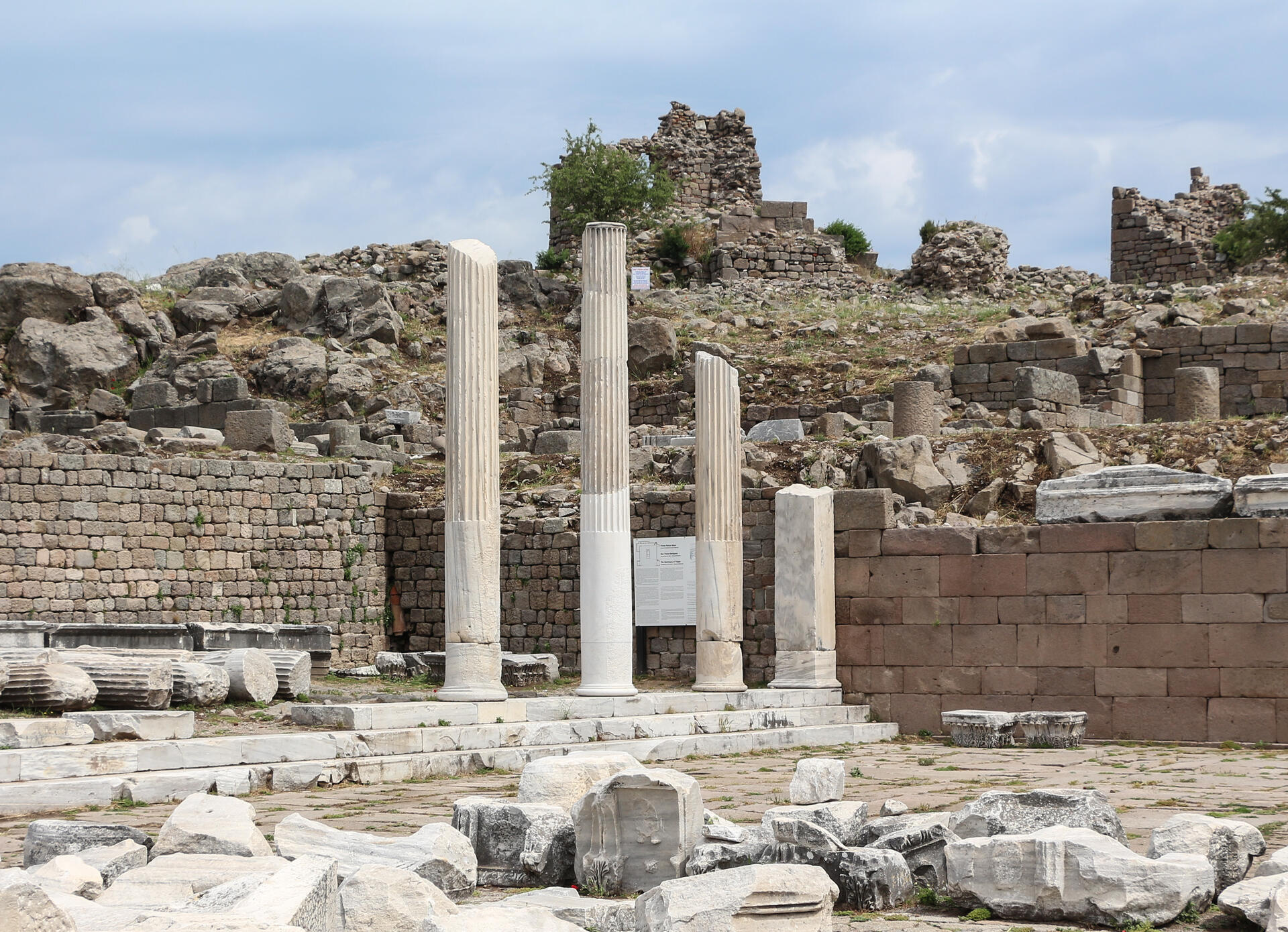
This site rises high above the Bakirçay Plain in Turkey’s Aegean region. The acropolis of Pergamon was the capital of the Hellenistic Attalid dynasty, a major centre of learning in the ancient world. Monumental temples, theatres, stoa or porticoes, gymnasium, altar and library were set into the sloping terrain surrounded by an extensive city wall. The rock-cut Kybele Sanctuary lies to the north-west on another hill visually linked to the acropolis. Later the city became capital of the Roman province of Asia known for its Asclepieion healing centre. The acropolis crowns a landscape containing burial mounds and remains of the Roman, Byzantine and Ottoman empires in and around the modern town of Bergama on the lower slopes.
UNESCO Justification of the World Heritage Site
Criterion (i): The building of Pergamon into the slopes at the top of Kale Hill, exploiting the topography with manmade terraces and grand monuments dominating the surrounding plain, is a masterpiece of Hellenistic and Roman urban planning and design. The acropolis remained as Pergamon’s crown while the city developed on the lower slopes during the Byzantine and Ottoman periods, extending its domination of the landscape.
Criterion (ii): The urban planning, architectural and engineering works of Pergamon reflect a synthesis nourished from the cumulative background of Anatolia. The Kybele Sanctuary at Kapıkaya, with local Anatolian roots, represents the continual use, synthesis of cultures and interchange of human values through time. The Serapeum, a Roman temple dedicated to an Egyptian deity exhibits the interchange of human values, as did the relocation of the Kybele meteorite to Rome, facilitated by the Attalids.
Criterion (iii): ‘Pergamon and its Multi-layered Cultural Landscape’ bears unique and exceptional testimony to Hellenistic urban and landscape planning. The architectural monuments including the Asclepion, Serapis Temple and Sanctuary, Kybele Sanctuary at Kapıkaya and Tumuli are exceptional testimonies to their period, culture and civilization.
Criterion (iv): The acropolis of Pergamon, with its urban planning and architectural remains is an outstanding ensemble of the Hellenistic Period. The Serapis Temple and Sanctuary, Asclepion, water supply system and amphitheatre combine to illustrate the Roman period in Anatolia as a significant stage in history.‘Pergamon and its Multi-layered Cultural Landscape’ is an outstanding historic urban landscape illustrating significant stages of human existence in the geography to which it belongs.
Criterion (vi): Pergamon is associated with important people, schools, ideas and traditions concerning art, architecture, planning, religion and science. The Pergamon sculpture school contributed the ‘Pergamon style’. The Kybele Cult represents a continual tradition and belief in Anatolia. Due to the consequent settling of Romans in Anatolia, following transfer of the Kybele cult idol to Rome by Pergamon’s Attalid king and the subsequent inheritance by Rome of Pergamon due to Attalid bequest in 133 BC, Pergamon is directly associated with the creation of an eastern Roman empire. The continual religious use of the Temple of Serapis, which was first constructed as a temple during the Roman period, converted and used as a church during late Roman and Byzantine periods, while one of its rotunda was used as a synagogue, and which then continued to be used but as a mosque beginning from 13th century onwards, is an example of the continuity of use for religious purposes at a particular place. The physician, surgeon and philosopher Galen was trained in Pergamon and his works were disseminated from there. Last but not least, there is the tradition of production of Parchment specific to Pergamon.
Encyclopedia Record: Pergamon
Pergamon or Pergamum, also referred to by its modern Greek form Pergamos (Πέργαμος), was a rich and powerful ancient Greek city in Aeolis. It is located 26 kilometres (16 mi) from the modern coastline of the Aegean Sea on a promontory on the north side of the river Caicus and northwest of the modern city of Bergama, Turkey.Additional Site Details
Area: 332.5 hectares
Number of Components: 9
(ii) — Significant interchange of human values
(iii) — Unique or exceptional testimony to a cultural tradition
(iv) — Outstanding example of a type of building or landscape
(vi) — Directly associated with events or living traditions
Coordinates: 39.1258333333 , 27.18
Image
© Bernard Gagnon, CC BY-SA 3.0 Resized from original. (This derivative is under the same CC BY-SA license.)
