World Heritage Identification Number: 285
World Heritage since: 1984
Category: Cultural Heritage
WHE Type: Buildings & Architectural Ensembles
Transboundary Heritage: No
Endangered Heritage: No
Country: 🇨🇴 Colombia
Continent: Americas
UNESCO World Region: Latin America and the Caribbean
Map
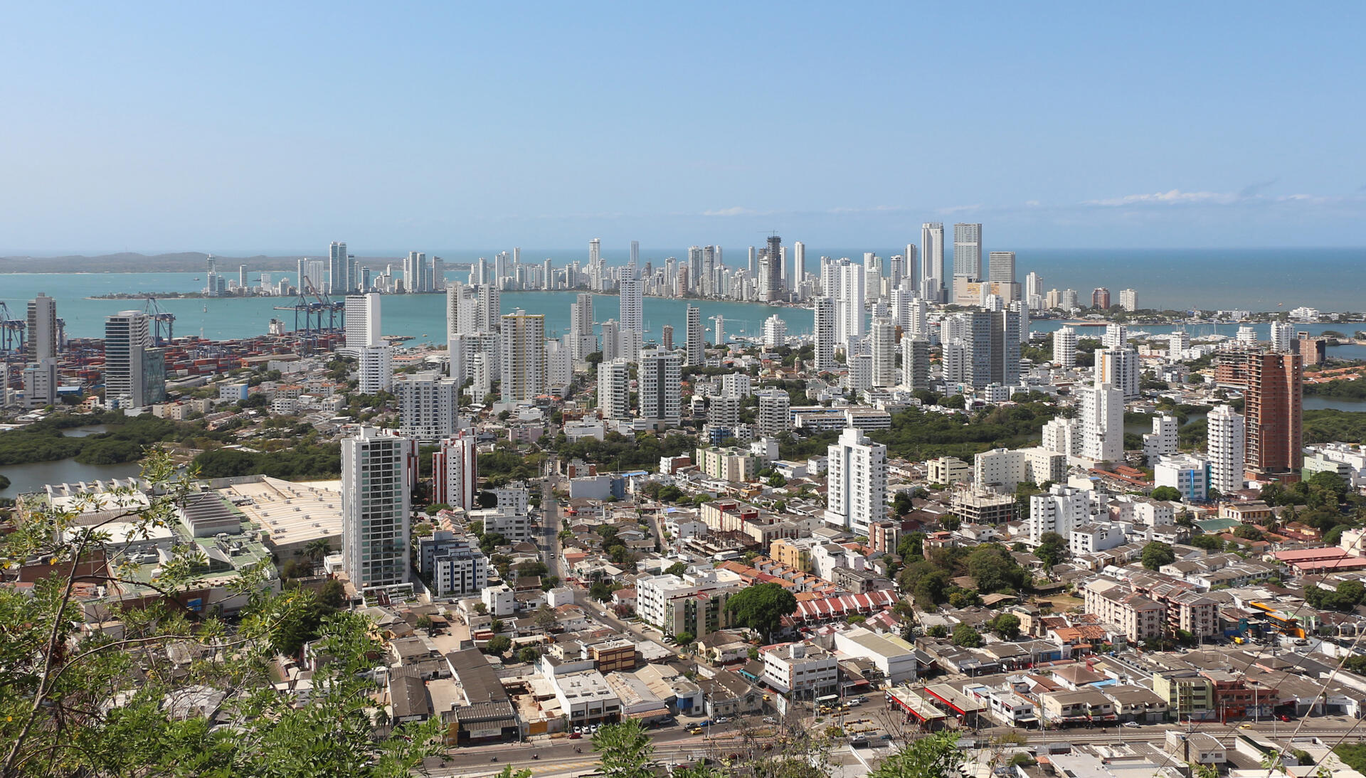
Cartagena's Historical Landscape: Port, Fortresses, and Group of Monuments
Cartagena, officially known as Cartagena de Indias, is a significant city located on the northern coast of Colombia in the Caribbean Coast Region. This coastal metropolis, situated in a bay of the Caribbean Sea, boasts the most extensive fortifications in South America, earning it a place on the UNESCO World Heritage List in 1984.
More to come…UNESCO Description of the World Heritage Site
Situated in a bay in the Caribbean Sea, Cartagena has the most extensive fortifications in South America. A system of zones divides the city into three neighbourhoods: San Pedro, with the cathedral and many Andalusian-style palaces; San Diego, where merchants and the middle class lived; and Gethsemani, the 'popular quarter'.
Encyclopedia Record: Cartagena, Colombia
Cartagena, known since the colonial era as Cartagena de Indias, is a city and one of the major ports on the northern coast of Colombia in the Caribbean Coast Region, along the Caribbean Sea. Cartagena's past role as a link in the route to the West Indies provides it with important historical value for world exploration and preservation of heritage from the great commercial maritime routes. As a former Spanish colony, it was a key port for the export of Bolivian silver to Spain and for the import of enslaved Africans under the asiento system. It was defensible against pirate attacks in the Caribbean. The city's strategic location between the Magdalena and Sinú rivers also gave it easy access to the interior of New Granada and made it a main port for trade between Spain and its overseas empire, establishing its importance by the early 1540s.Additional Site Details
Area: Not available
Number of Components: 1
(vi) — Directly associated with events or living traditions
Coordinates: 10.41666667 , -75.53333333
Image
© Bernard Gagnon, CC BY-SA 4.0 Resized from original. (This derivative is under the same CC BY-SA license.)
