World Heritage Identification Number: 1352
World Heritage since: 2010
Category: Cultural Heritage
WHE Type: Archaeological Sites
Transboundary Heritage: No
Endangered Heritage: No
Country: 🇲🇽 Mexico
Continent: Americas
UNESCO World Region: Latin America and the Caribbean
Map
The Prehistoric Caves of Yagul and Mitla: A Window into Early Agriculture in North America
The Prehistoric Caves of Yagul and Mitla, located in the Central Valley of Oaxaca, Mexico, offer a unique glimpse into the early stages of agriculture in North America. Inscribed as a UNESCO World Heritage Site in 2010, this property comprises two pre-Hispanic archaeological complexes and a series of prehistoric caves and rock shelters.
More to come…UNESCO Description of the World Heritage Site
This property lies on the northern slopes of the Tlacolula valley in subtropical central Oaxaca and consists of two pre-Hispanic archaeological complexes and a series of pre-historic caves and rock shelters. Some of these shelters provide archaeological and rock-art evidence for the progress of nomadic hunter-gathers to incipient farmers. Ten thousand-year-old Cucurbitaceae seeds in one cave, Guilá Naquitz, are considered to be the earliest known evidence of domesticated plants in the continent, while corn cob fragments from the same cave are said to be the earliest documented evidence for the domestication of maize. The cultural landscape of the Prehistoric Caves of Yagul and Mitla demonstrates the link between man and nature that gave origin to the domestication of plants in North America, thus allowing the rise of Mesoamerican civilizations.
UNESCO Justification of the World Heritage Site
Criterion (iii): The botanical evidence from Guilá Naquitz cave related to the domestication of other plants, squash, gourds and beans, linked with the archaeological evidence from Cueva Blanca and Gheo Shih, can together be seen to be an exceptional testimony to the evolution from hunter-gathering to more settled communities in this area of central America.
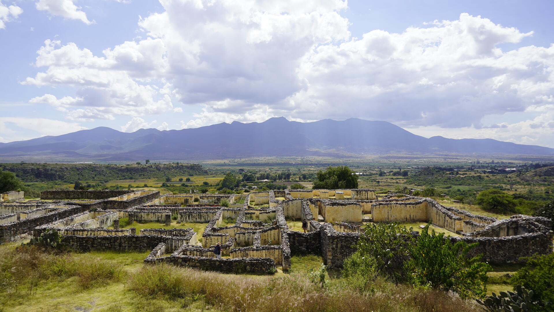
Encyclopedia Record: Yagul
Yagul is an archaeological site and former city-state associated with the Zapotec civilization of pre-Columbian Mesoamerica, located in the Mexican state of Oaxaca. The site was declared one of the country's four Natural Monuments on 13 October 1998. The site is also known locally as Pueblo Viejo and was occupied at the time of the Spanish Conquest. After the Conquest the population was relocated to the nearby modern town of Tlacolula where their descendants still live.Additional Site Details
Area: 1,515.17 hectares
Number of Components: 1
Coordinates: 16.9508333333 , -96.4211111111
Image
© México en Fotos, CC BY-SA 2.0 Resized from original. (This derivative is under the same CC BY-SA license.)
