World Heritage Identification Number: 1116
World Heritage since: 2003
Category: Cultural Heritage
WHE Type: Natural Landscapes & Geographic Features
Transboundary Heritage: No
Endangered Heritage: No
Country: 🇦🇷 Argentina
Continent: Americas
UNESCO World Region: Latin America and the Caribbean
Map
Exploring the Cultural Landscape of Quebrada de Humahuaca, Argentina
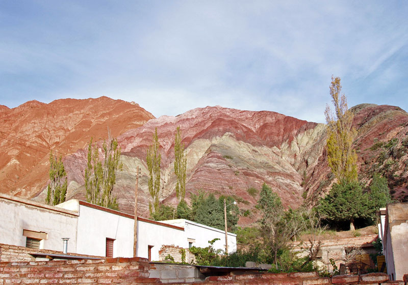
The Quebrada de Humahuaca, a stunning mountain valley nestled within the province of Jujuy in northwest Argentina, offers a unique blend of natural beauty and rich cultural heritage. Stretching approximately 155 kilometers from north to south, this picturesque valley is characterized by its dramatic landscapes, vibrant indigenous cultures, and significant historical sites that have shaped the region's identity for thousands of years.
More to come…UNESCO Description of the World Heritage Site
Quebrada de Humahuaca follows the line of a major cultural route, the Camino Inca, along the spectacular valley of the Rio Grande, from its source in the cold high desert plateau of the High Andean lands to its confluence with the Rio Leone some 150 km to the south. The valley shows substantial evidence of its use as a major trade route over the past 10,000 years. It features visible traces of prehistoric hunter-gatherer communities, of the Inca Empire (15th to 16th centuries) and of the fight for independence in the 19th and 20th centuries.
UNESCO Justification of the World Heritage Site
Criterion (ii): The Quebrada de Humahuaca valley has been used over the past 10,000 years as a crucial passage for the transport of people and ideas from the high Andean lands to the plains. Criteria (iv) and (v): The Quebrada de Humahuaca valley reflects the way its strategic position has engendered settlement, agriculture and trade. Its distinctive pre-Hispanic and pre-Incan settlements, as a group with their associated field systems, form a dramatic addition to the landscape and one that can certainly be called outstanding.
Encyclopedia Record: Quebrada de Humahuaca
The Quebrada de Humahuaca is a narrow mountain valley located in the province of Jujuy in northwest Argentina, 1,649 km (1,025 mi) north of Buenos Aires. It is about 155 km (96 mi) long, oriented north–south, bordered by the Altiplano in the west and north, by the Sub-Andean hills in the east, and by the warm valleys in the south.Additional Site Details
Area: 172,116.4 hectares
Number of Components: 1
(iv) — Outstanding example of a type of building or landscape
(v) — Outstanding example of traditional human settlement
Coordinates: -23.19986111 , -65.34886111
Image
© Unknown, CC BY-SA 3.0 Resized from original. (This derivative is under the same CC BY-SA license.)
