World Heritage Identification Number: 1568
World Heritage since: 2018
Category: Cultural Heritage
WHE Type: Archaeological Sites
Transboundary Heritage: No
Endangered Heritage: No
Country: 🇮🇷 Iran (Islamic Republic of)
Continent: Asia
UNESCO World Region: Asia and the Pacific
Map
Sassanid Archaeological Landscape of Fars Region: A Legacy of Ancient Persia
The Sassanid Archaeological Landscape of Fars Region, inscribed as a UNESCO World Heritage Site in 2018, offers a captivating glimpse into the rich history and architectural prowess of ancient Persia. This extensive archaeological landscape encompasses eight significant sites spread across three distinct geographical regions within the southeastern part of Fars Province, Iran.
More to come…UNESCO Description of the World Heritage Site
The eight archaeological sites situated in three geographical areas in the southeast of Fars Province: Firuzabad, Bishapur and Sarvestan. The fortified structures, palaces and city plans date back to the earliest and latest times of the Sassanian Empire, which stretched across the region from 224 to 658 CE. Among these sites is the capital built by the founder of the dynasty, Ardashir Papakan, as well as a city and architectural structures of his successor, Shapur I. The archaeological landscape reflects the optimized utilization of natural topography and bears witness to the influence of Achaemenid and Parthian cultural traditions and of Roman art, which had a significant impact on the architecture of the Islamic era.
UNESCO Justification of the World Heritage Site
Criterion (ii): The Sassanid Archaeological Landscape of the Fars region was influenced by the Achaemenid and Parthian cultural and ritual traditions, and references their architectural and artistic approaches. This is illustrated in the rock-carving techniques of the reliefs in the Firuzabad and Bishapur components and the sculpture of Shapur I in Tang-e Chogan. Likewise, particularly in Bishapur, the property illustrates influences deriving from the encounter with Roman art and architecture, contemporaneous with it. The Sassanid urban plan of Ardashir Khurreh inspired city planning throughout the region well into the Islamic era and Sarvestan Monument demonstrates how Sassanid architectural language continued to be utilized in Early Islamic times.
Criterion (iii): The property bears an exceptional testimony to the Early Sassanid Civilization and its contribution to the distribution and establishment of Zoroastrianism. As for the architectural language, the chahar-taq form illustrates best the linkages of Zoroastrianism and Sassanid rule: the Sassanid Archaeological Landscape of Fars Region encompasses Zoroastrian monumental architecture from its very beginning with the Takht-e Neshin, its consolidation at Bishapur, here in particular with the fire temple formerly interpreted as Shapur’s Palace and its development during the Early Islamic time with the Sarvestan Monument. The layout and location of the two first Sassanid ruling cities are testimonies to the legitimization and hierarchy of power as well as ritual ceremonies.
Criterion (v): The Sassanid archaeological landscape represents a highly efficient system of land use and strategic utilization of natural topography in the creation of the earliest cultural centres of the Sassanid civilization. Using indigenous construction materials and based on optimal exploitation of the surrounding natural resources including mountains, plains and rivers, a diverse set of urban structures, castles, buildings, bas-reliefs and other relevant monuments took shape within the landscape. Overall the Sassanid Archaeological Landscape of Fars Region is an outstanding example of the traditional land-use of Fars region where water management plays a fundamental role, and in which the Sassanid foundation of inhabited settlements and monumental buildings integrates itself in the landscape.
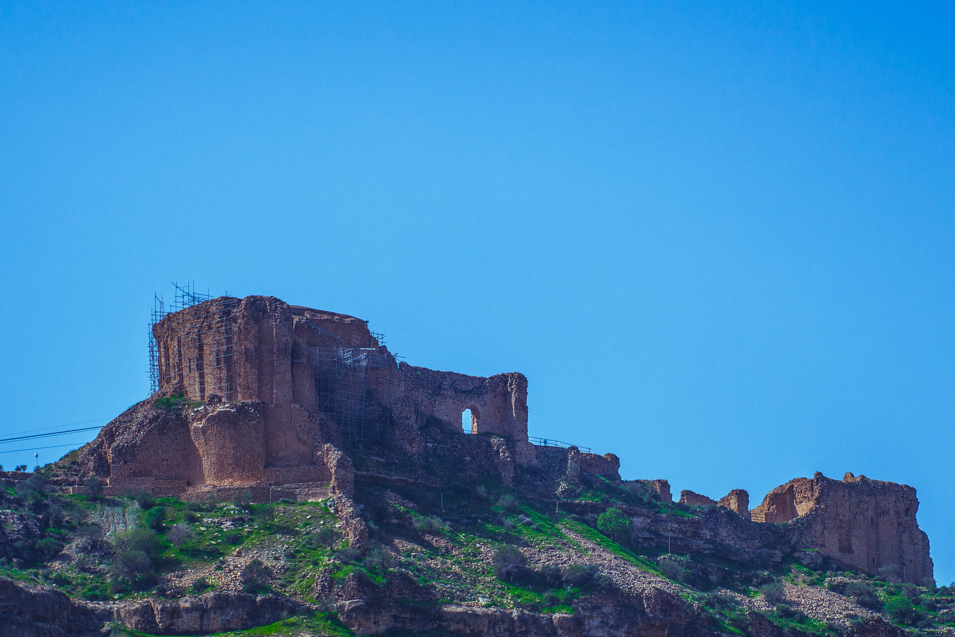
Encyclopedia Record: Qal'eh Dokhtar
Qal'eh Dokhtar, Ghale Dokhtar, Dokhtar Castle or Dezh Dokhtar is a castle made by Ardashir I, in present-day Fars, Iran, in 209 AD. It is located on a mountain slope near the Firouzabad-Kavar road.Additional Site Details
Area: 639.3 hectares
Number of Components: 8
(iii) — Unique or exceptional testimony to a cultural tradition
(v) — Outstanding example of traditional human settlement
Coordinates: 29.7774805556 , 51.57045
Image
© Herbert karim masihi, CC BY-SA 4.0 Resized from original. (This derivative is under the same CC BY-SA license.)
